 이 누리집은 대한민국 공식 전자정부 누리집입니다.


 X
X  페이스북
페이스북 * 이미지에 마우스를 올려 확대해 보세요.


중요
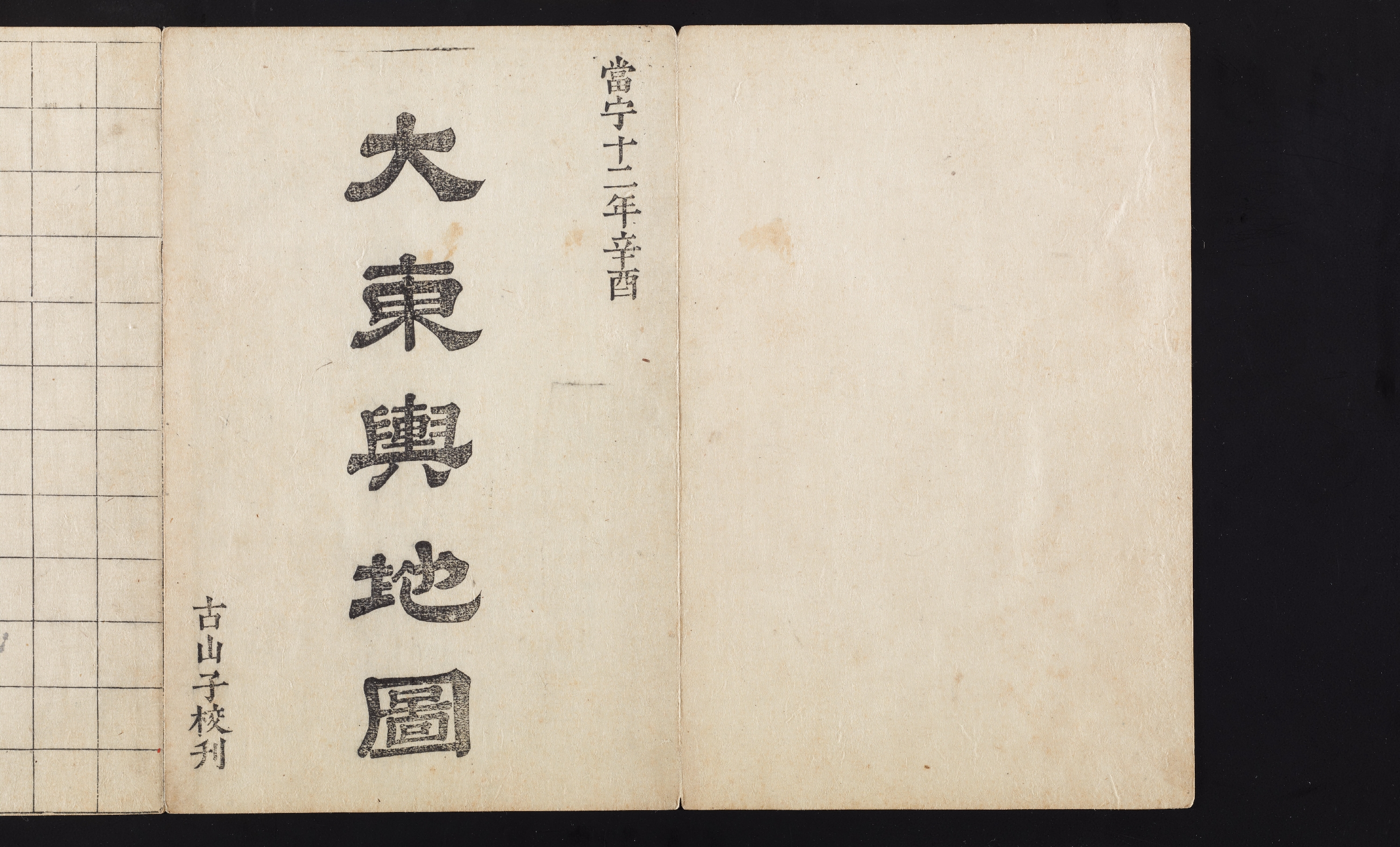
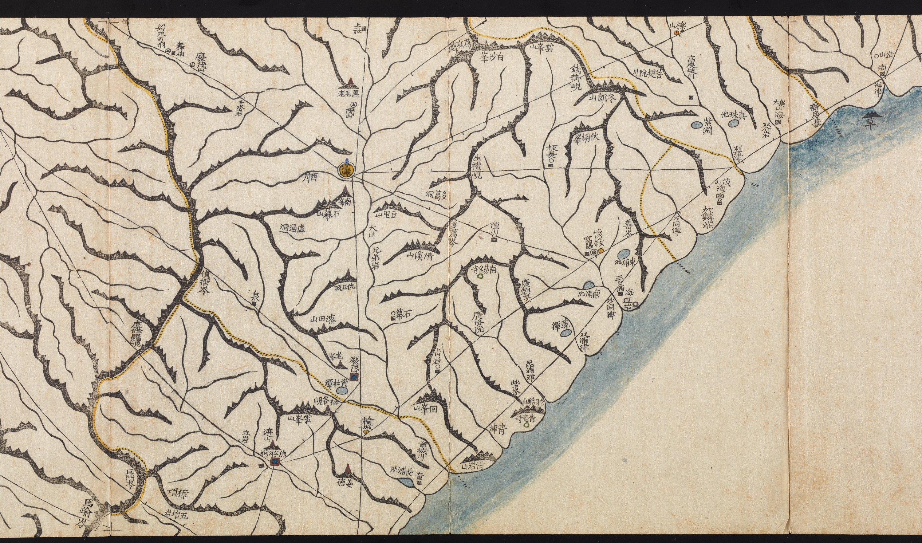
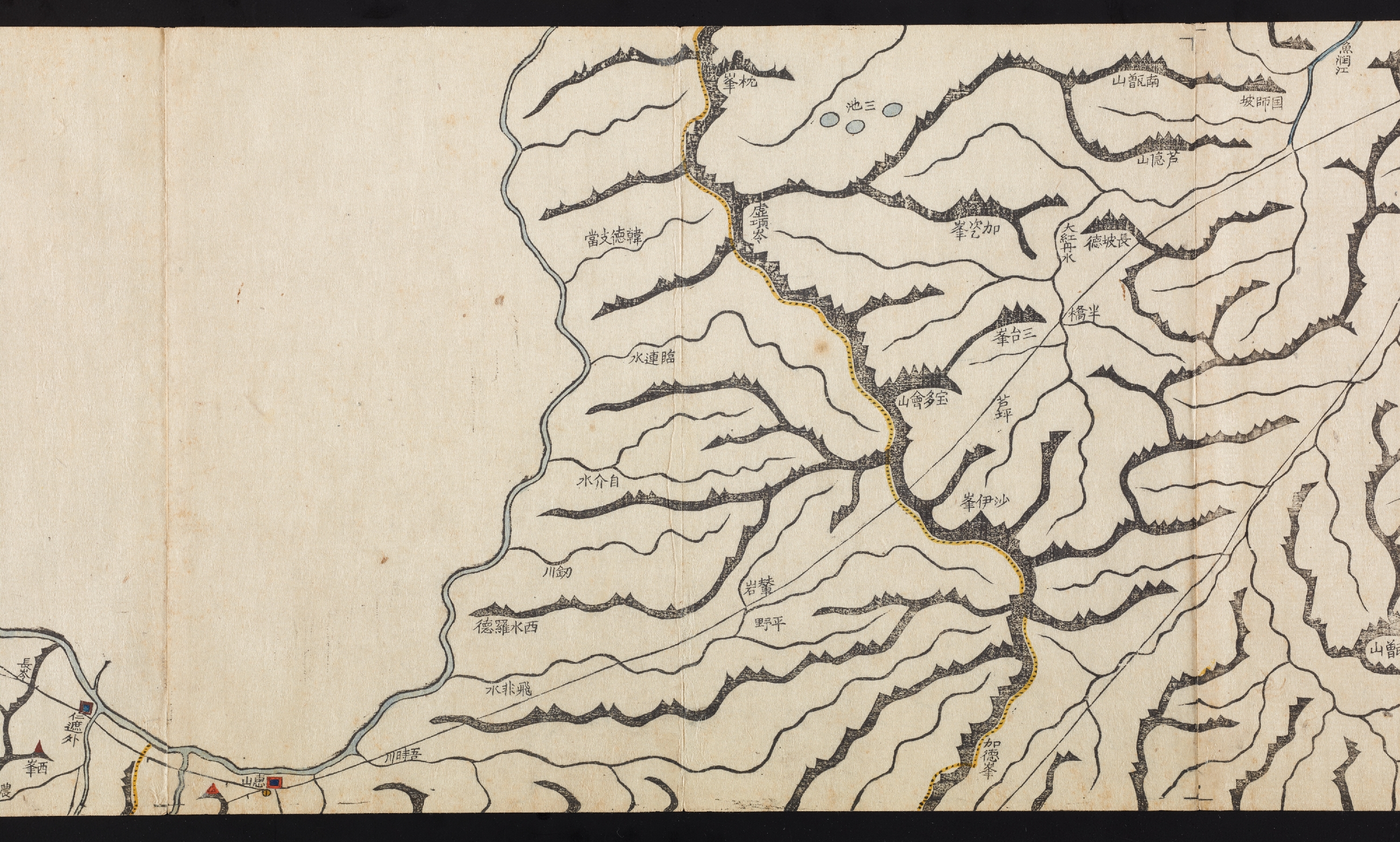
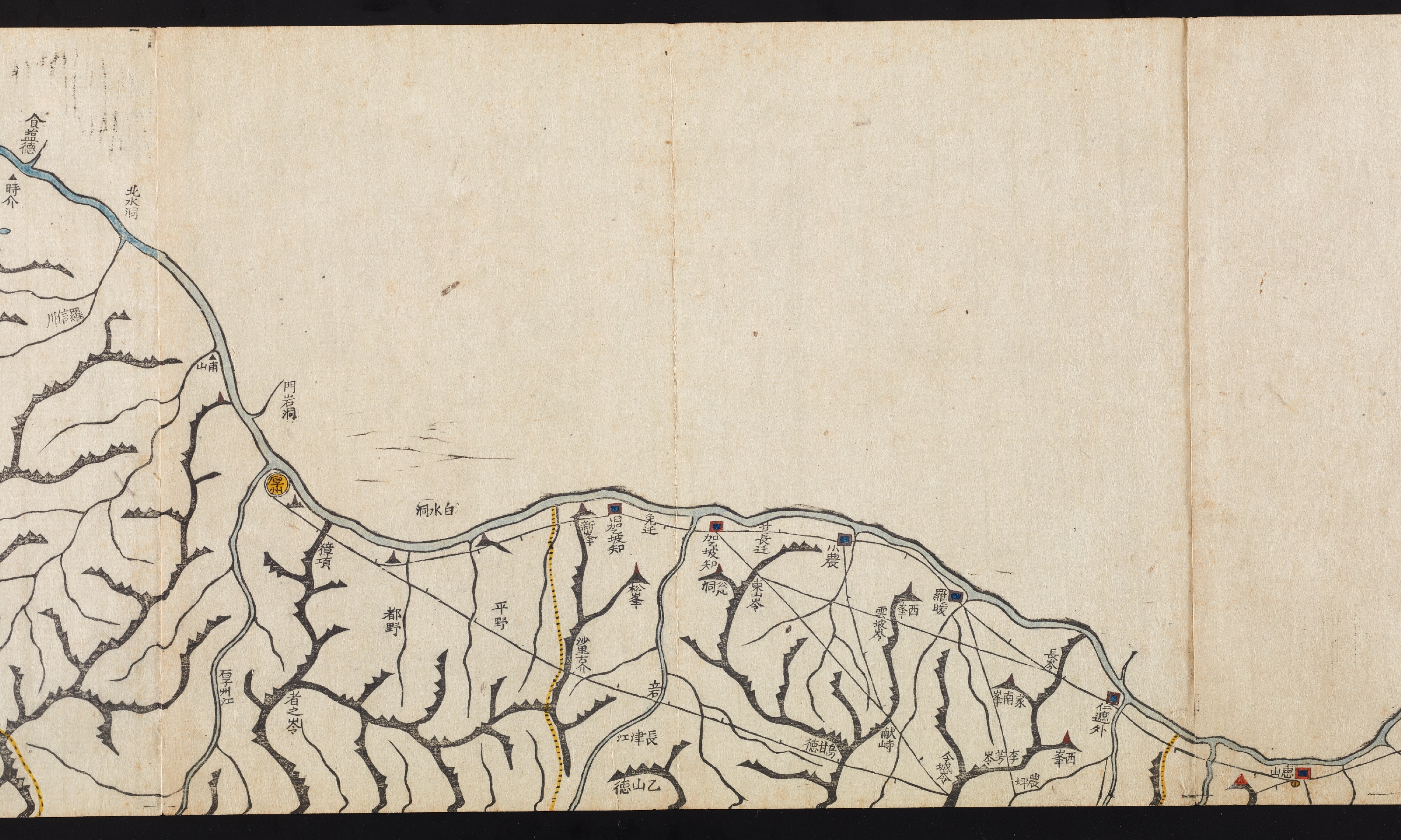
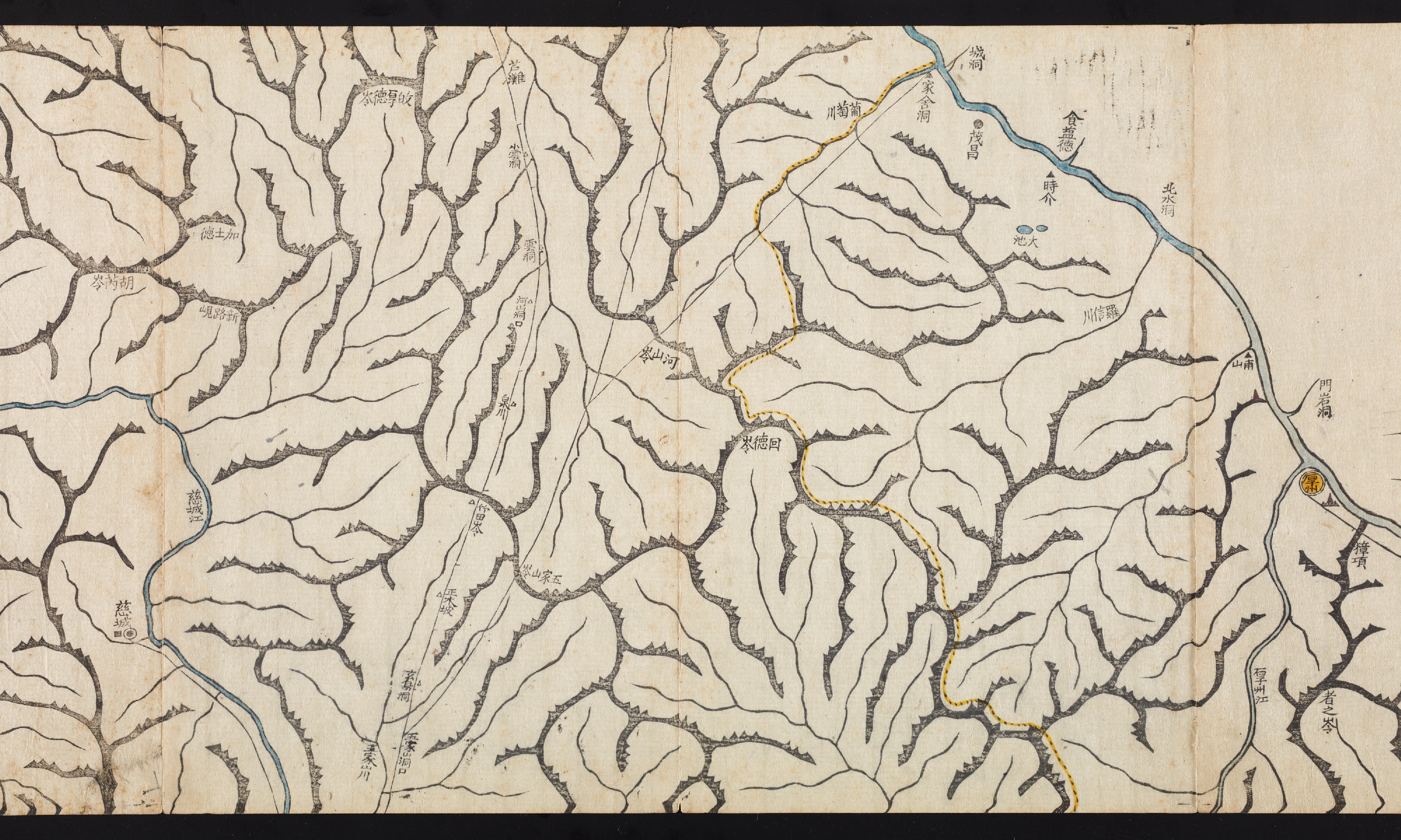
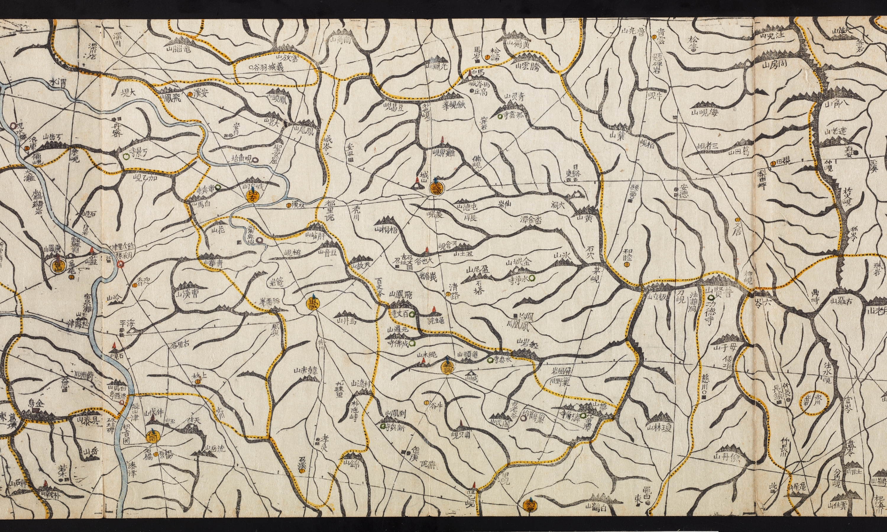
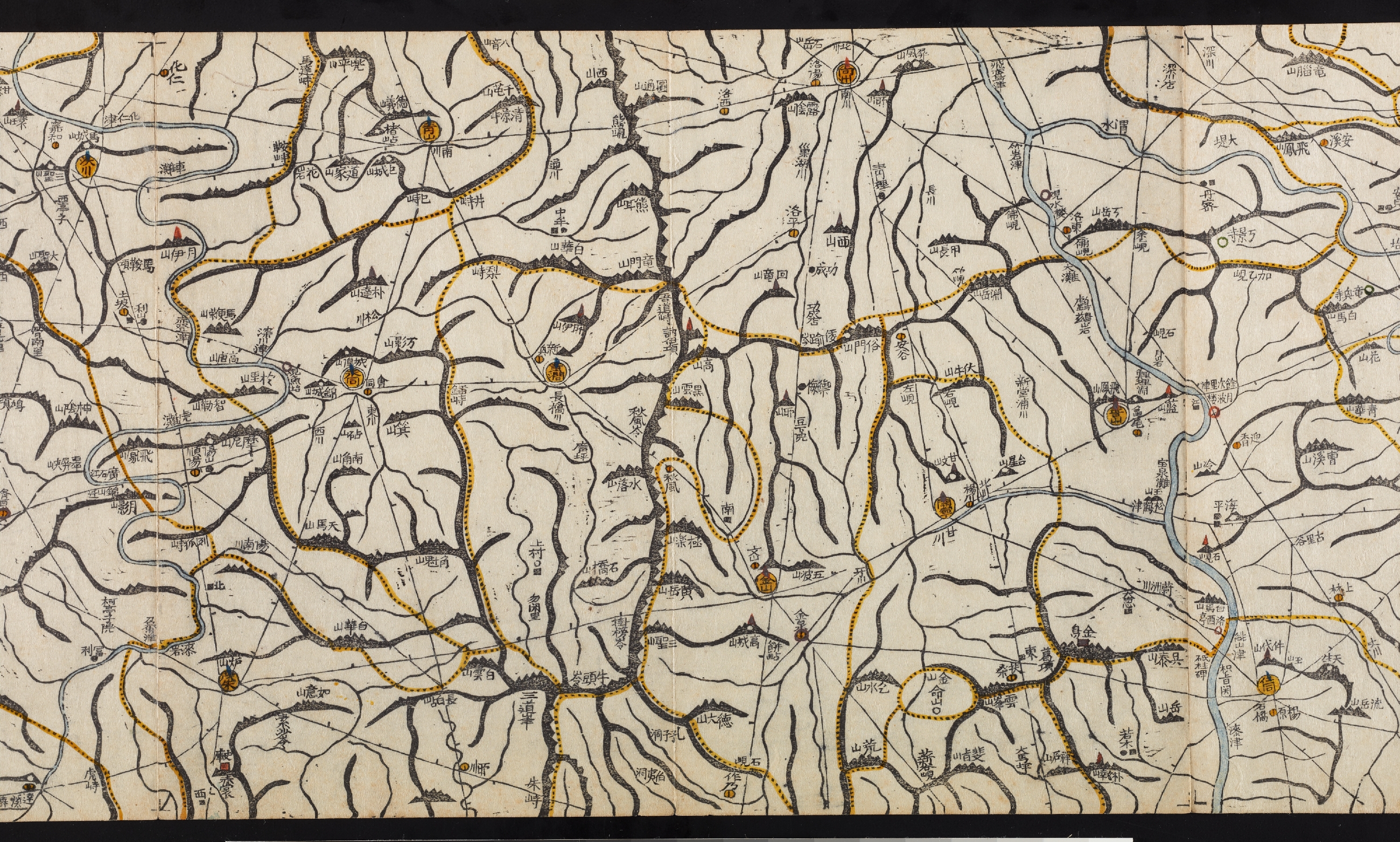
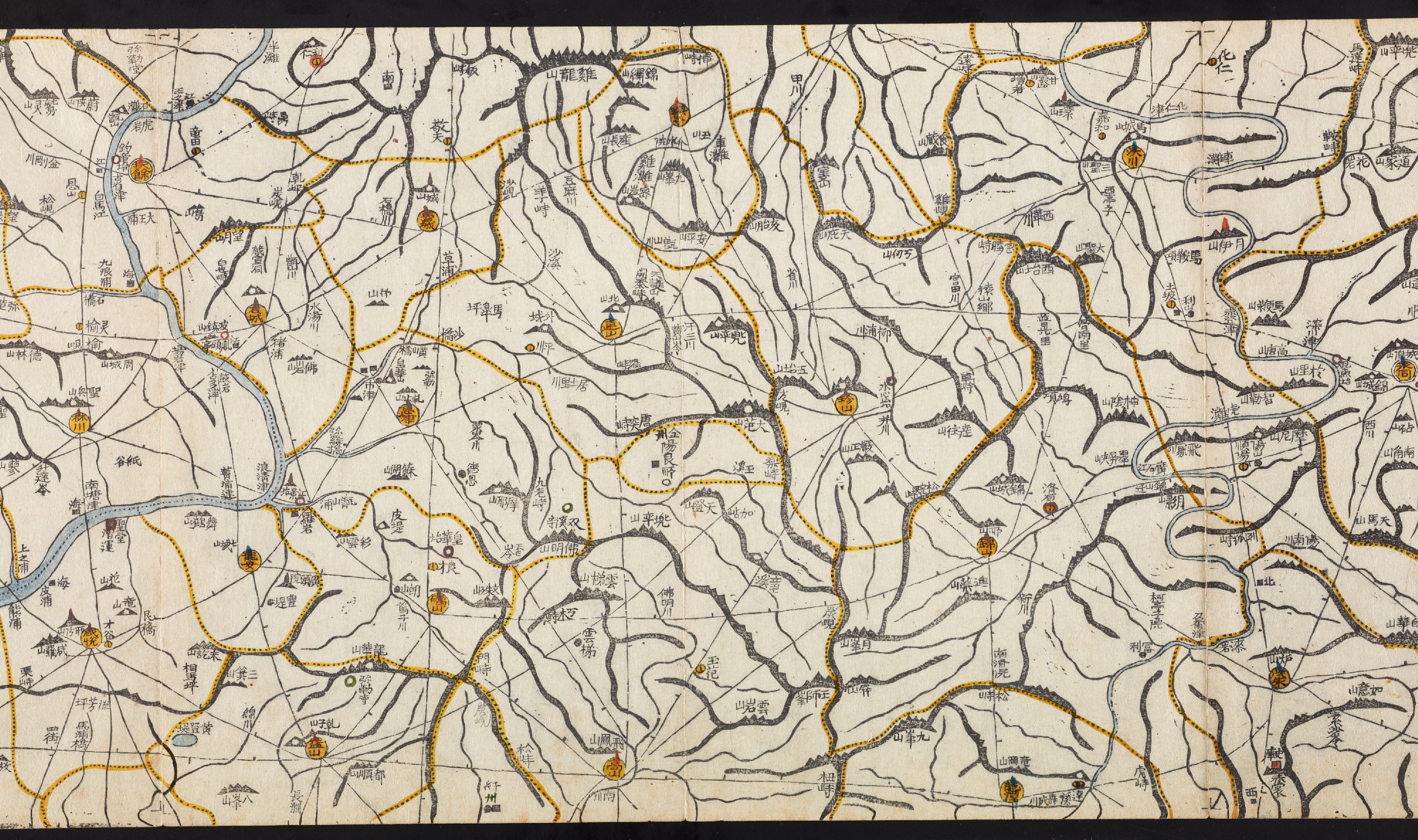
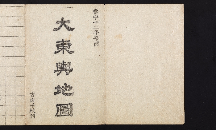
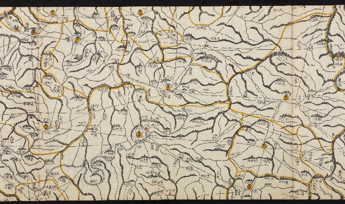
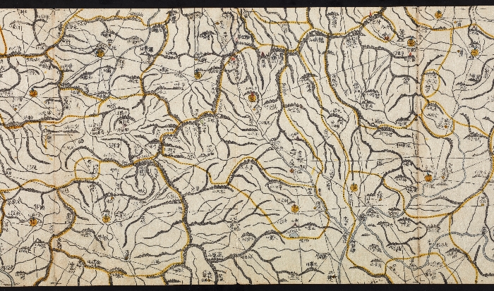
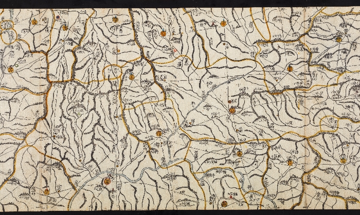
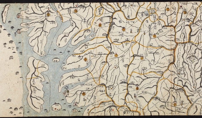
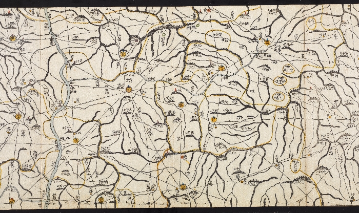
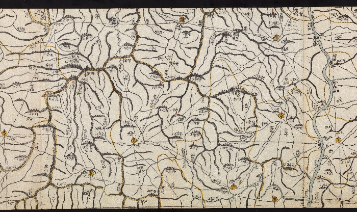
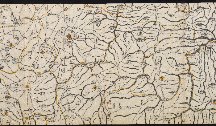
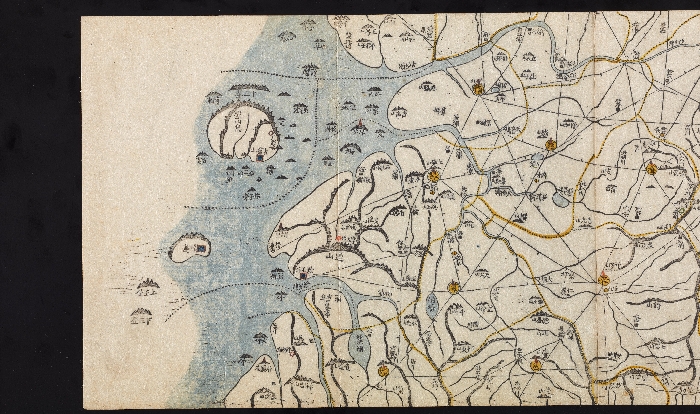
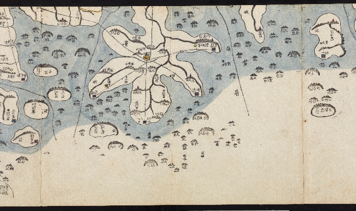
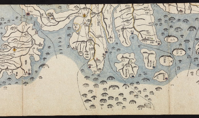
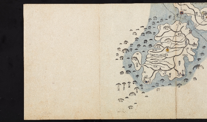
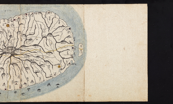
대동여지도
- 다른명칭
大東輿地圖
- 국적/시대
한국 - 조선
- 재질
종이
- 작가
김정호(金正浩)
- 분류
문화예술 - 문헌 - 기타
- 크기
세로 30.6cm, 가로 20.0cm
- 소장품번호
신수19997
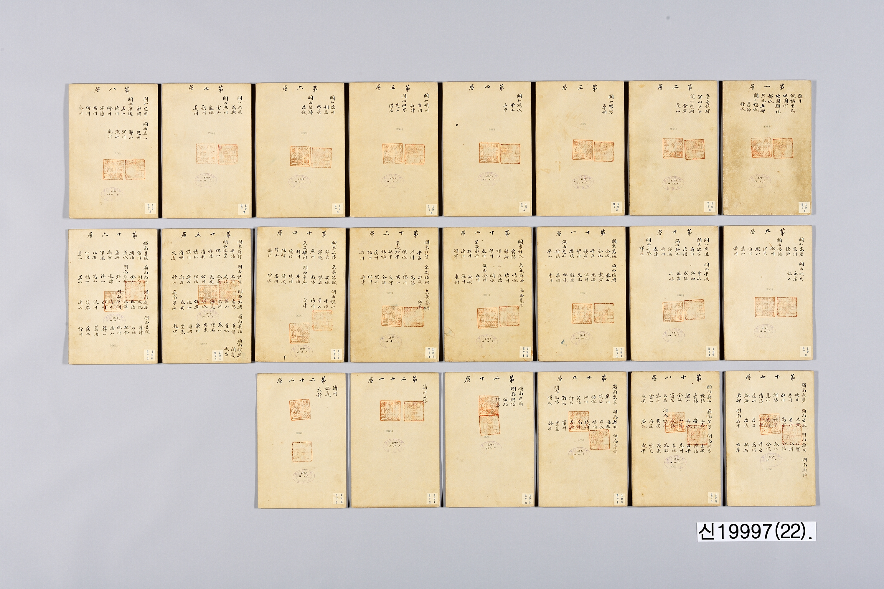
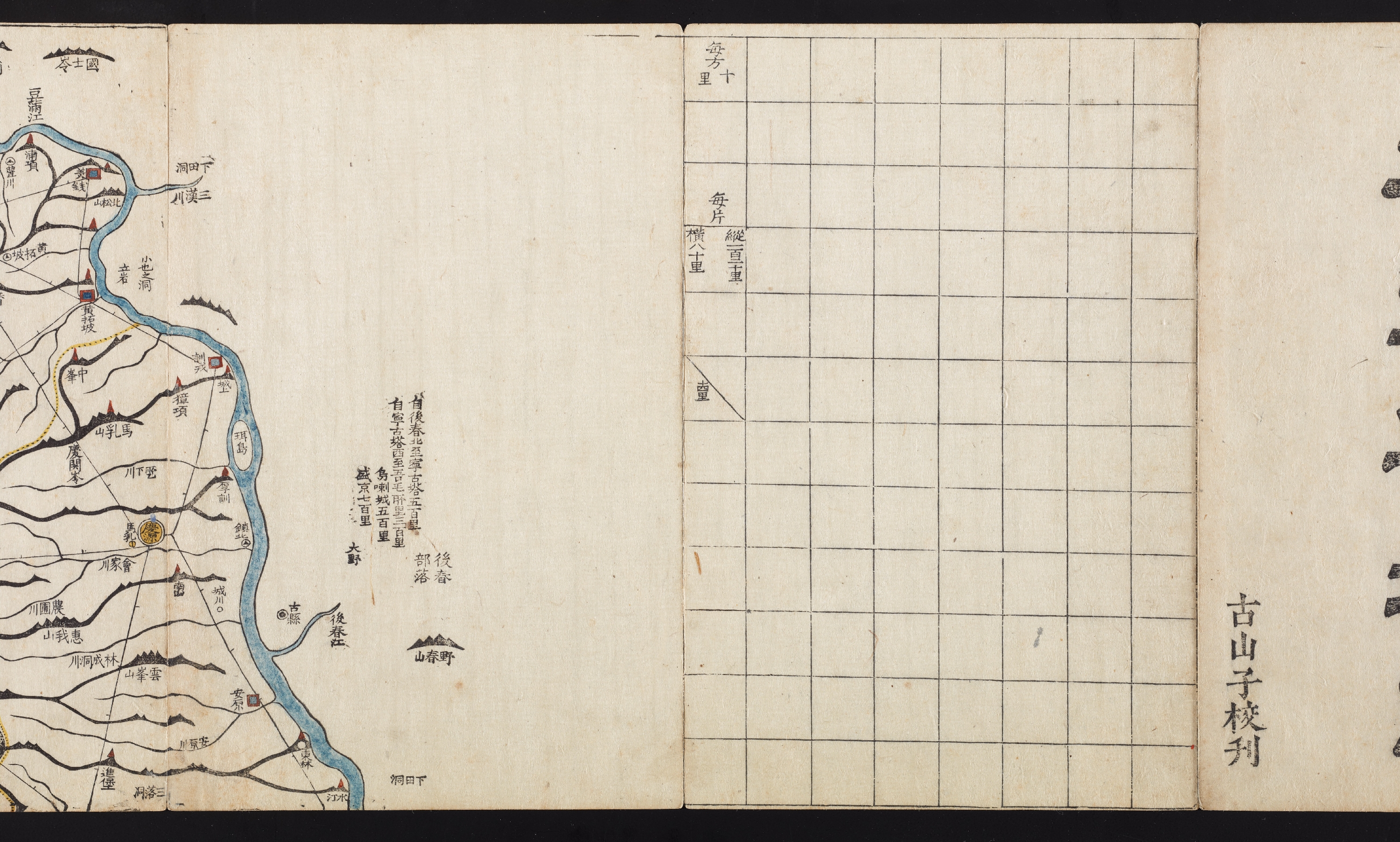
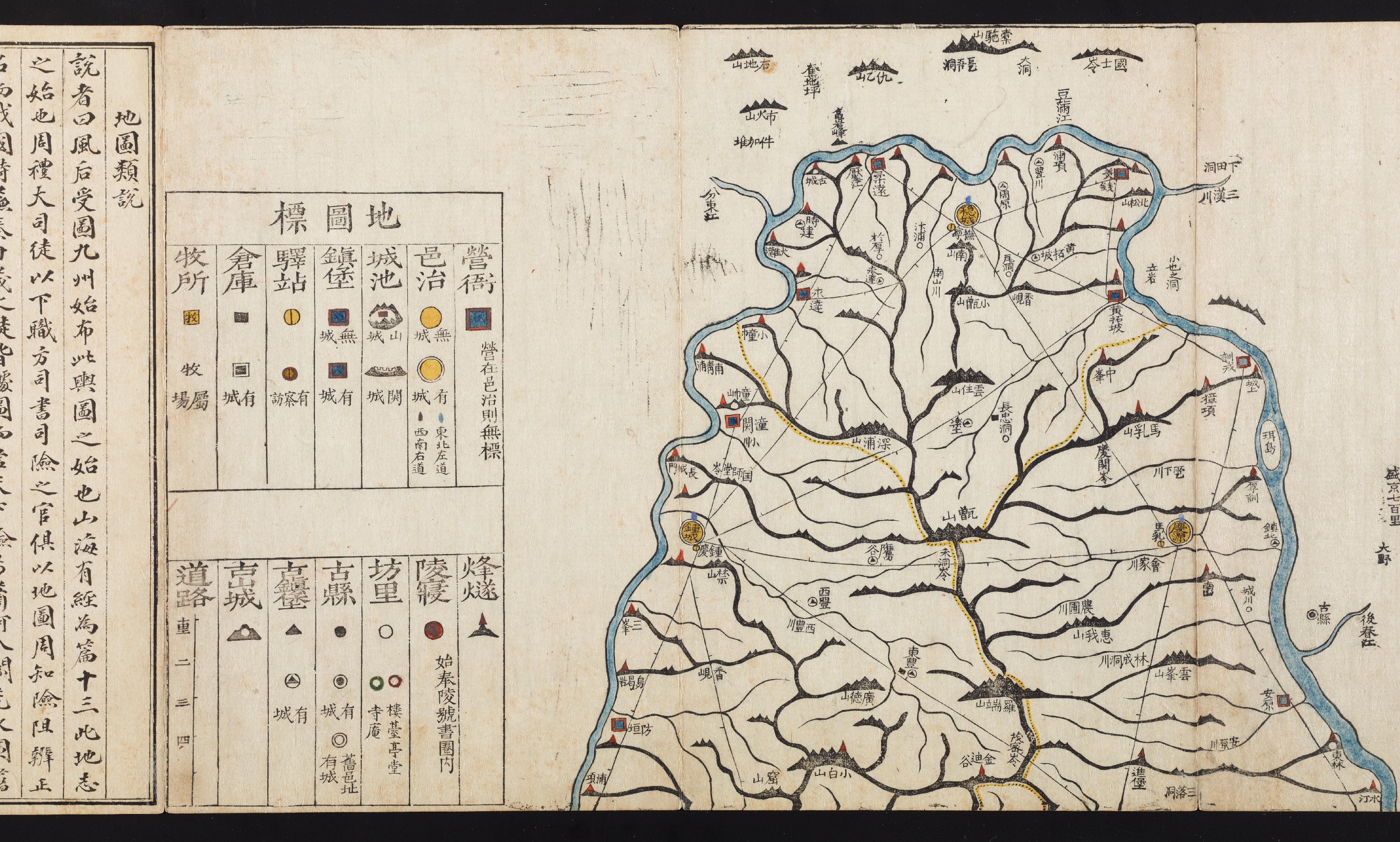
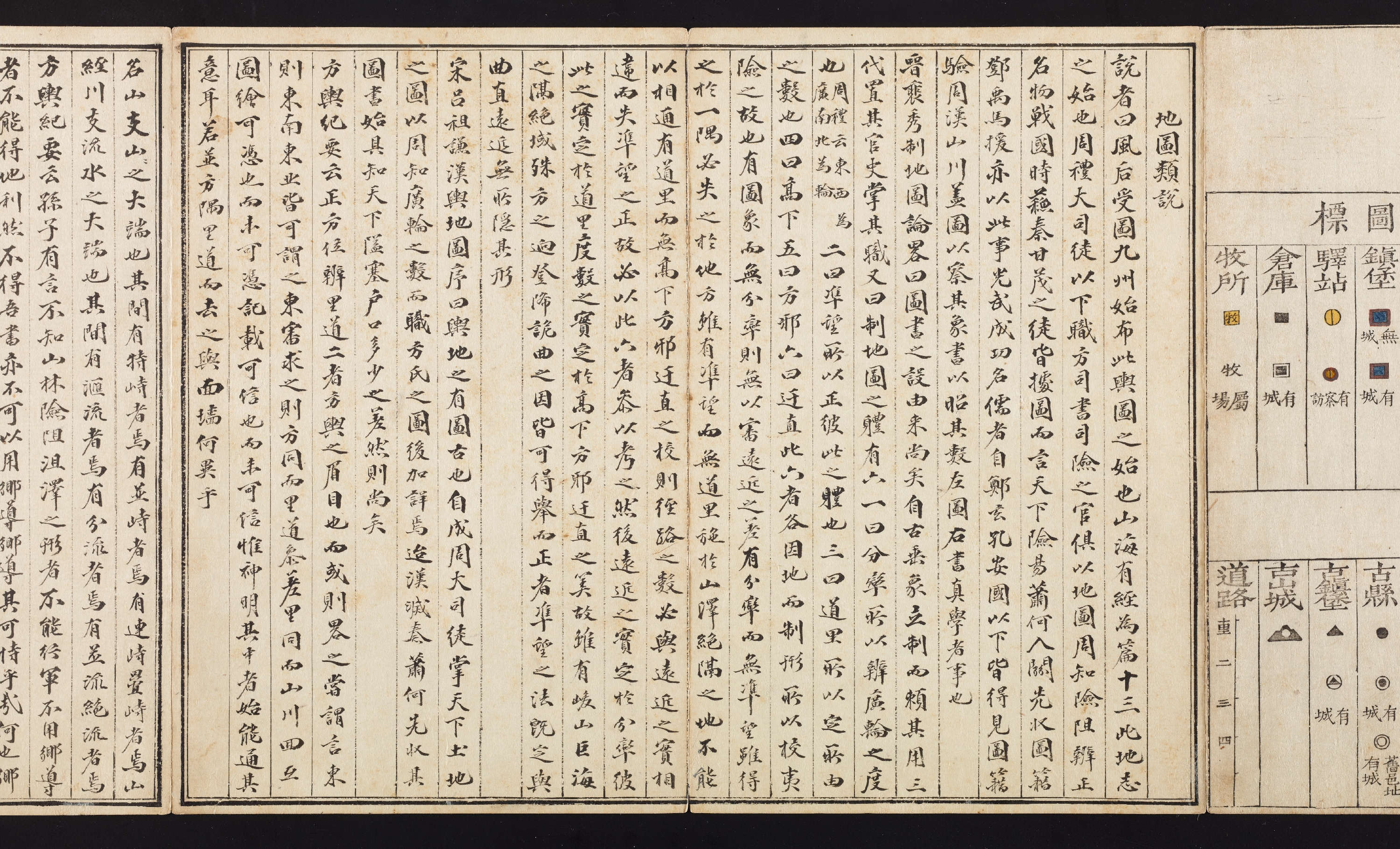
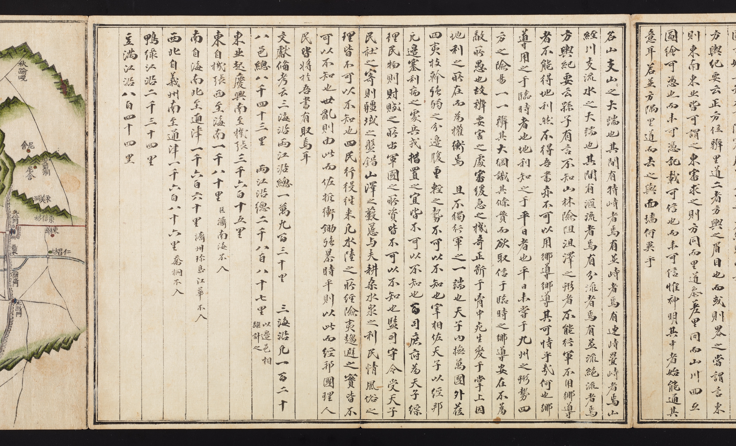
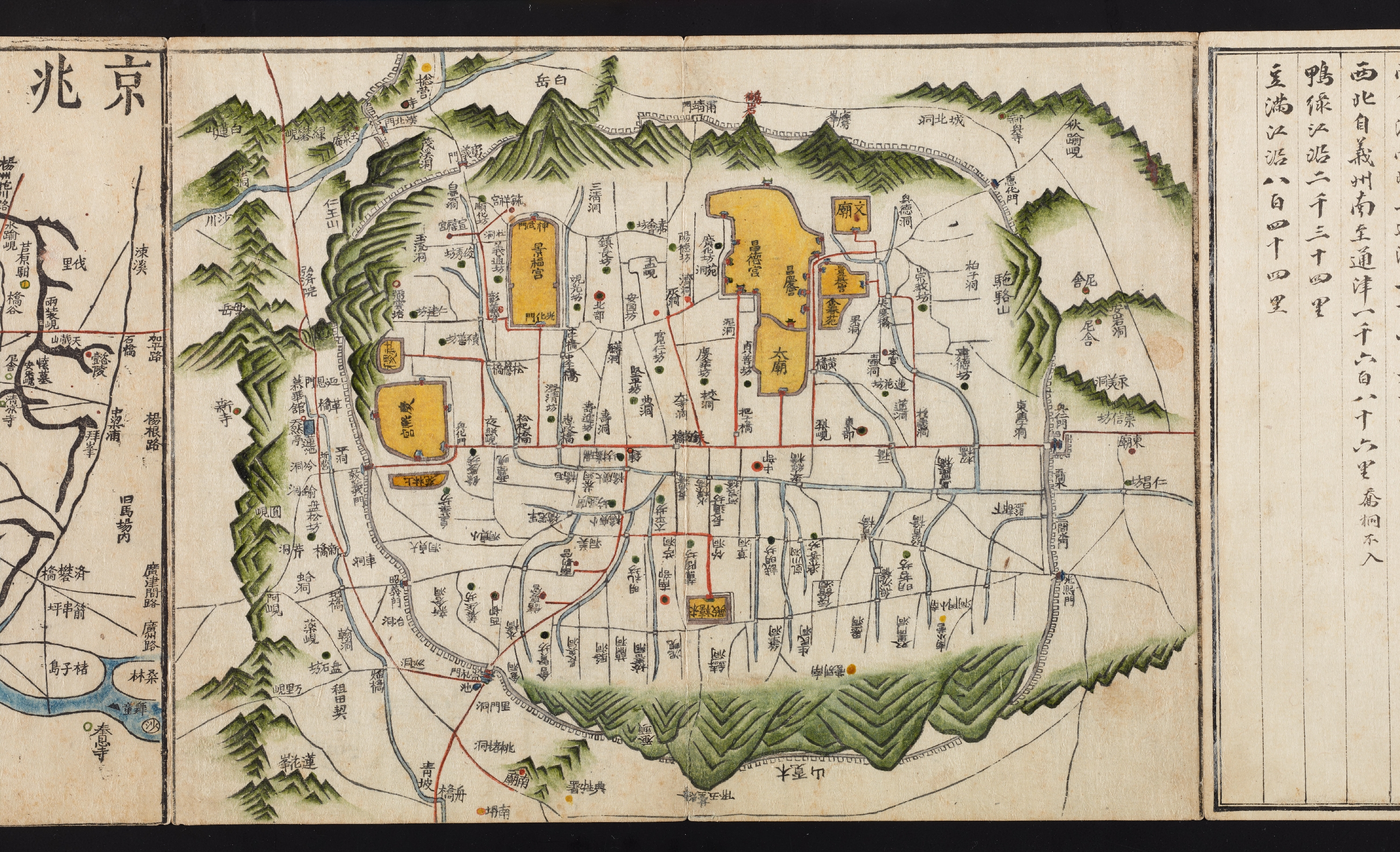
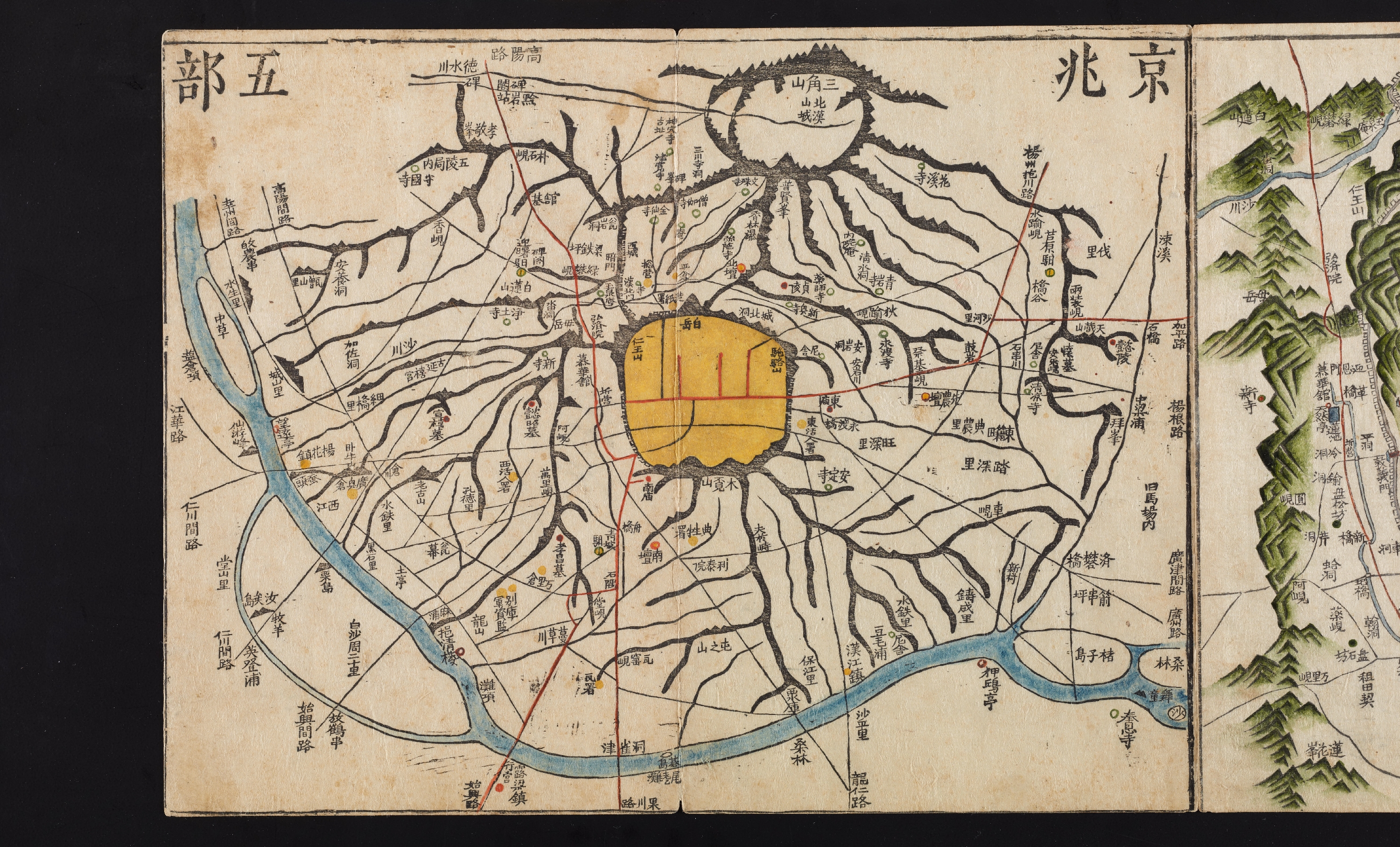
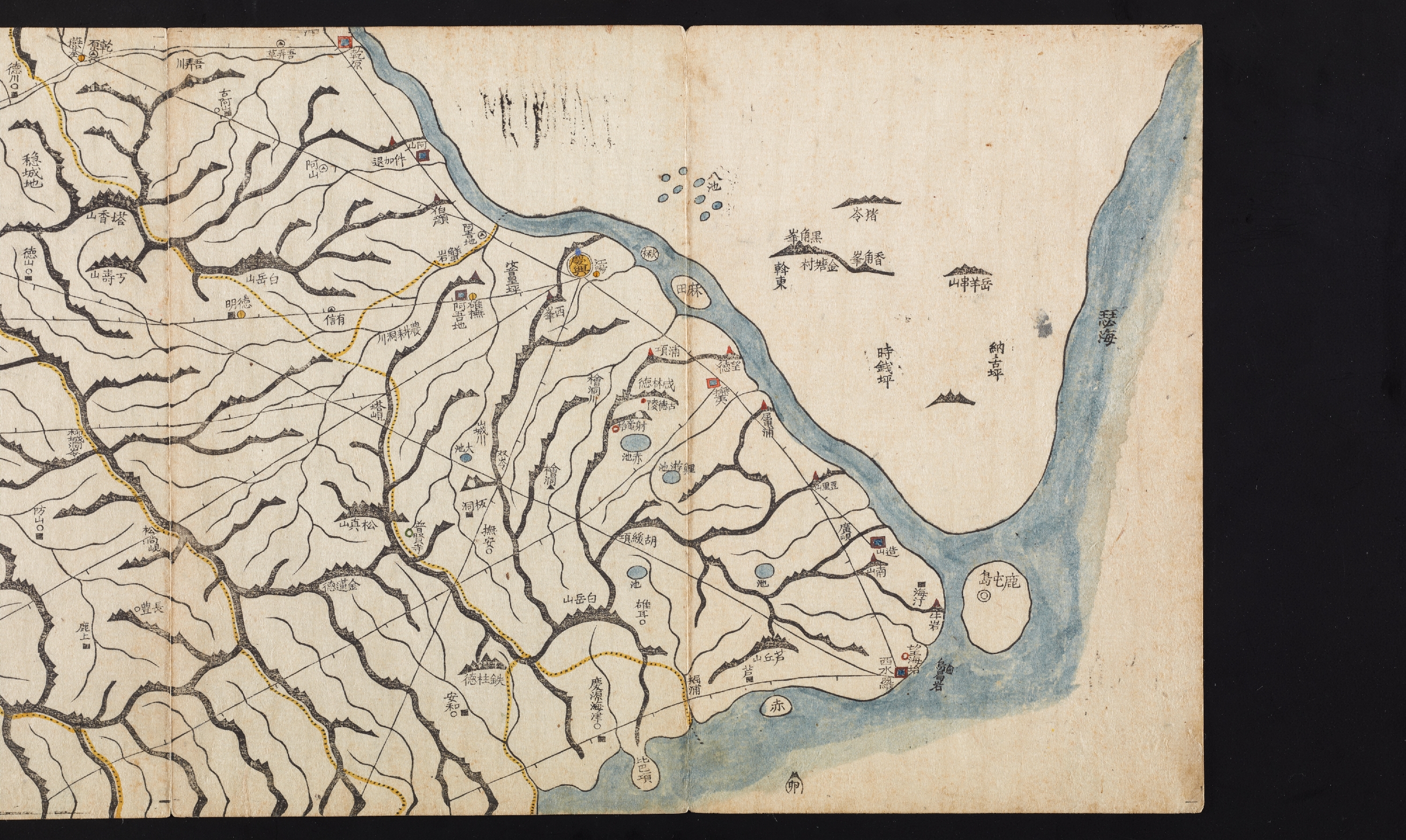
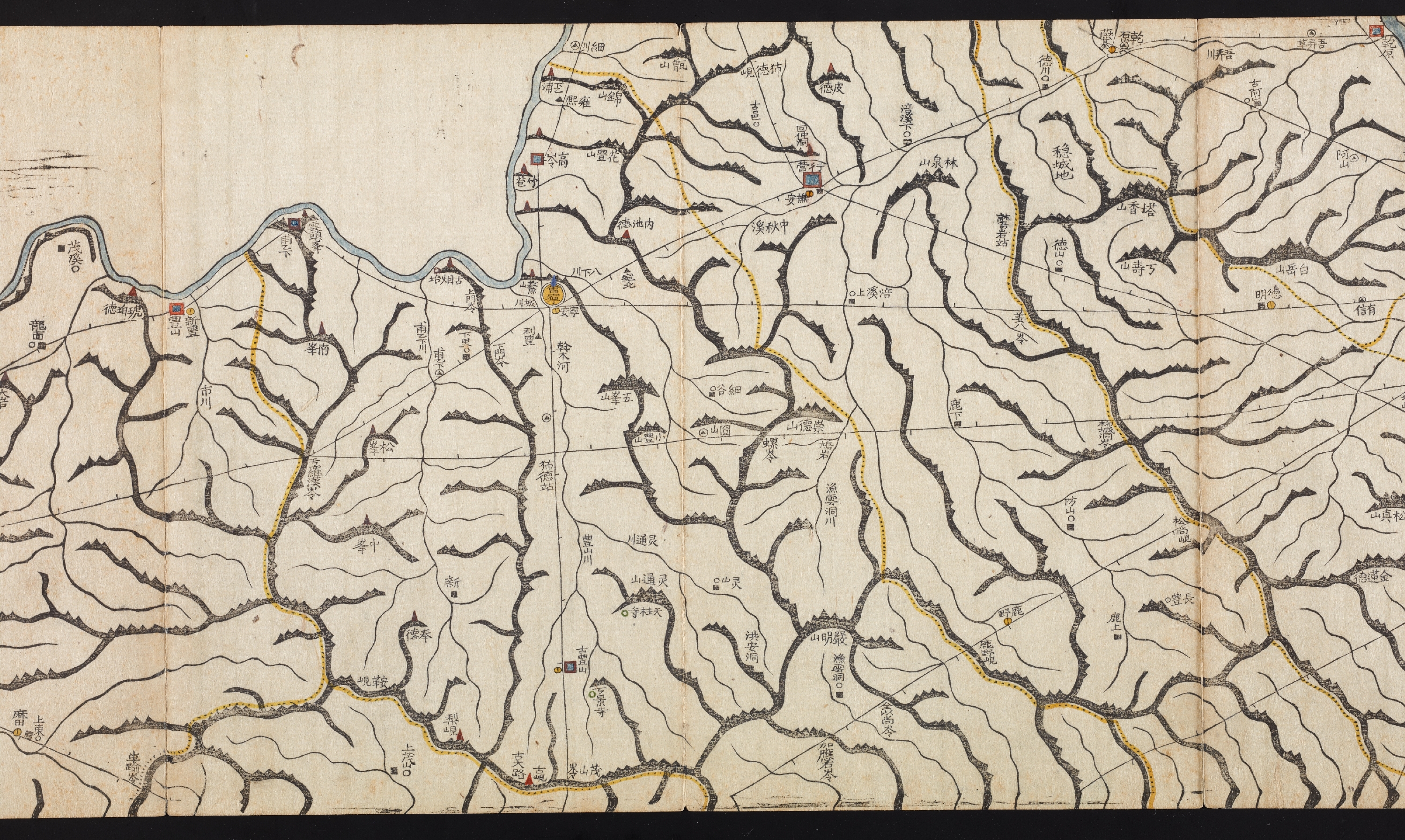
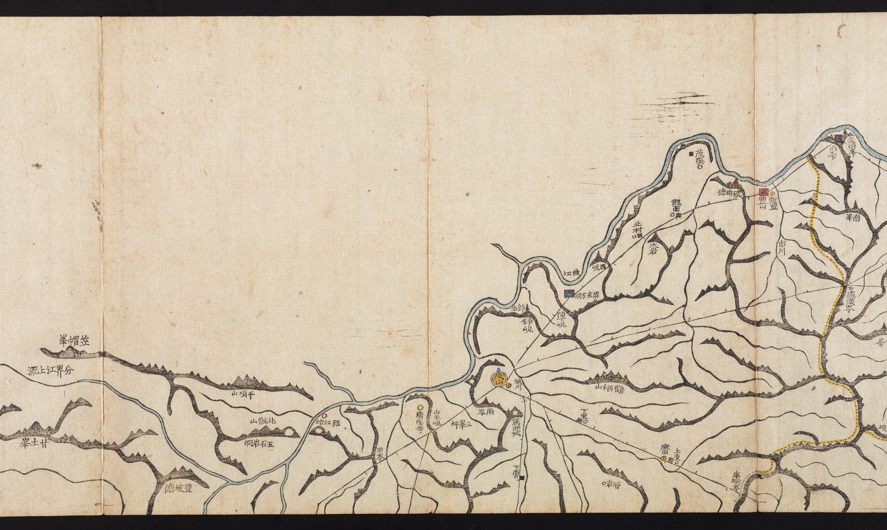
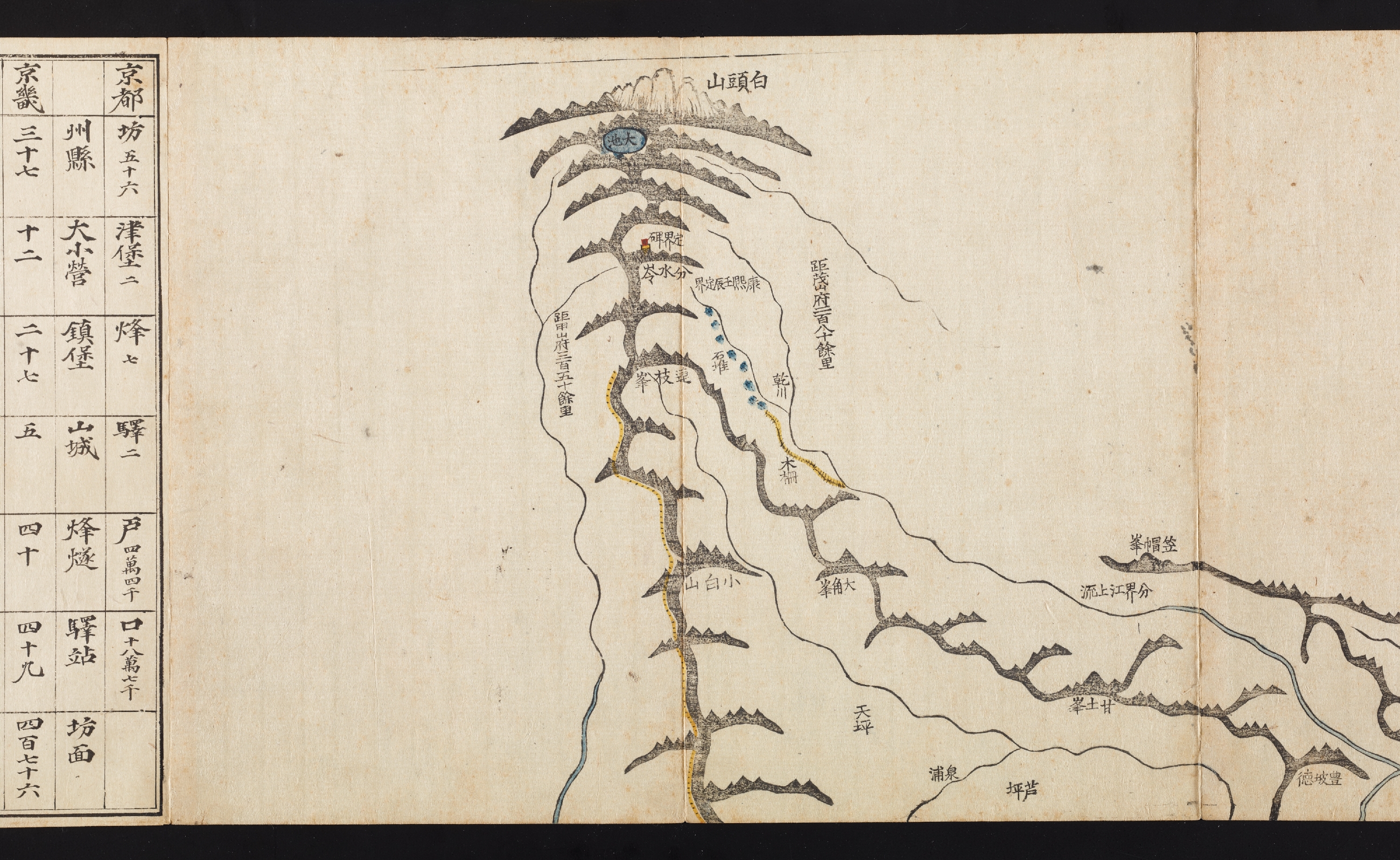
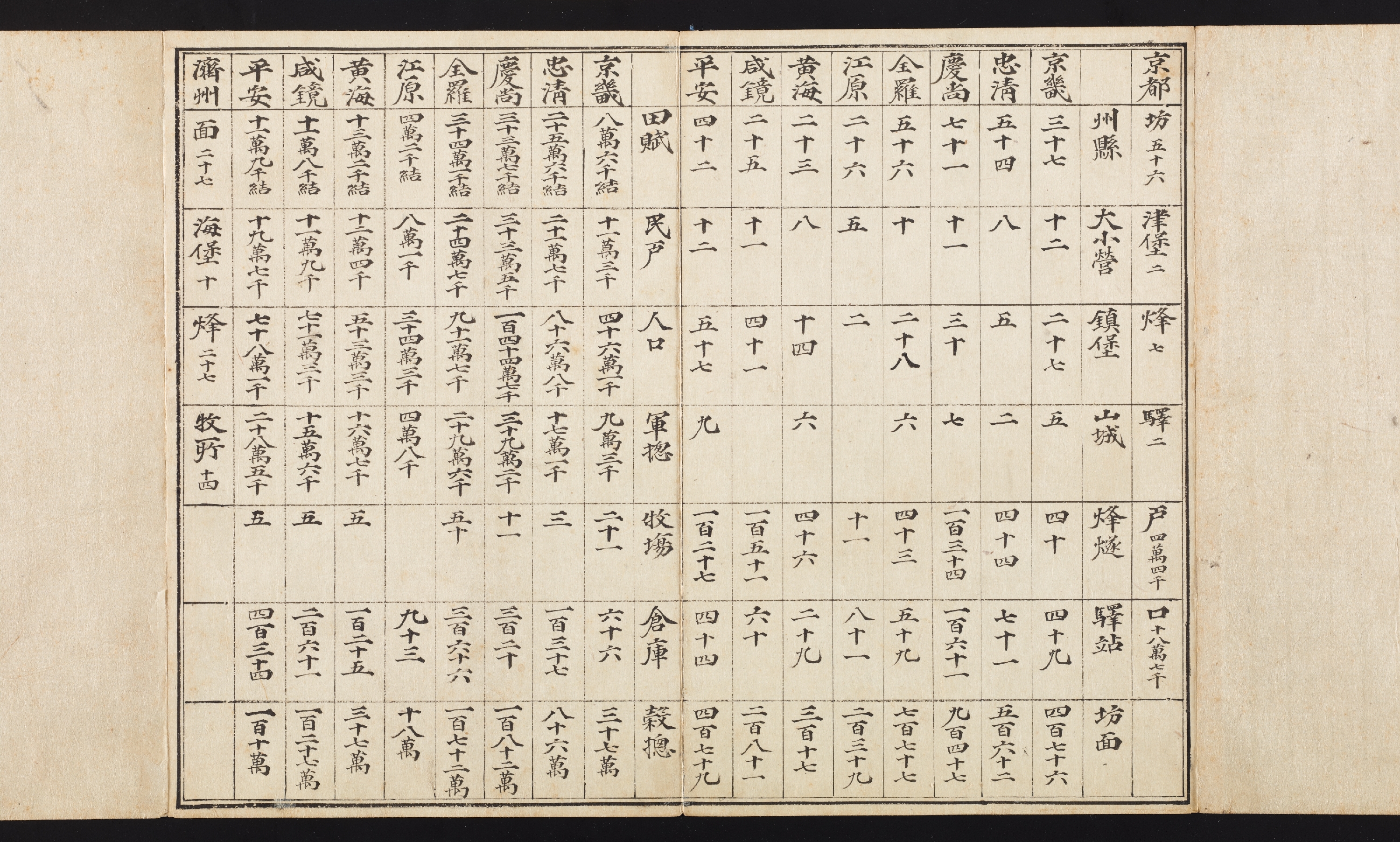
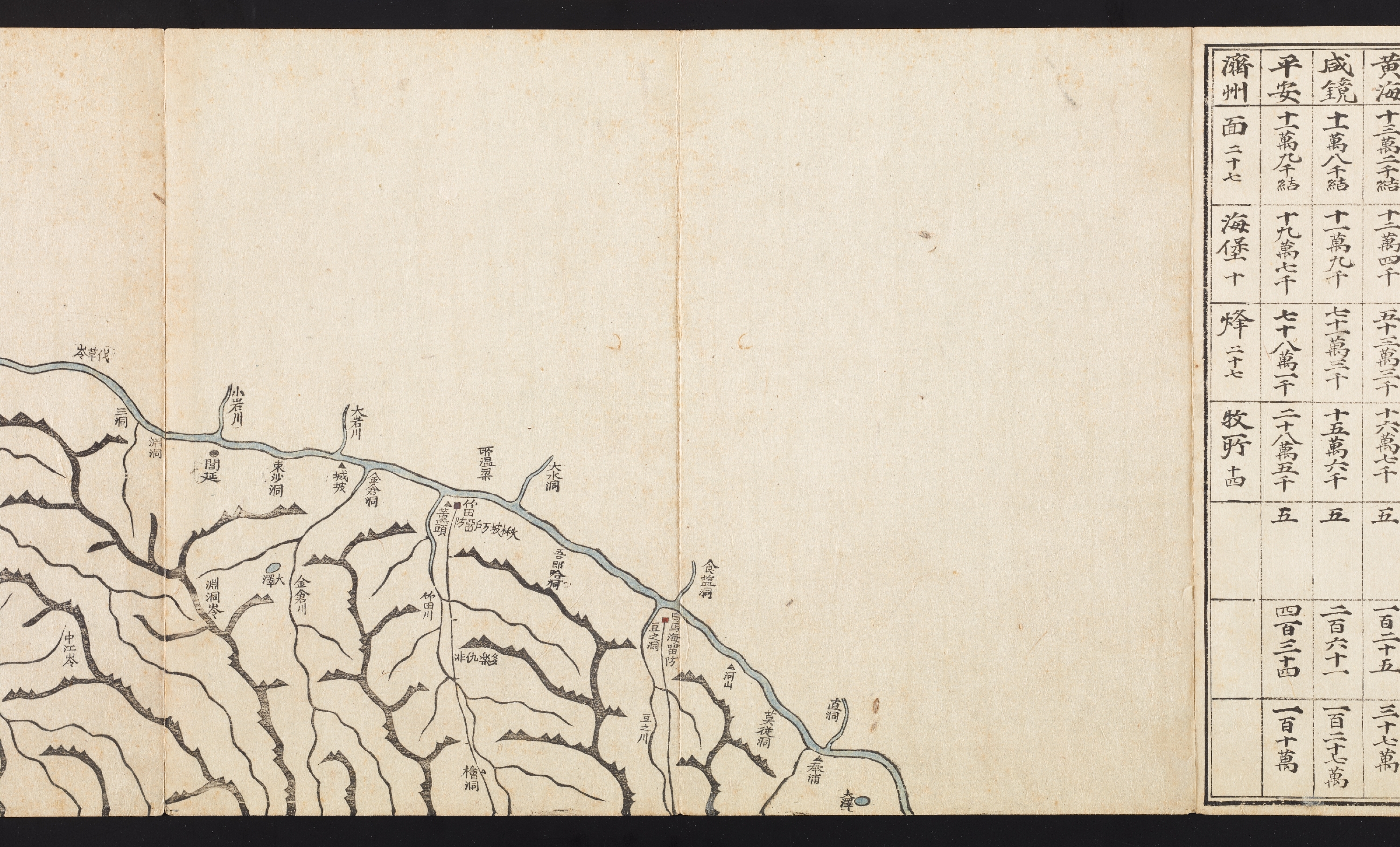
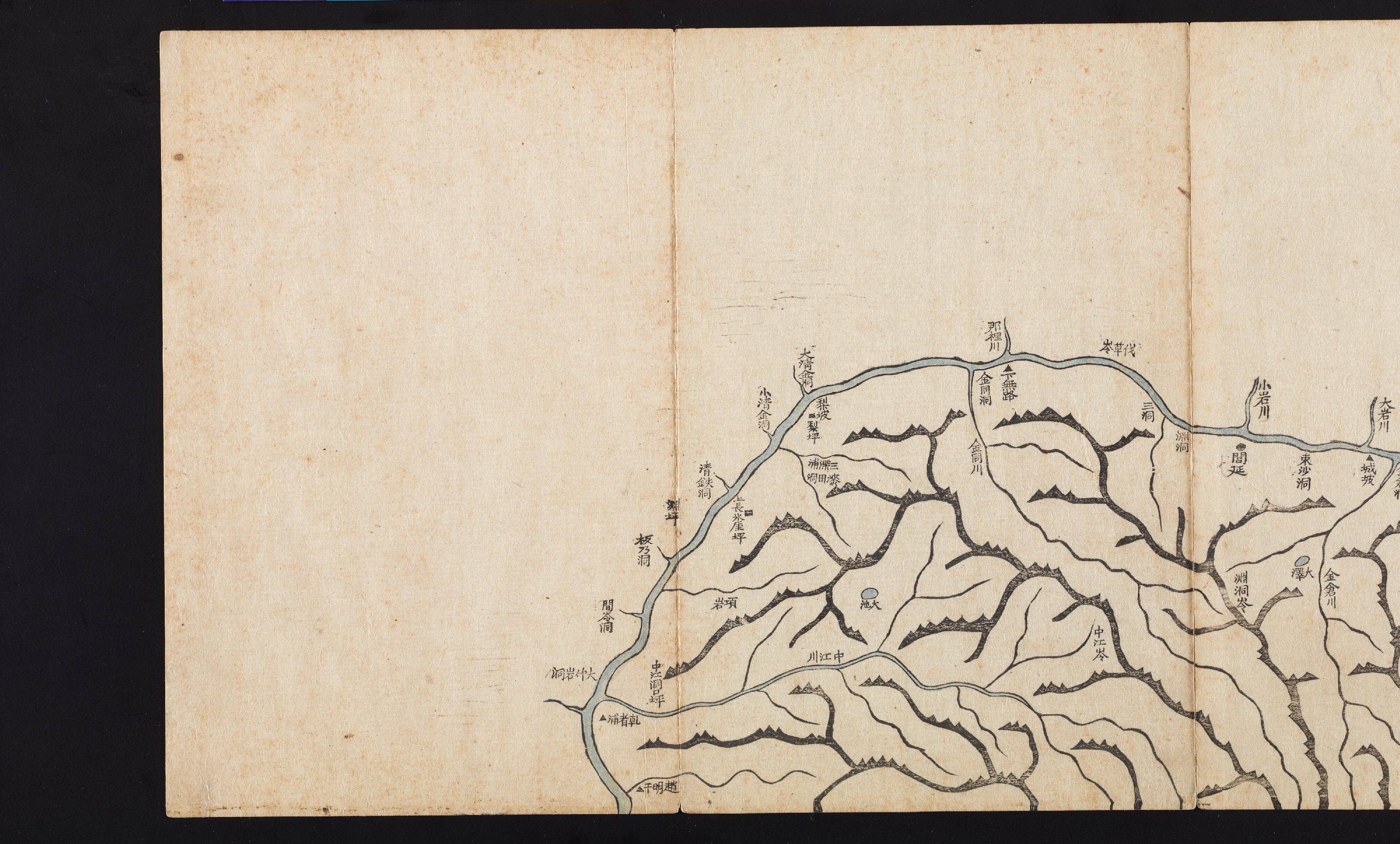
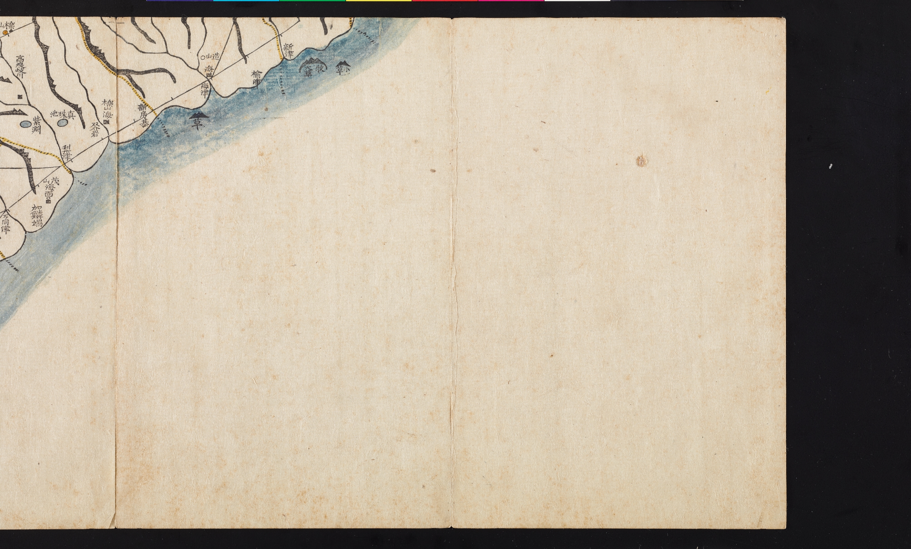
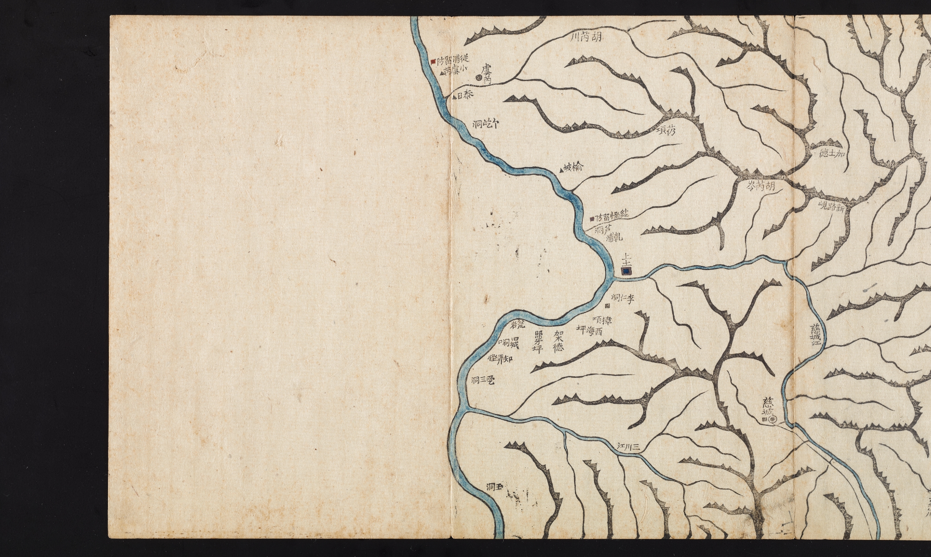
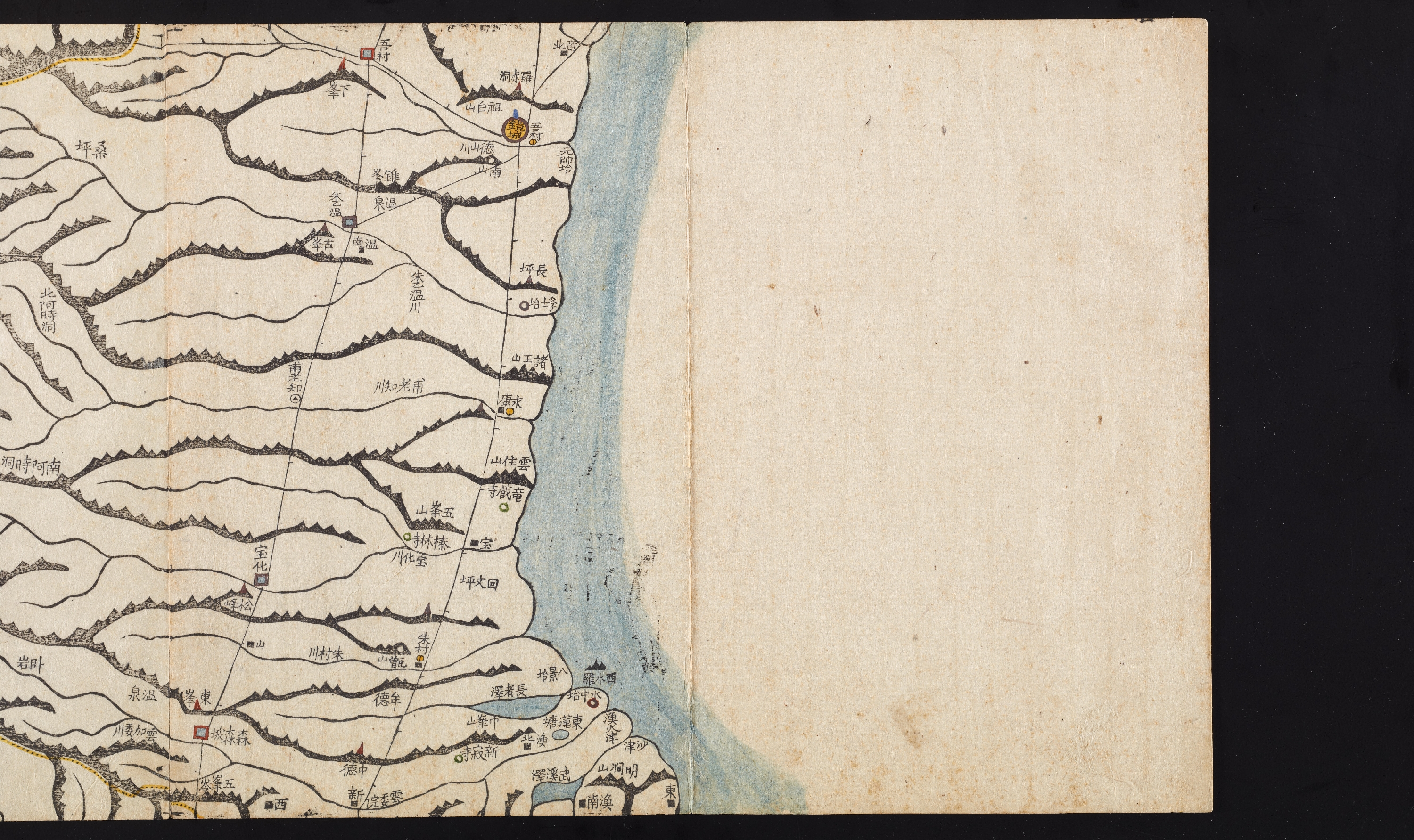
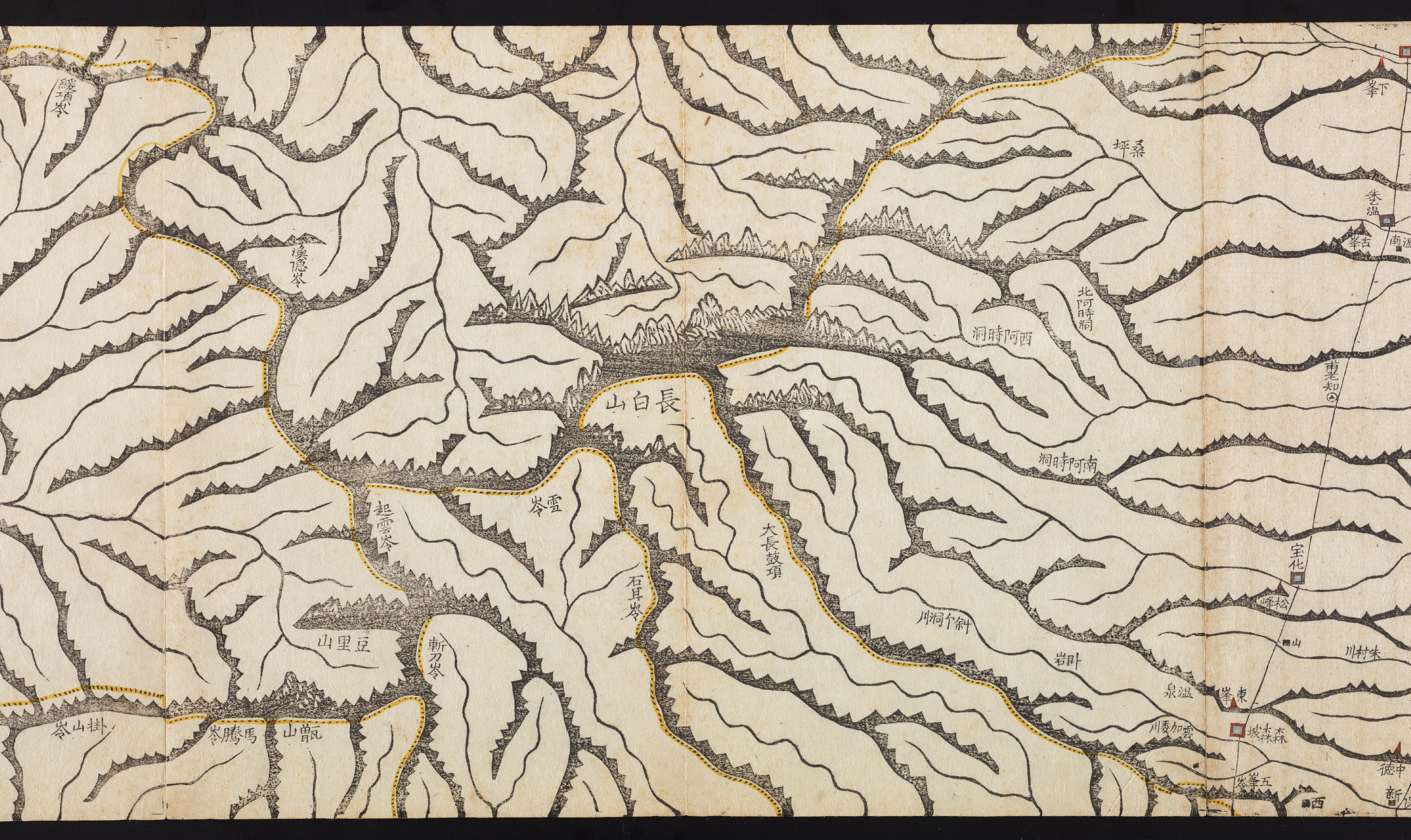
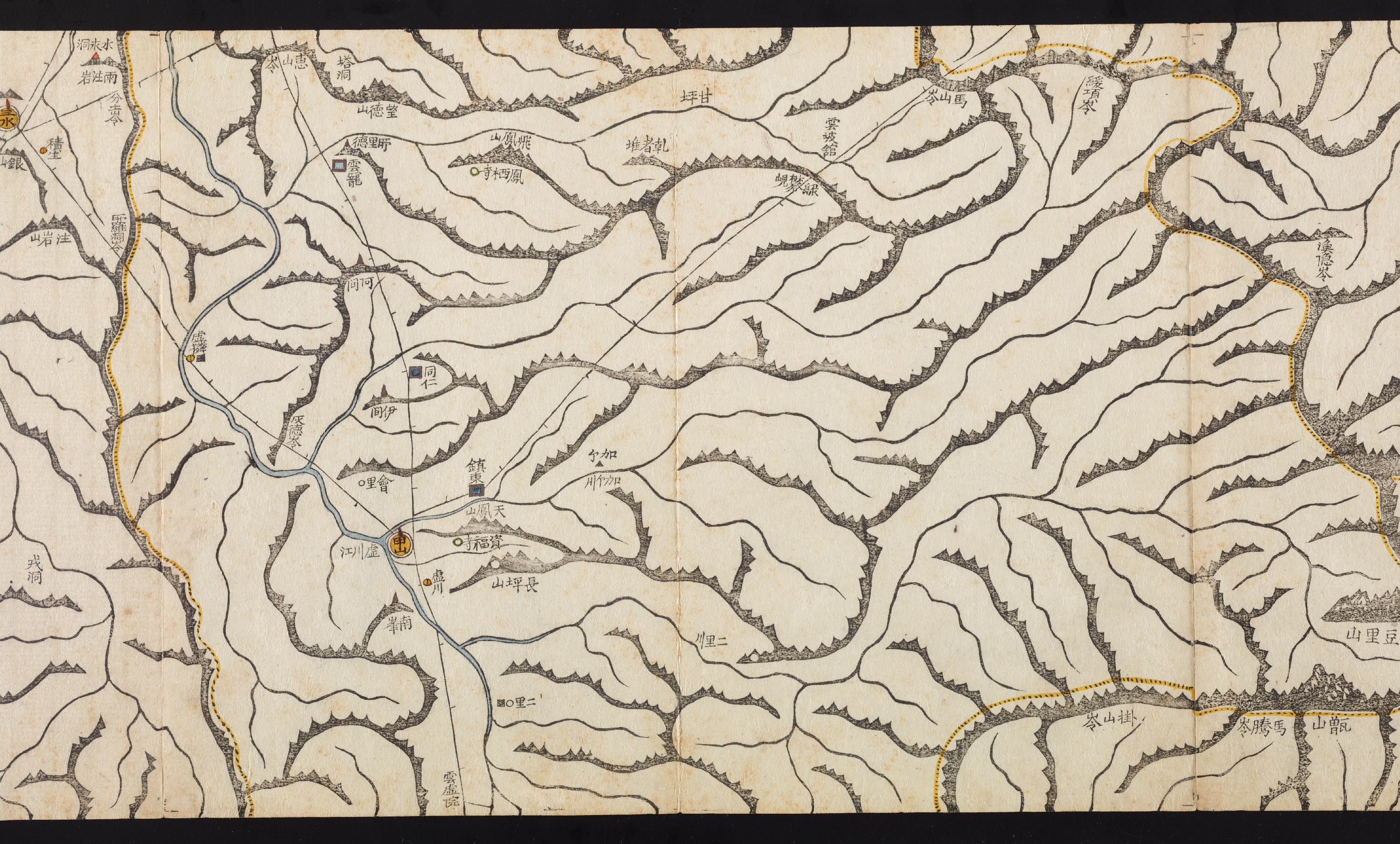
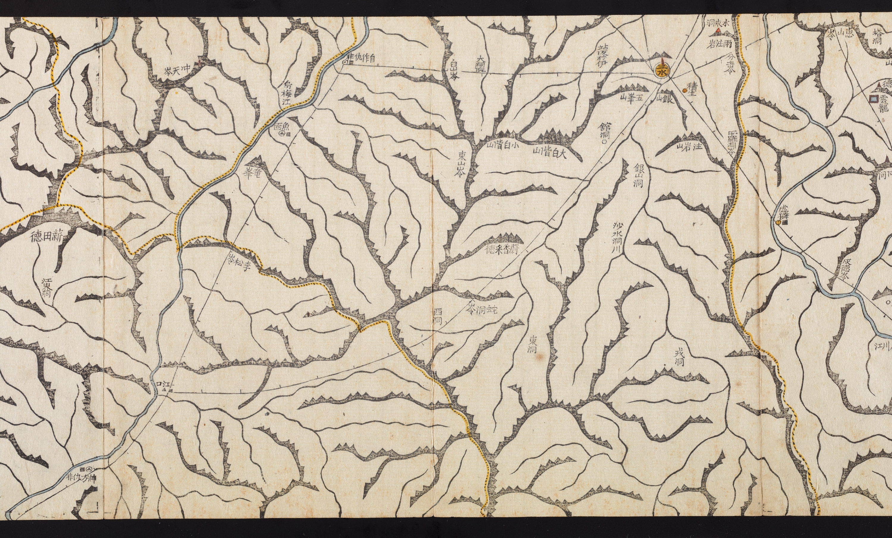
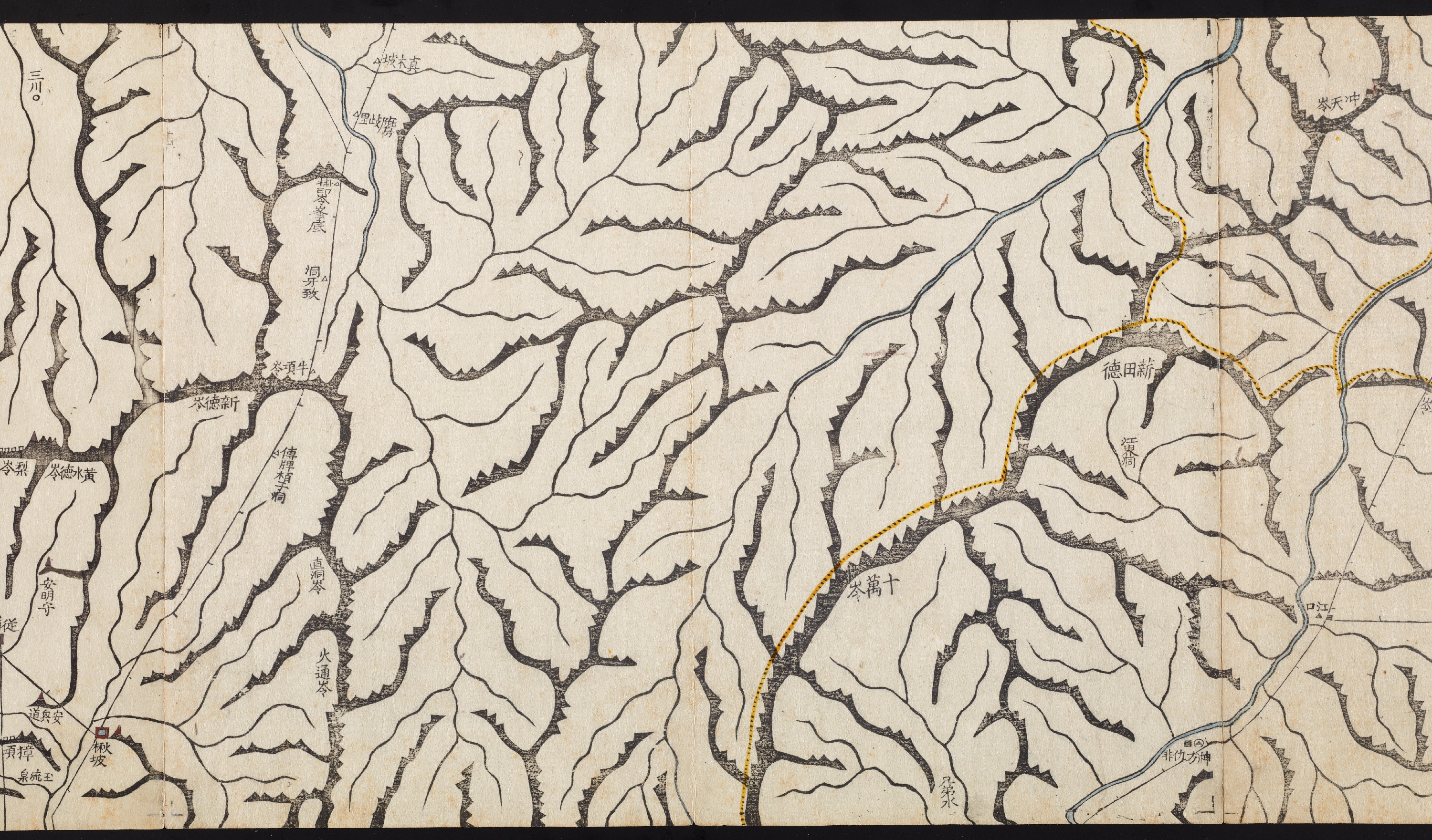
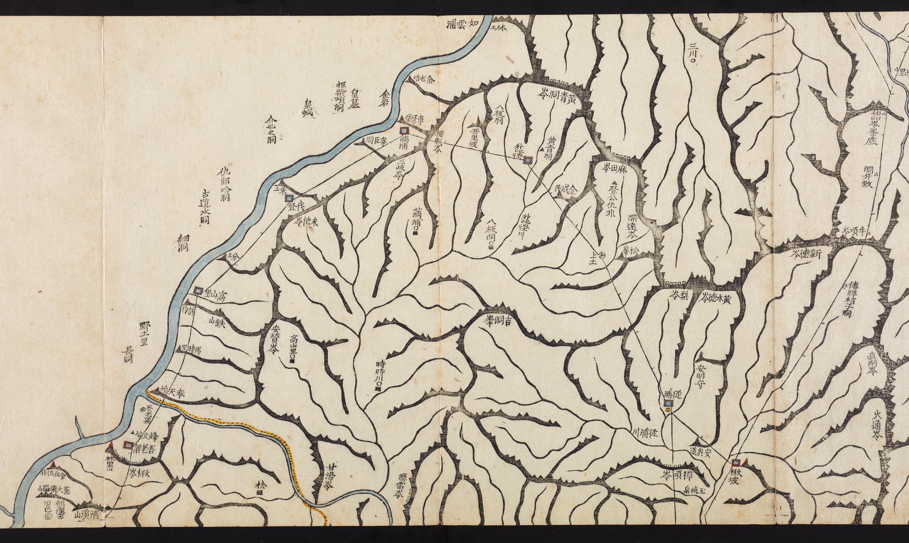
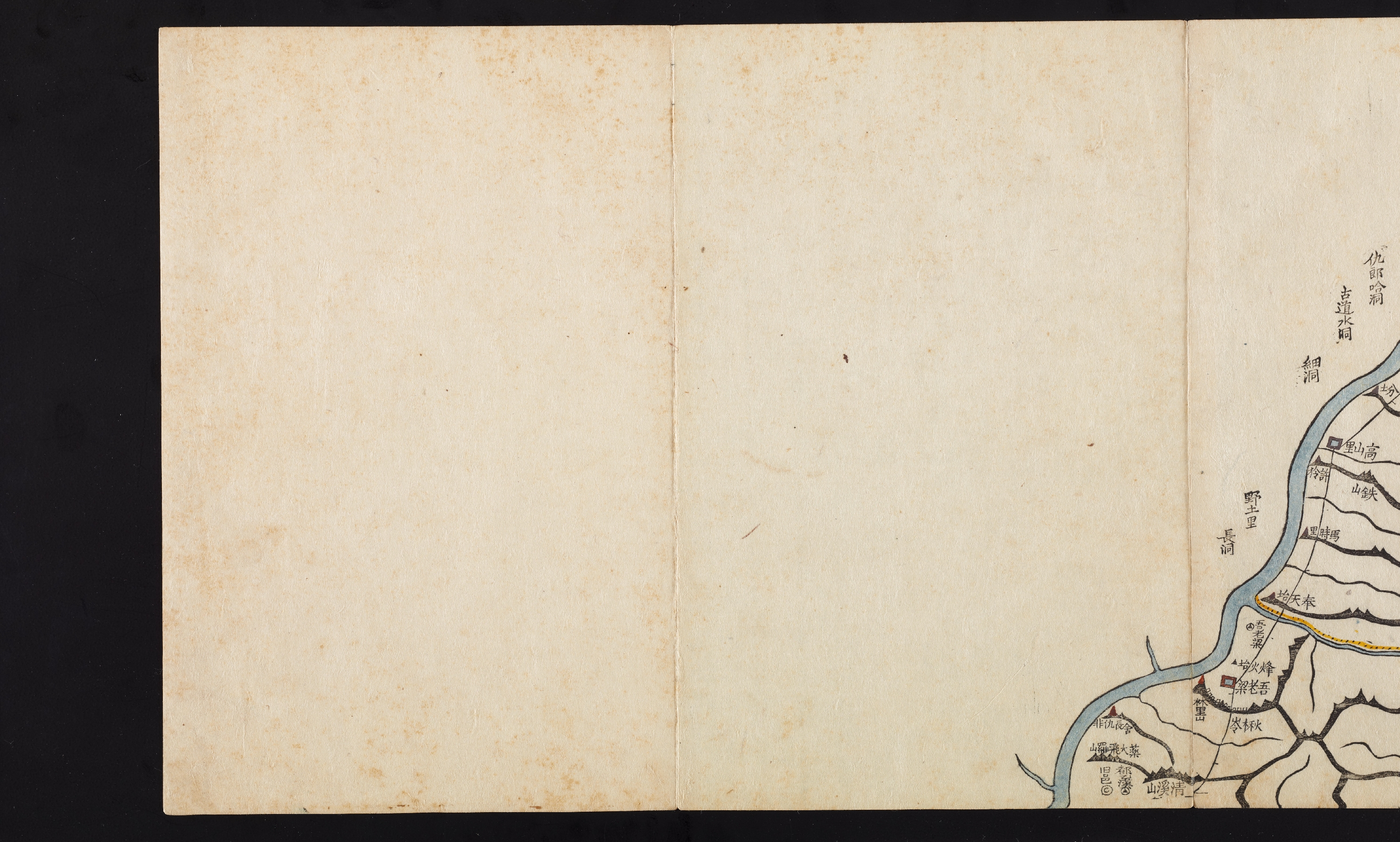
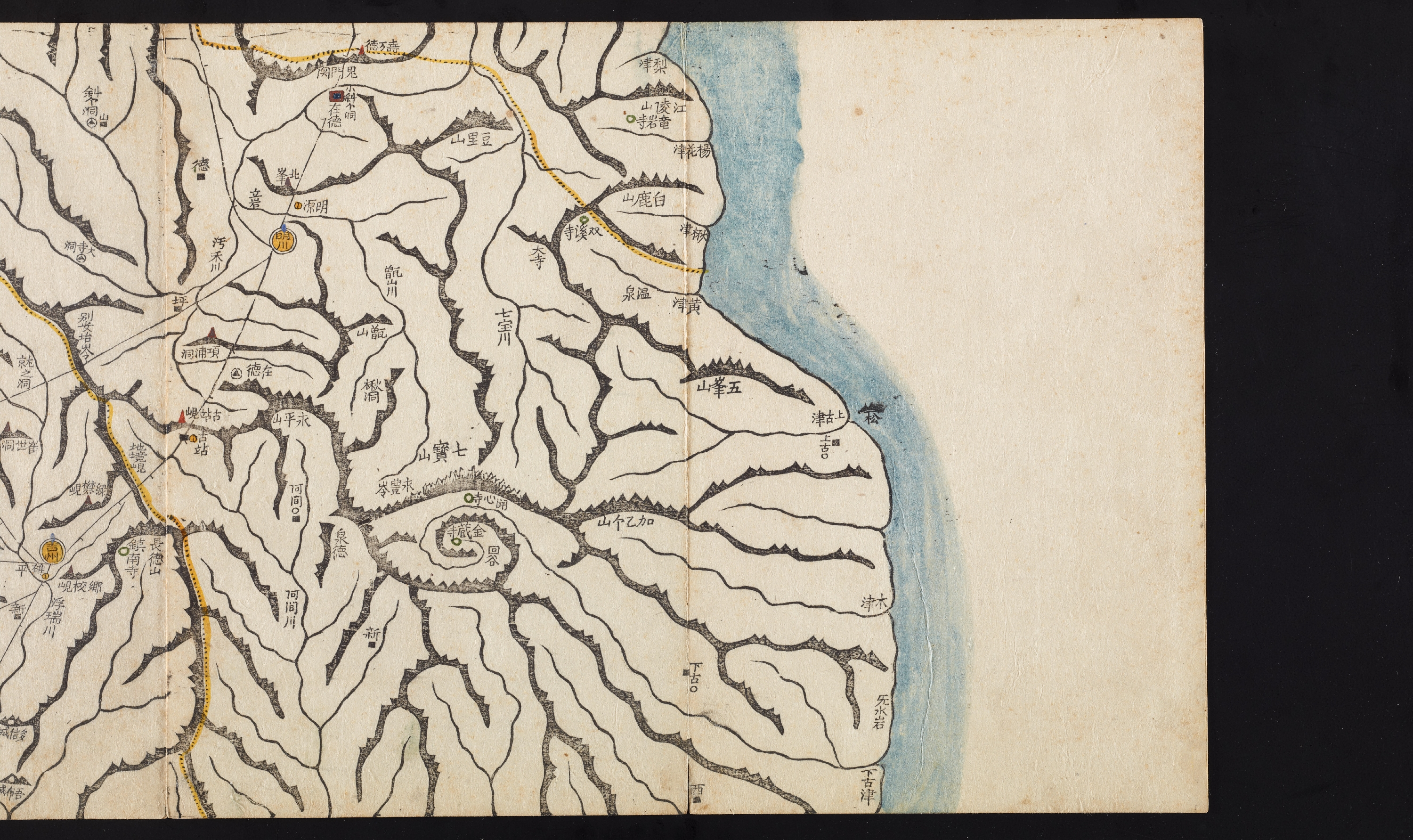
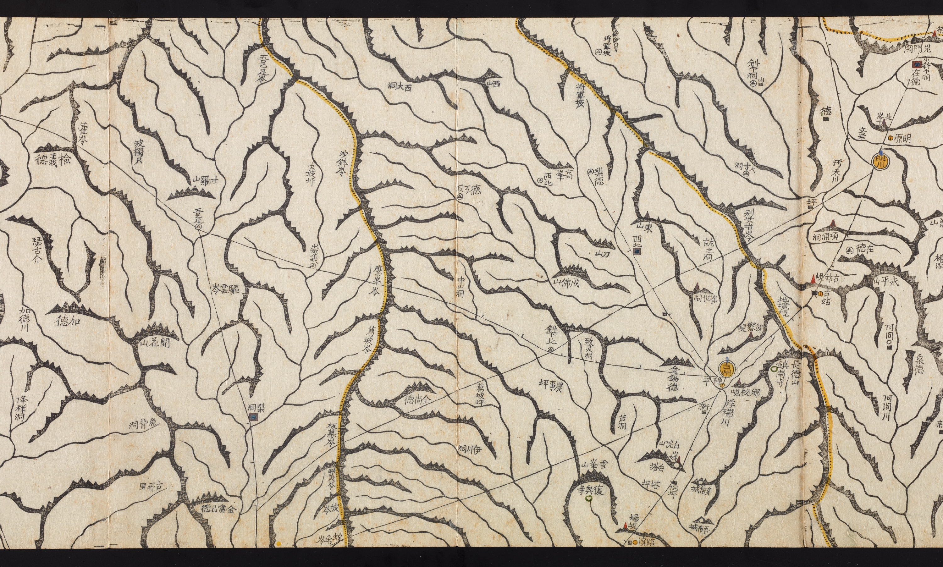
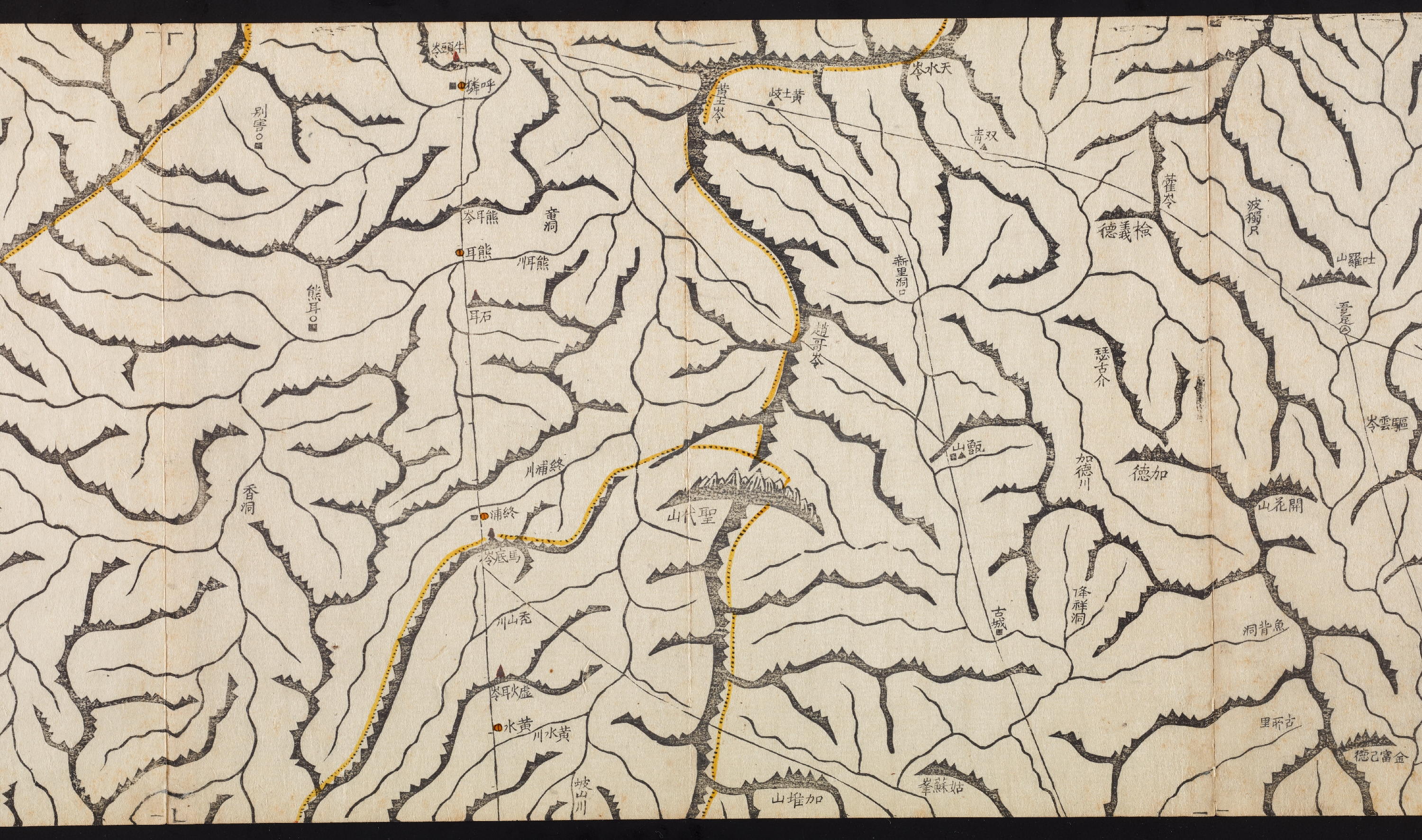
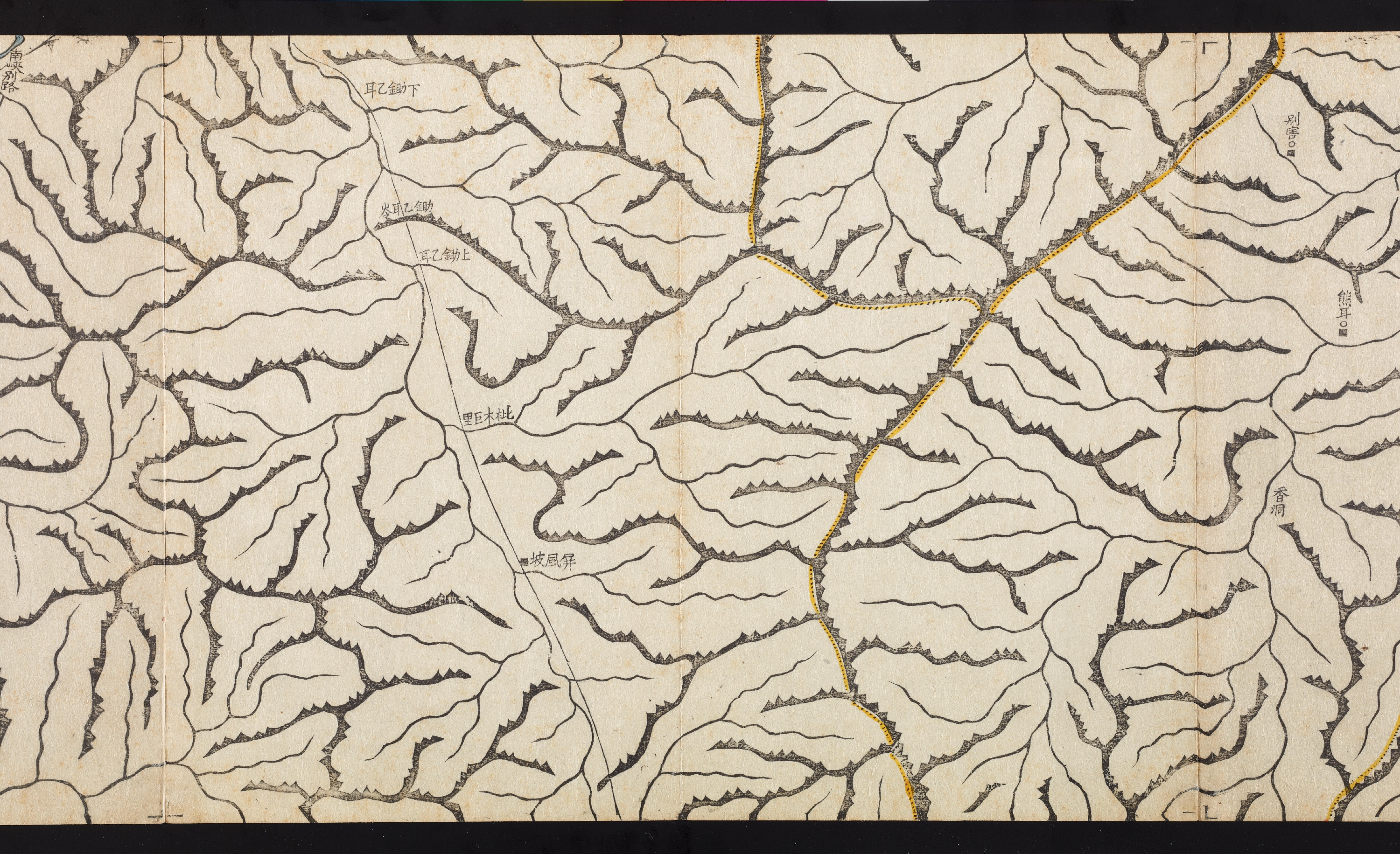
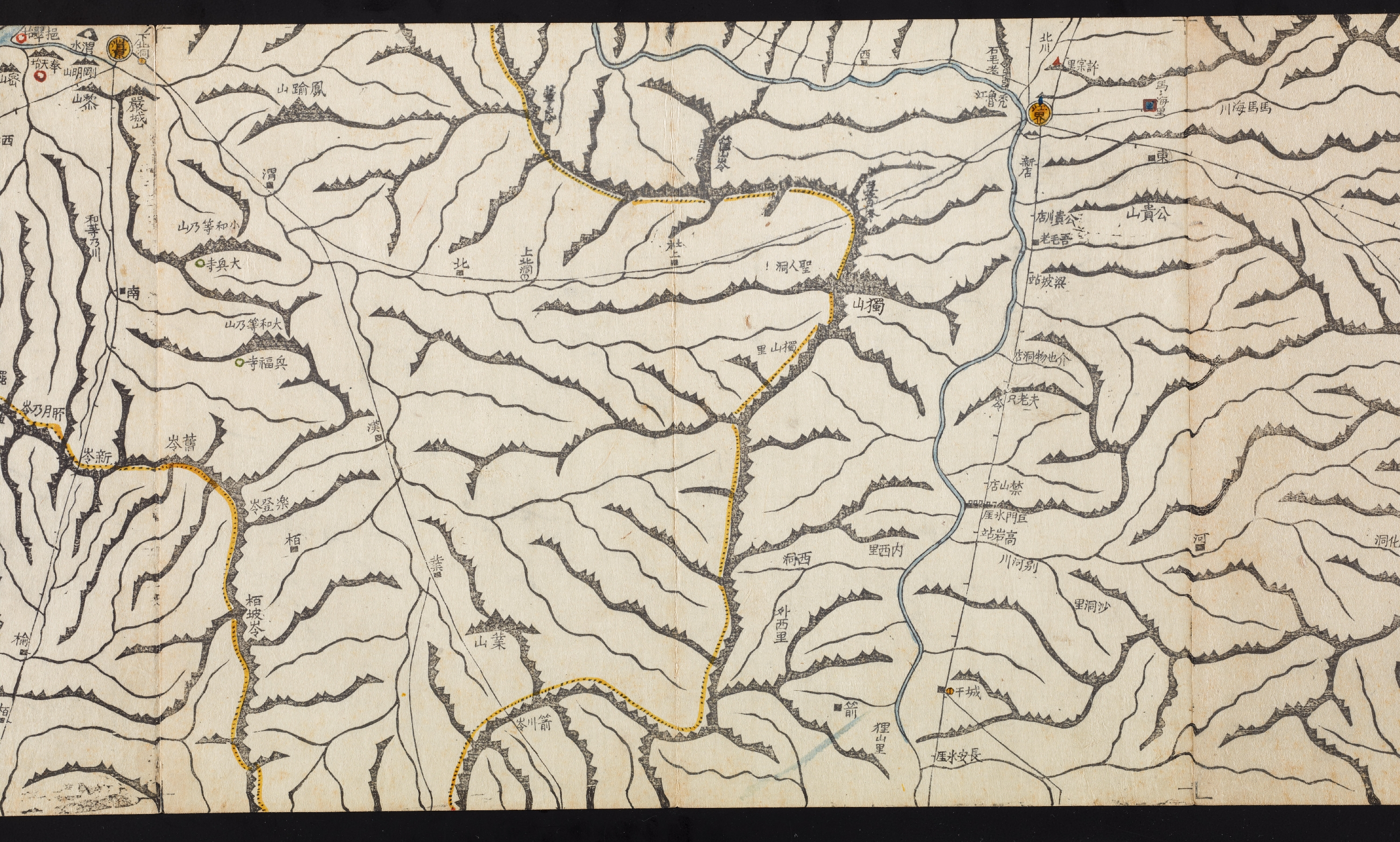
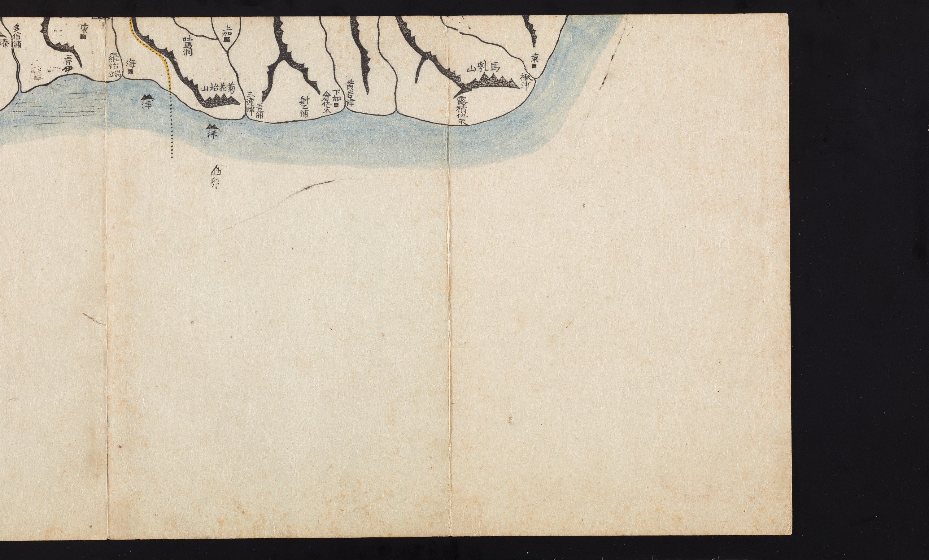
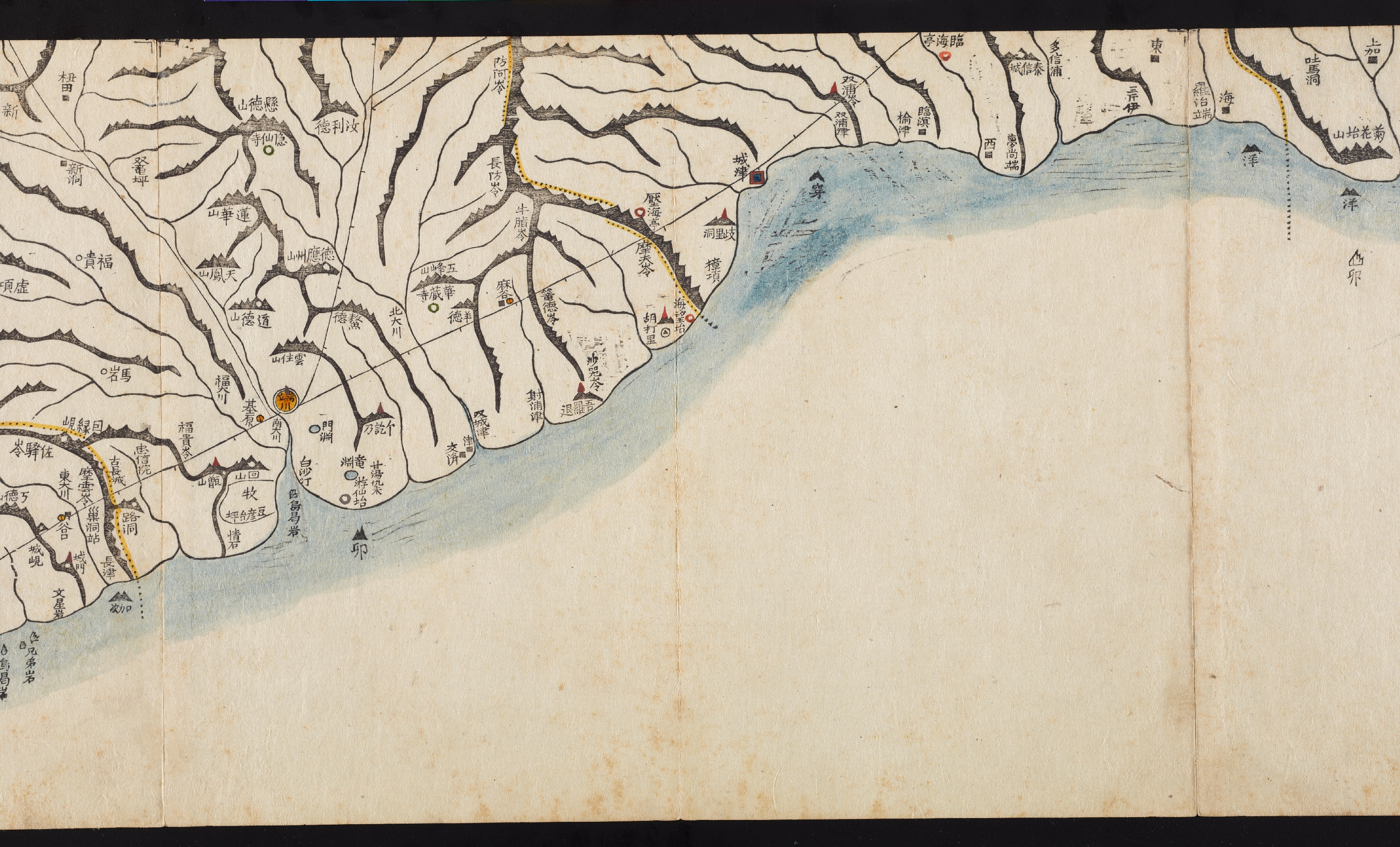
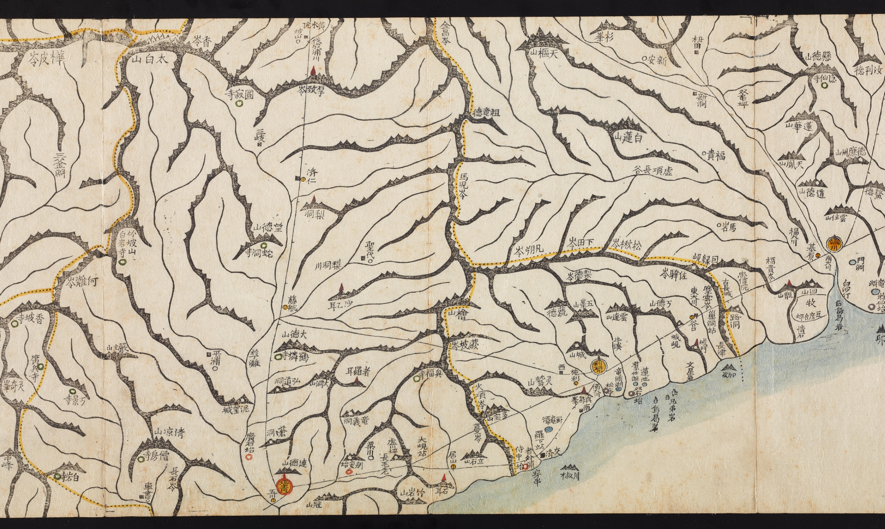
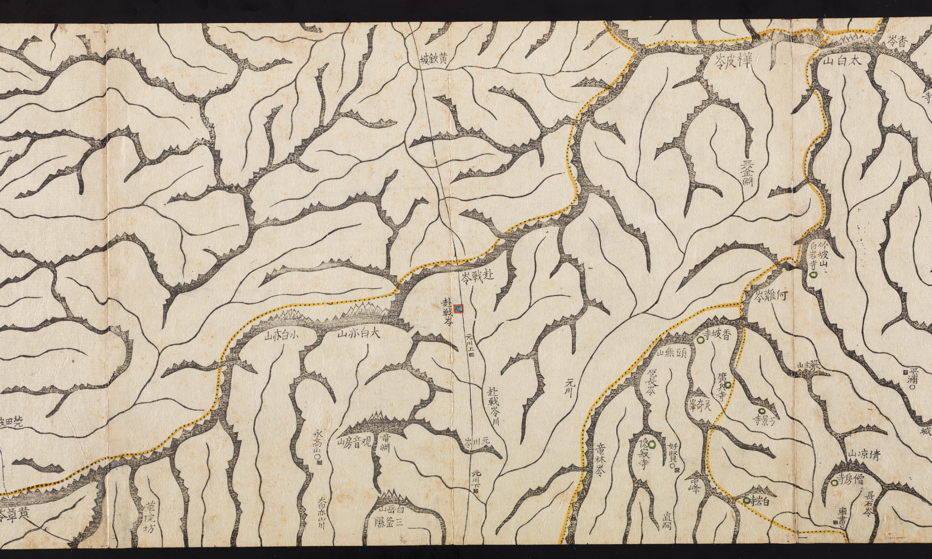
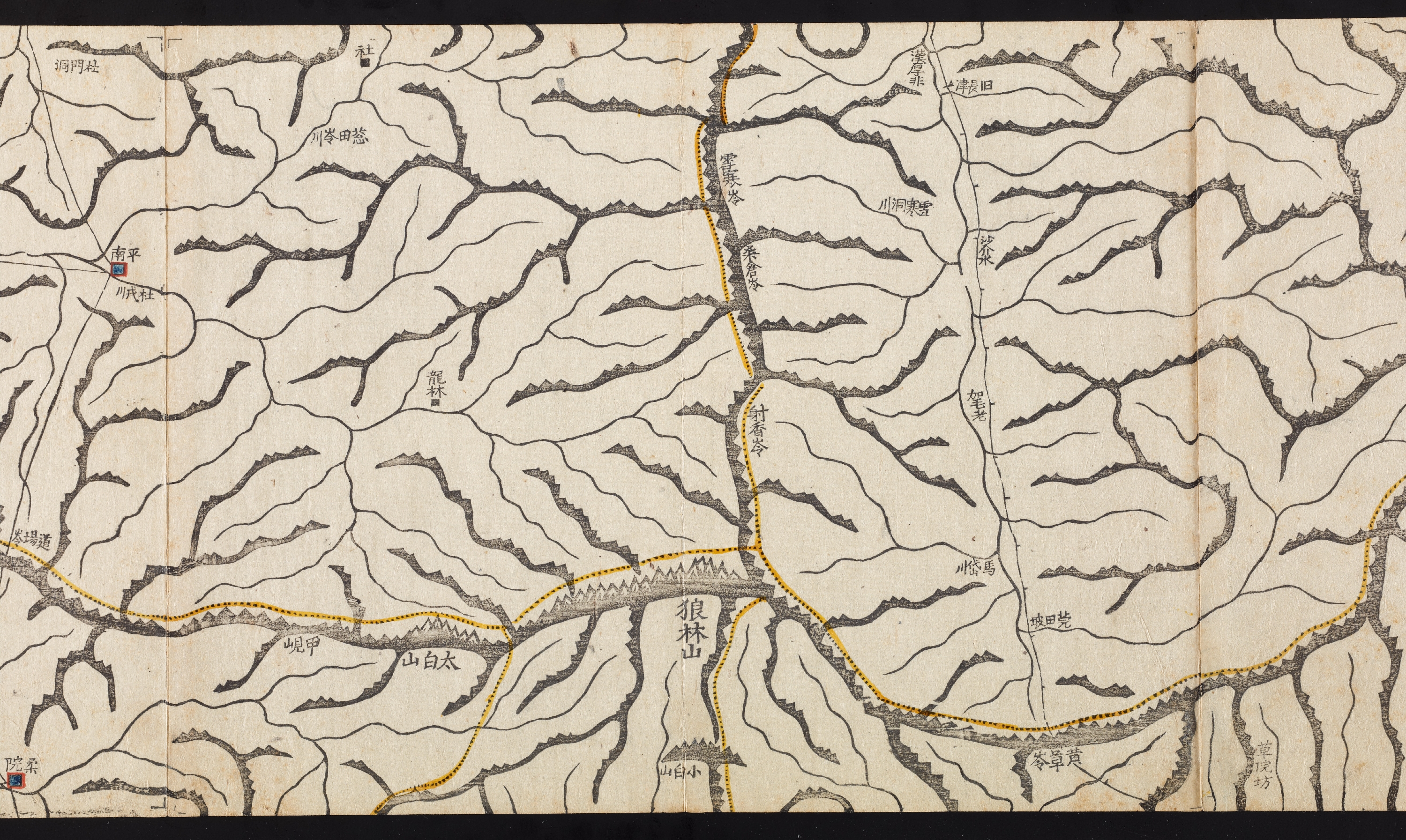
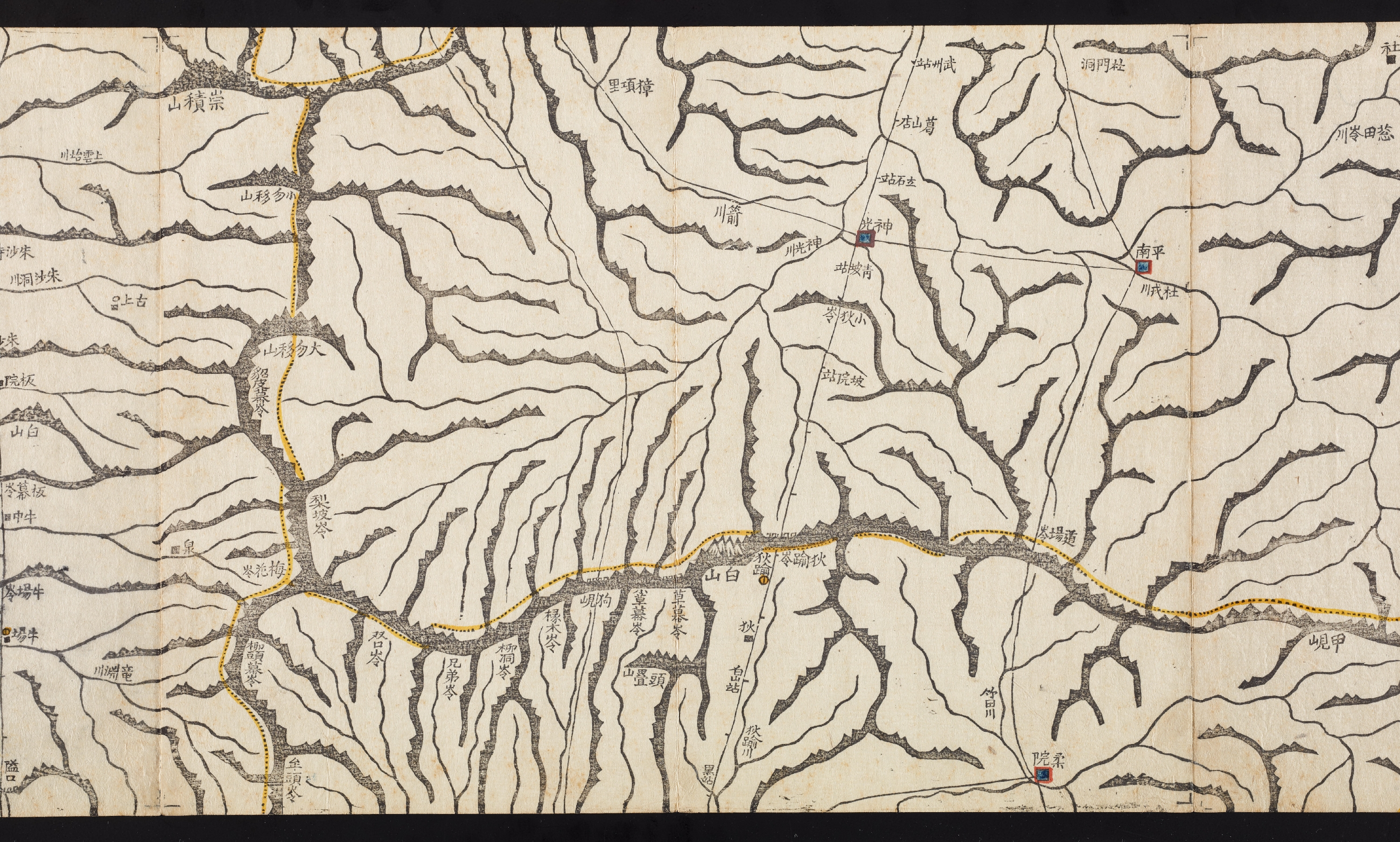
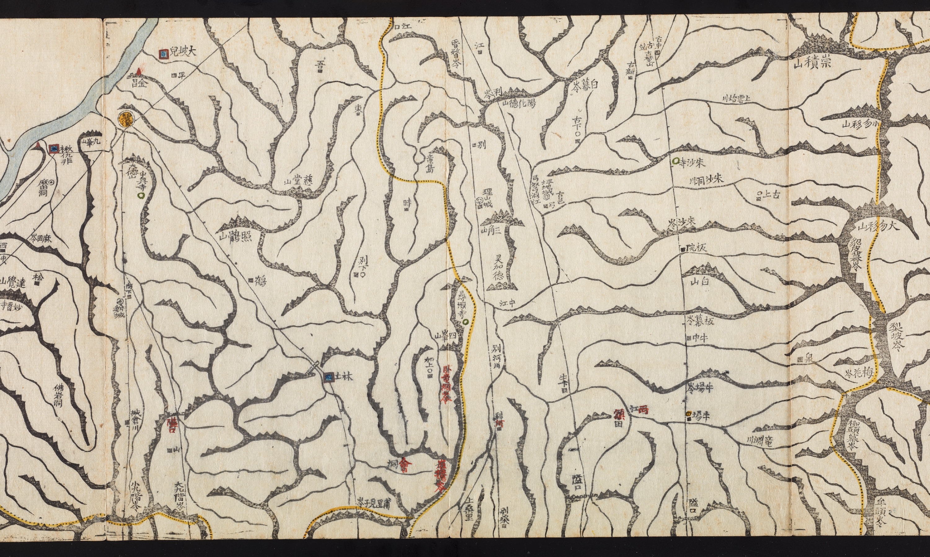
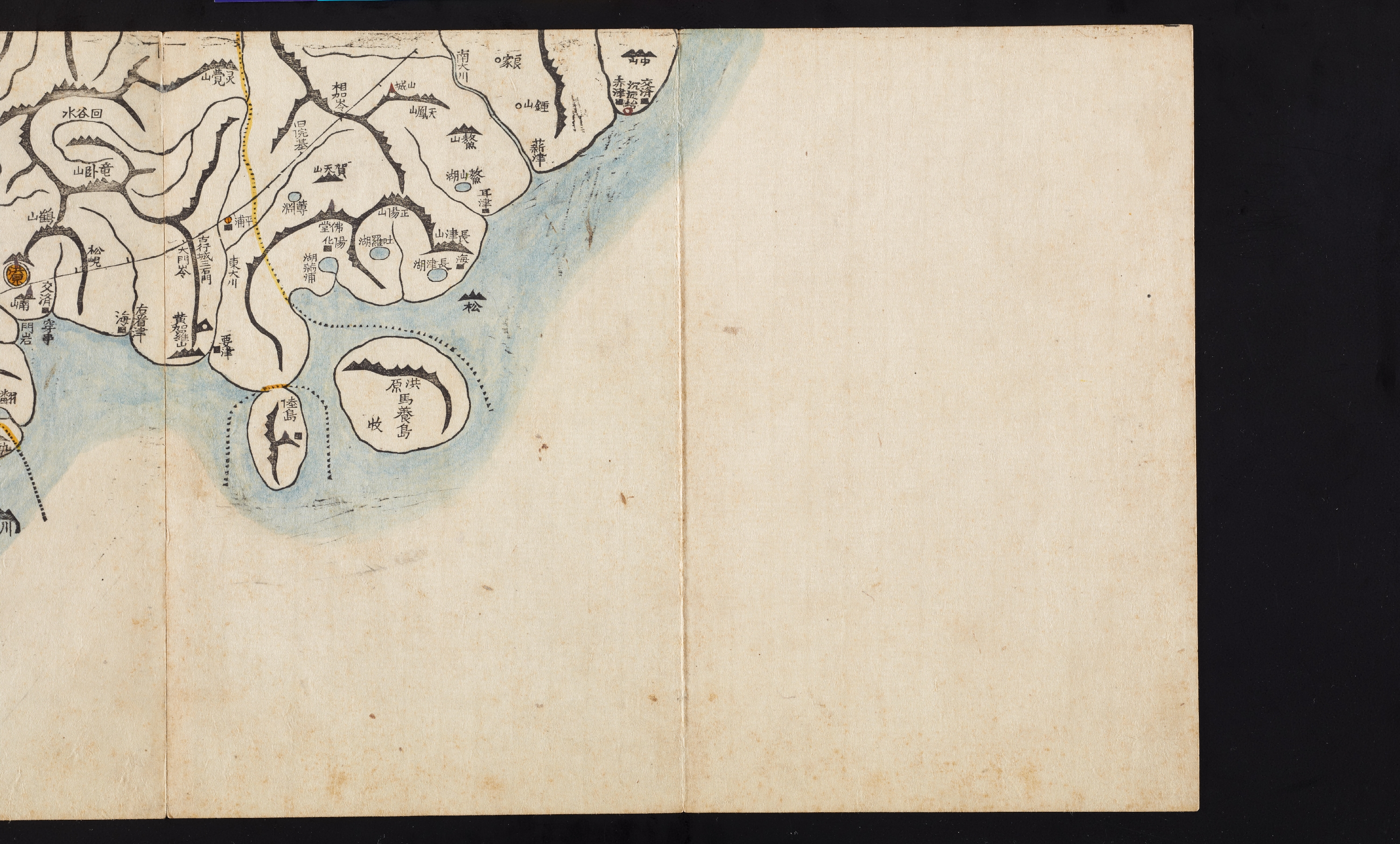
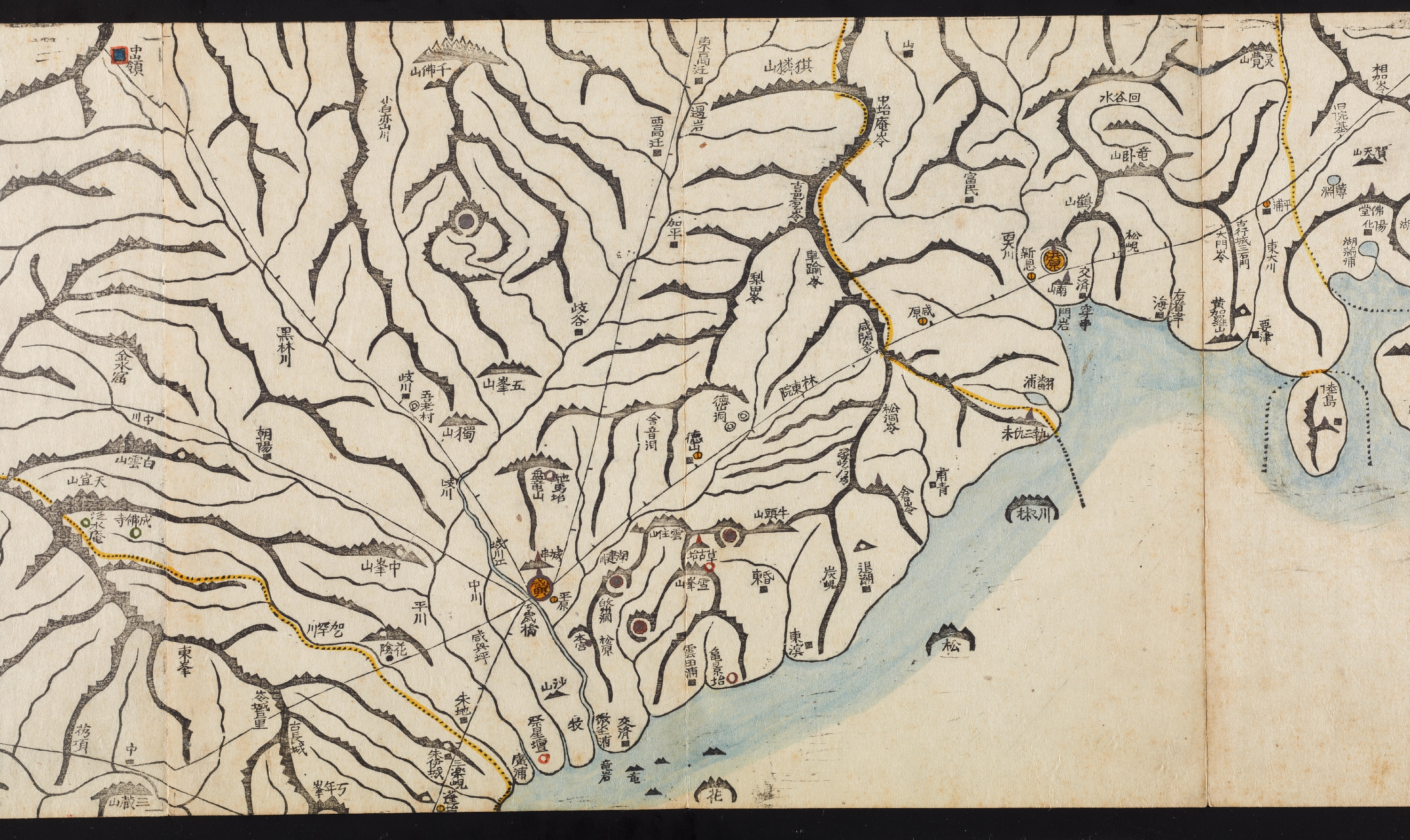
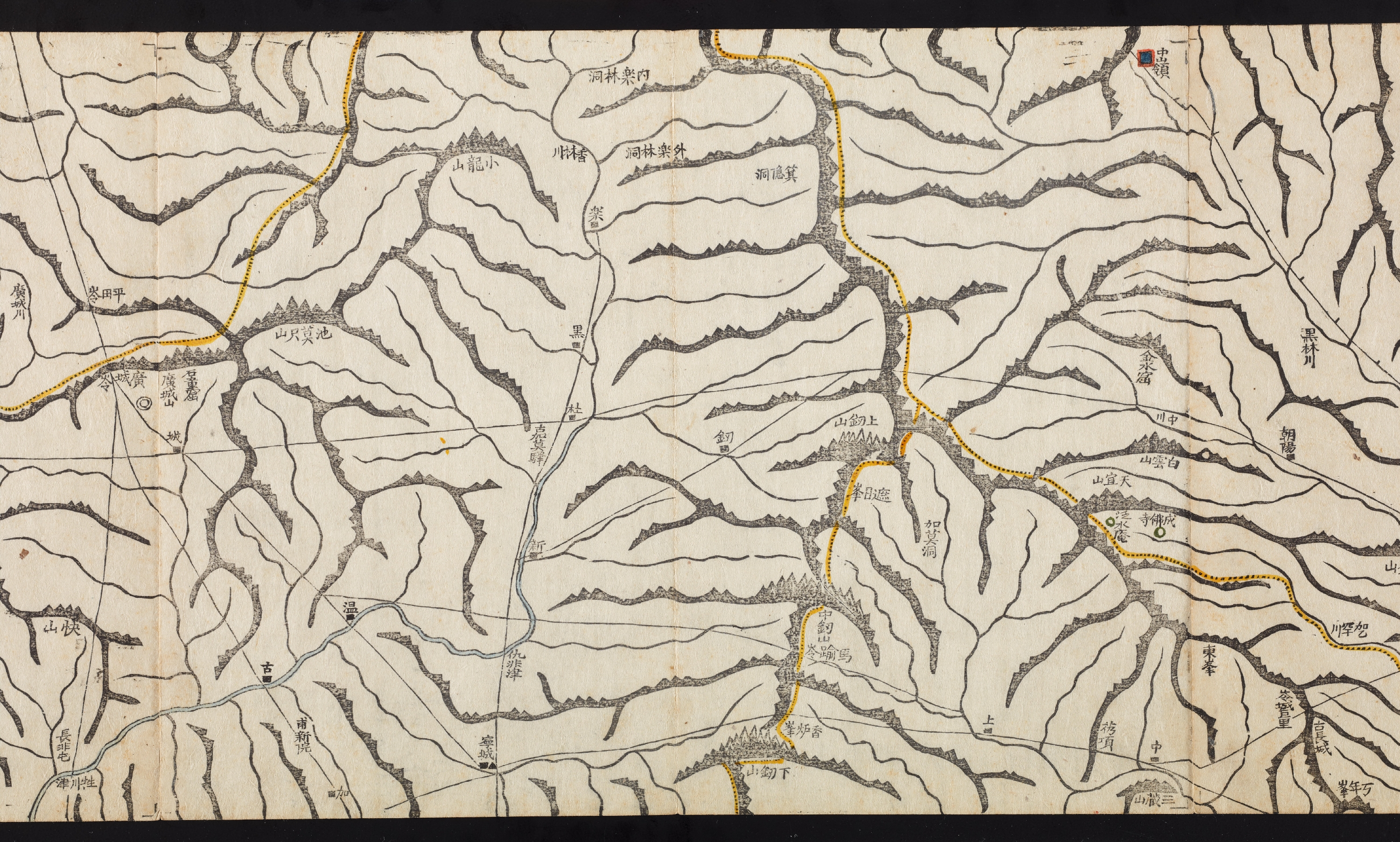
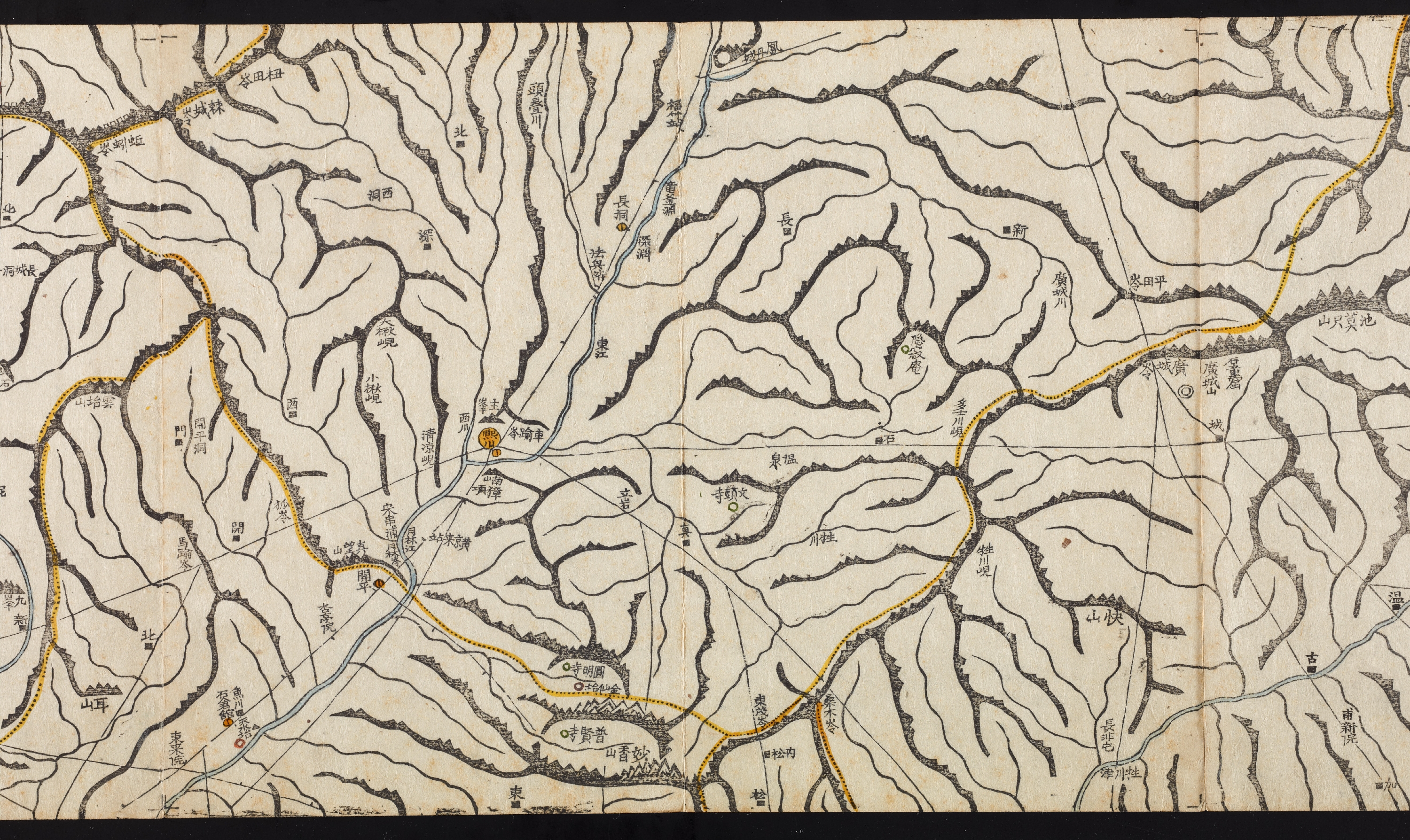
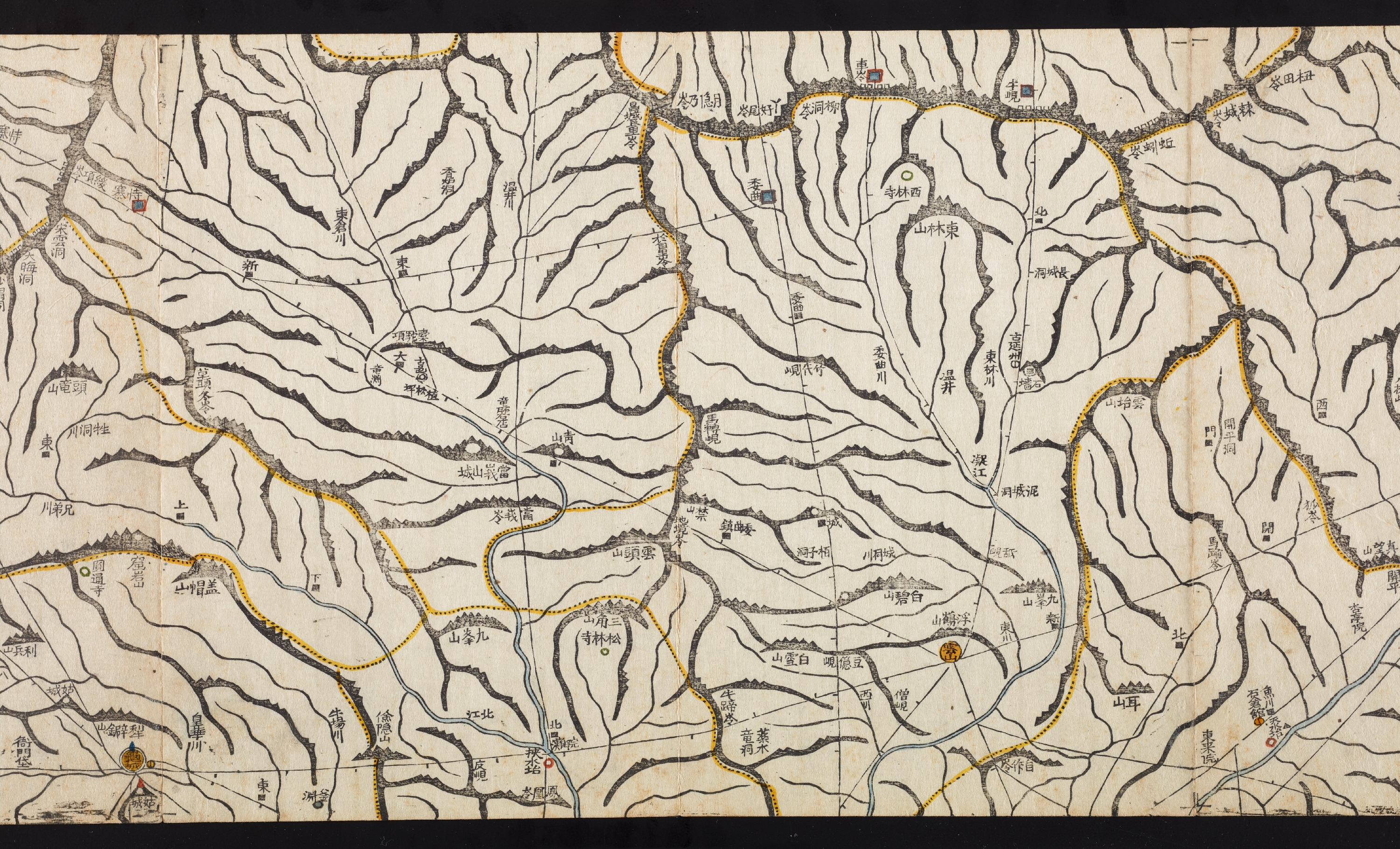
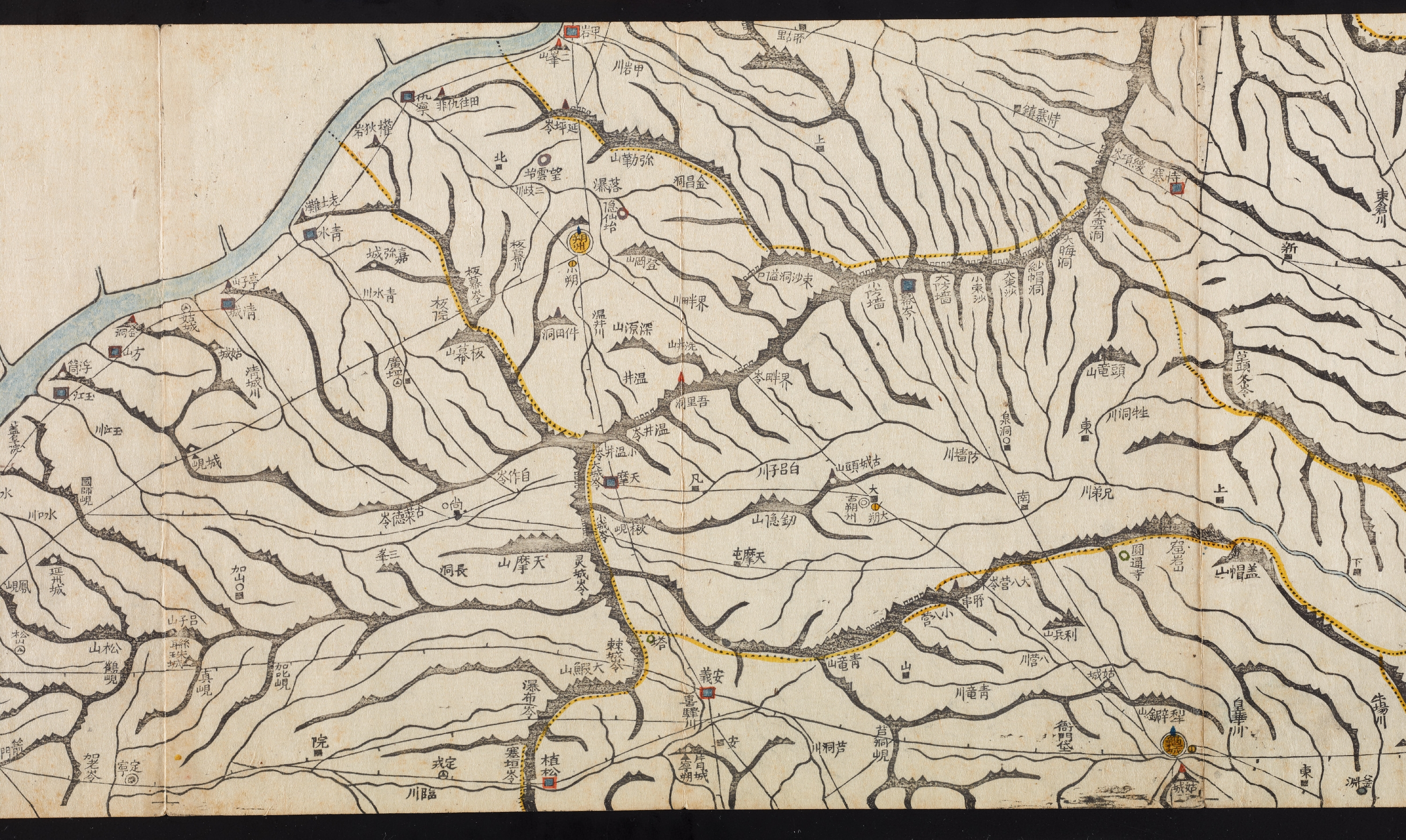
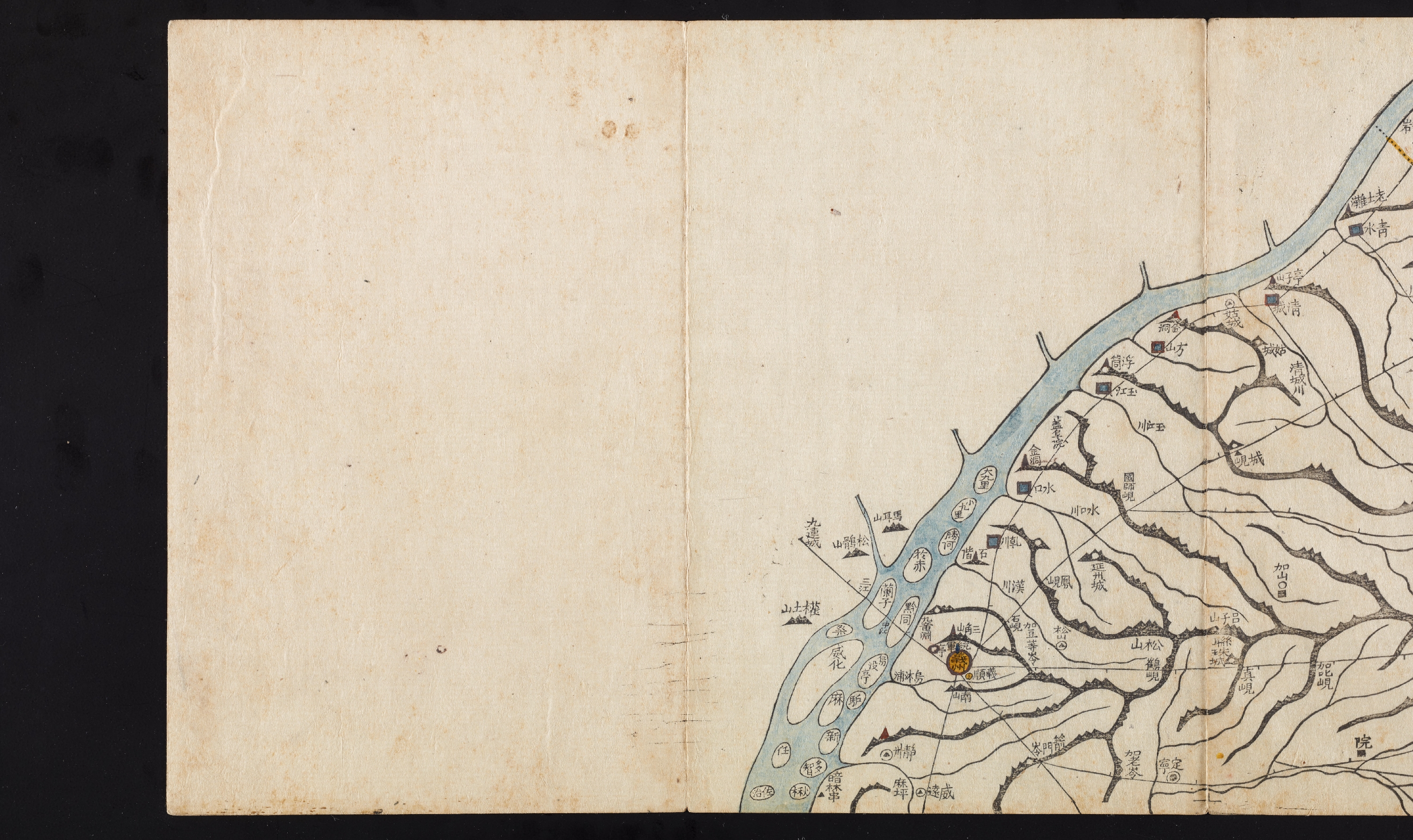
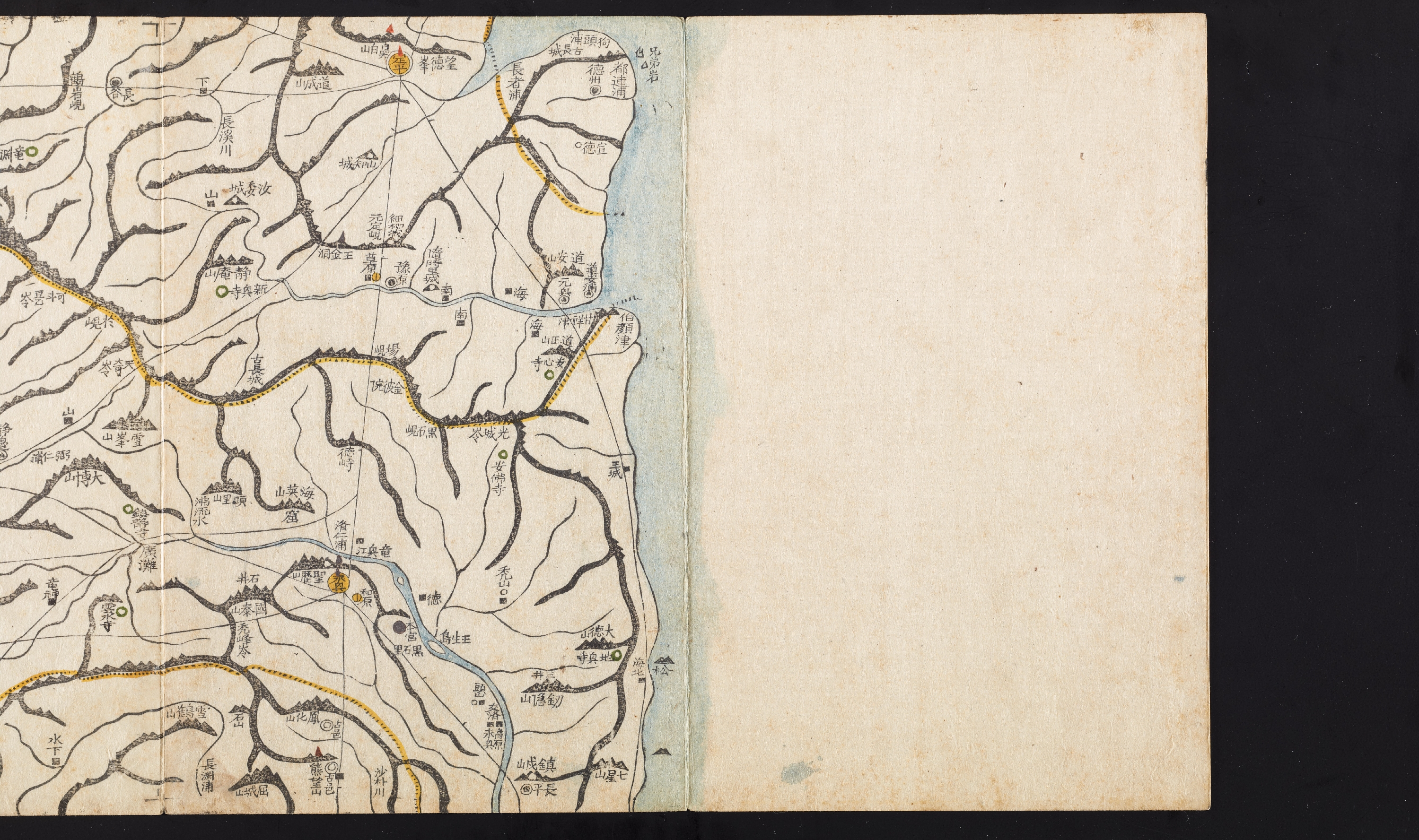
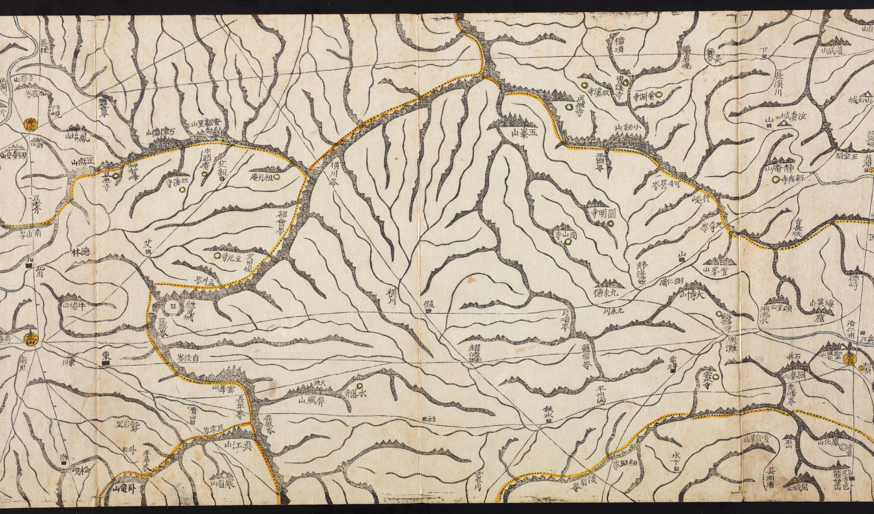
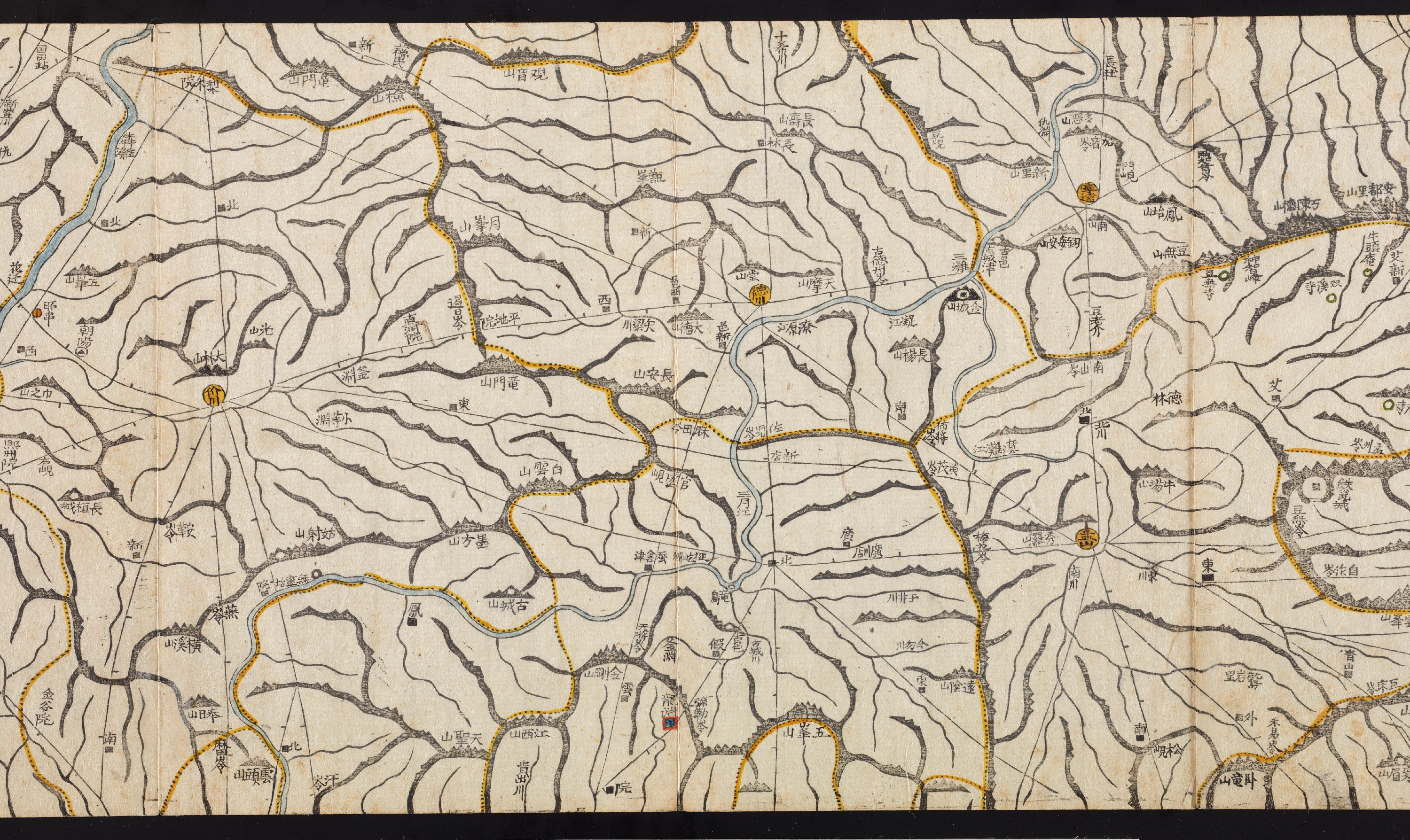
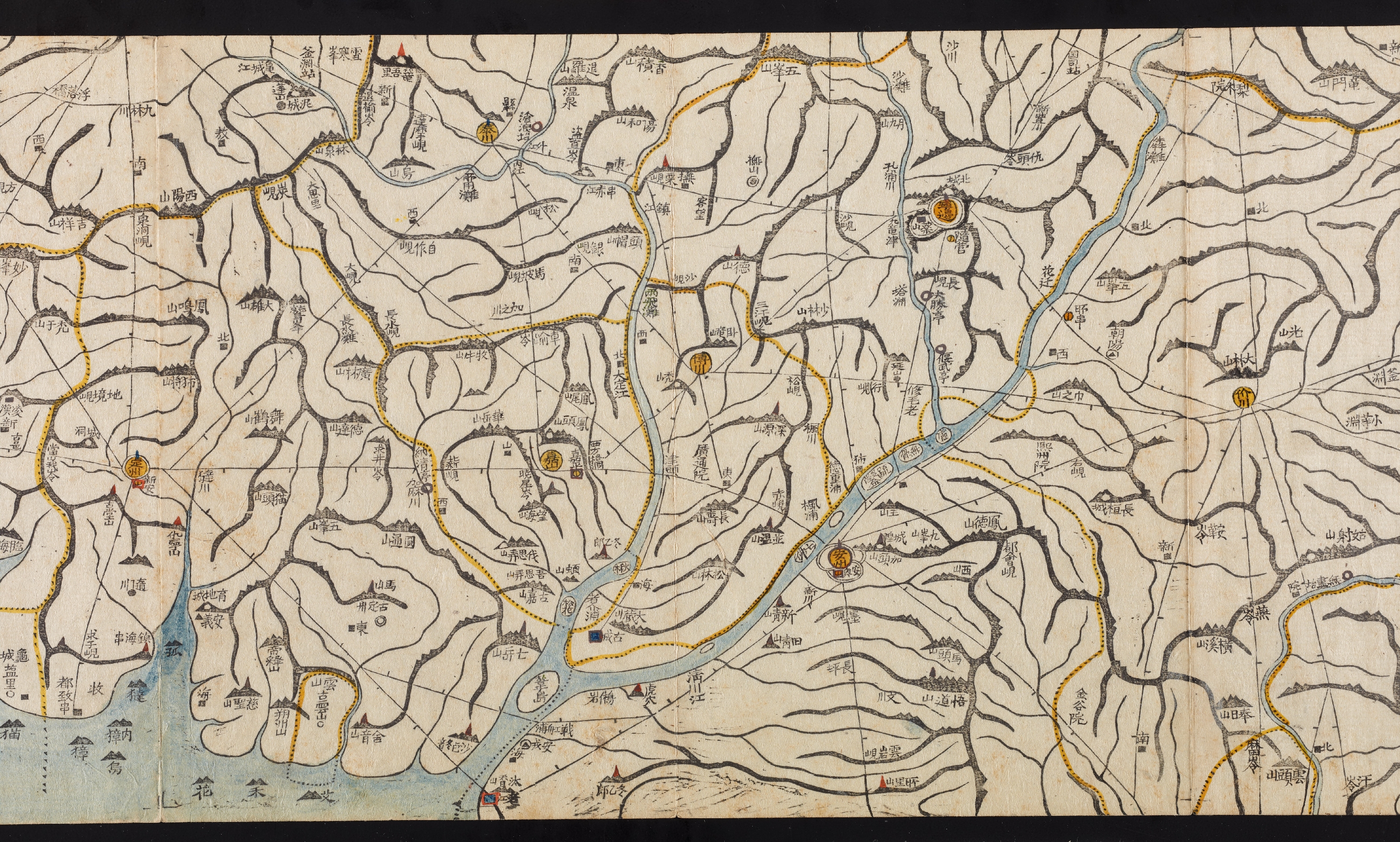
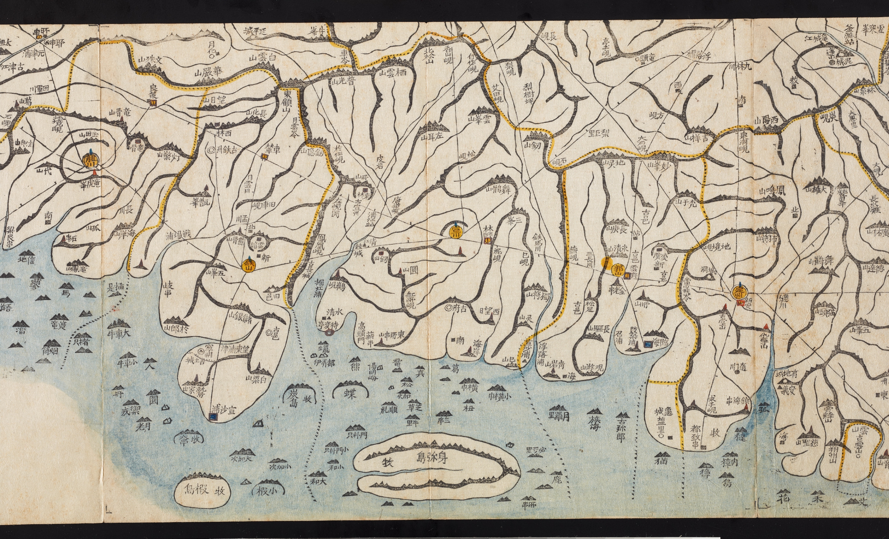
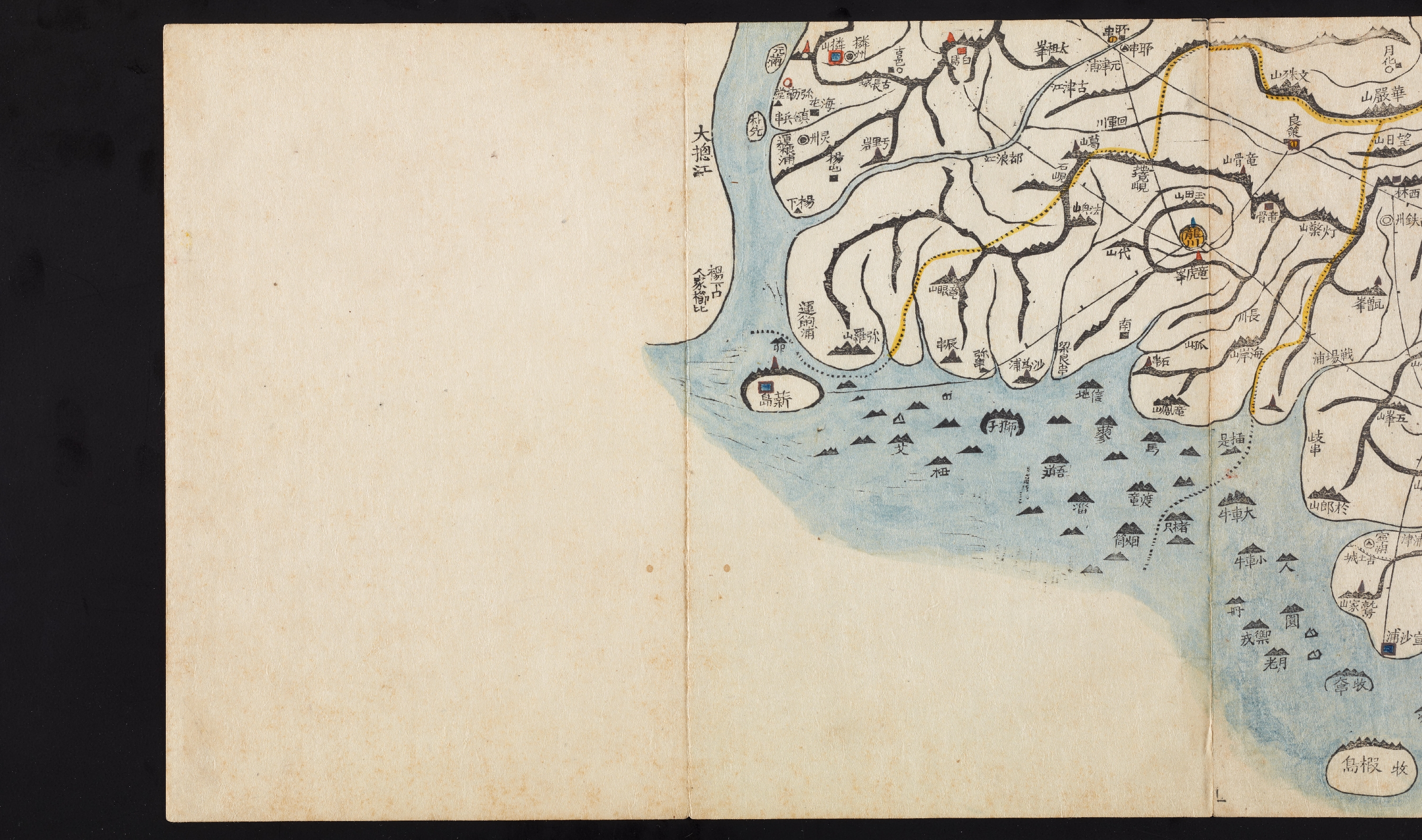
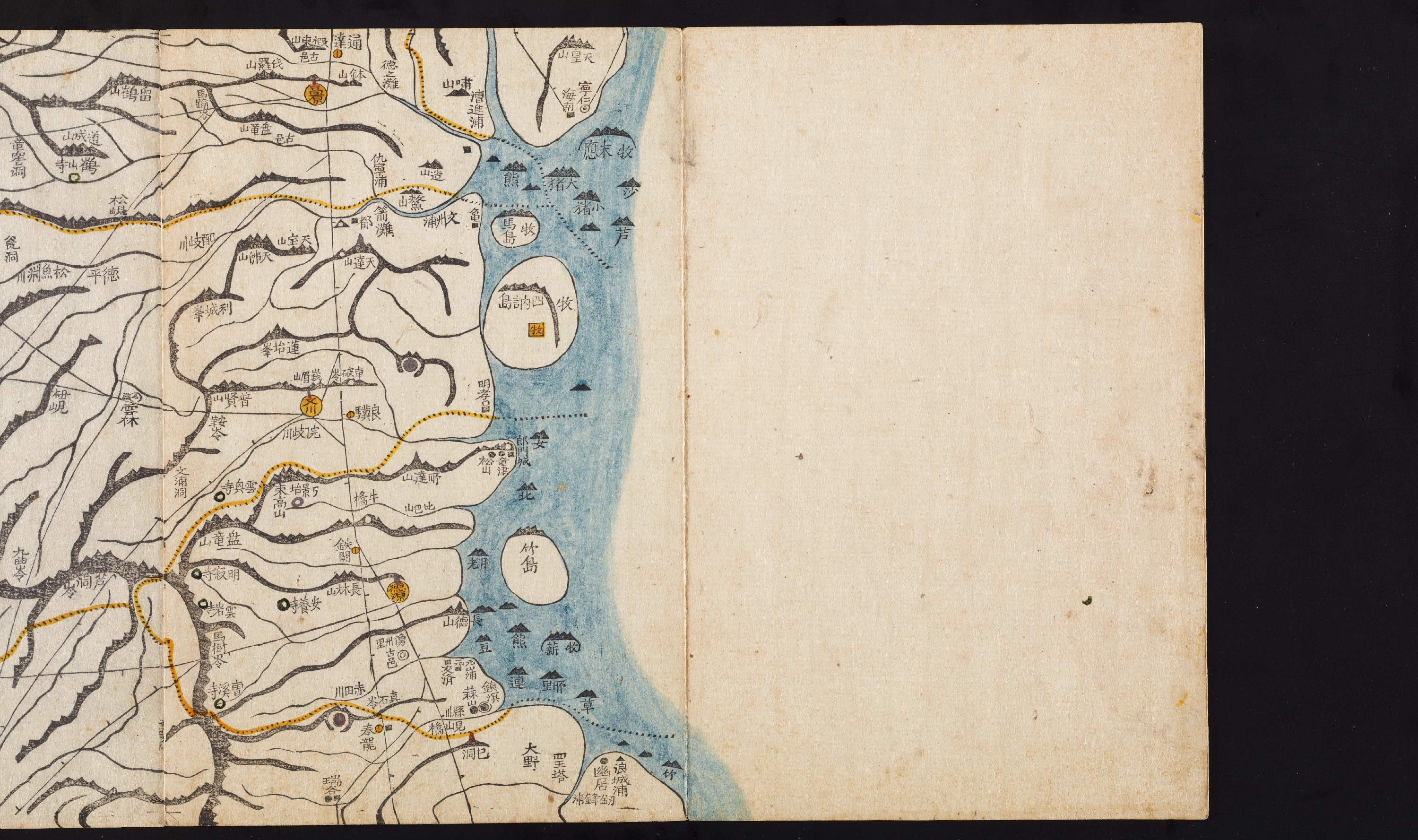
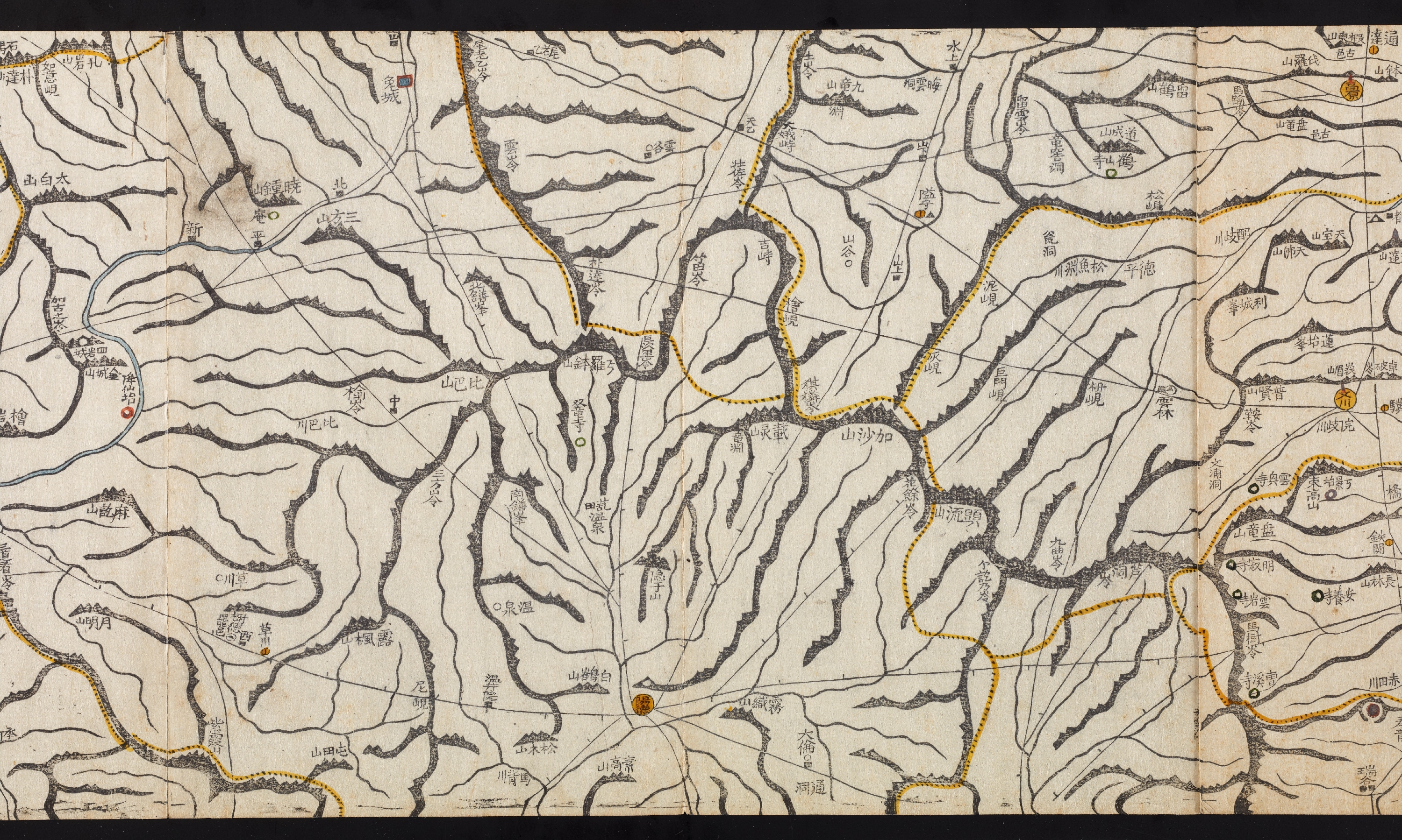
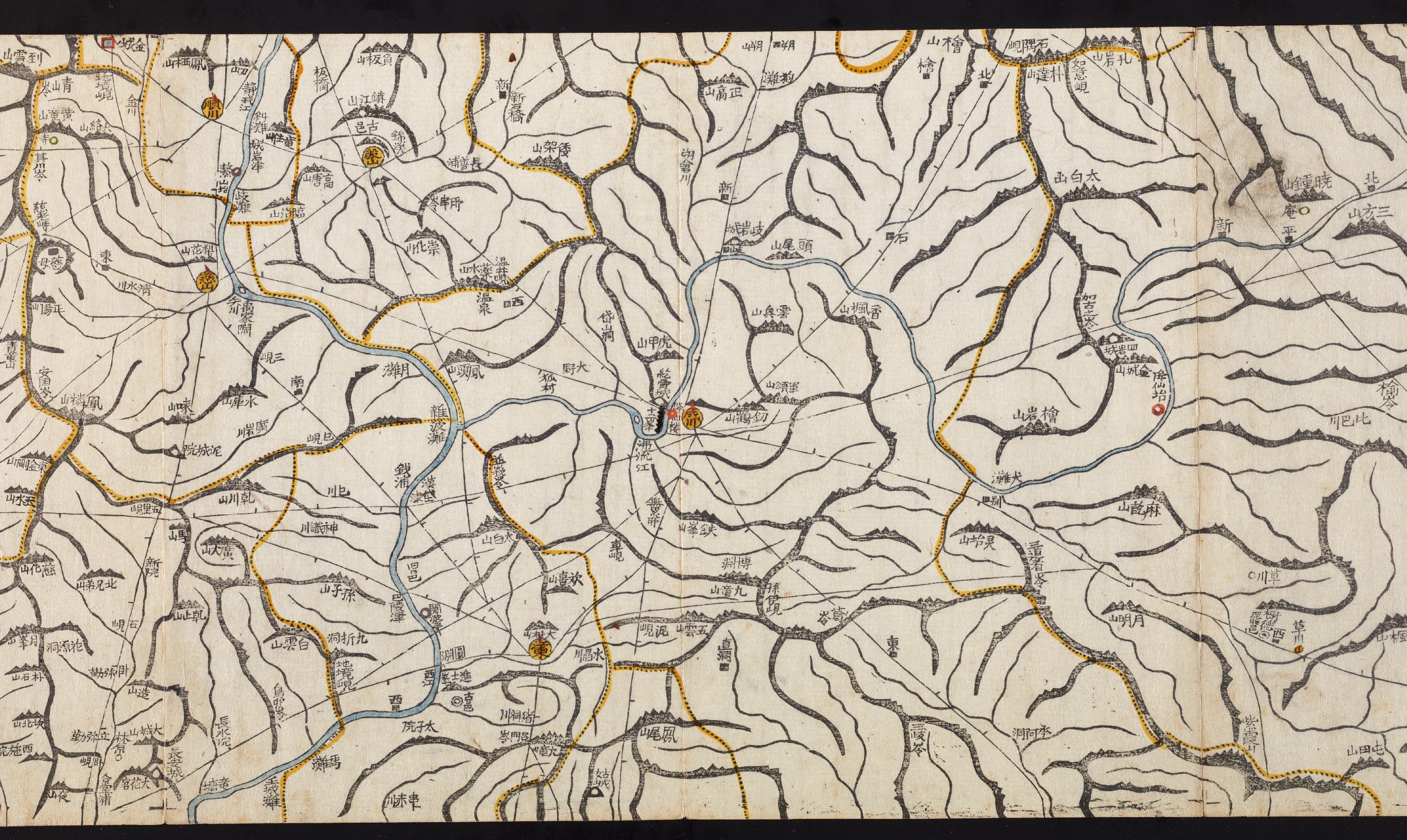
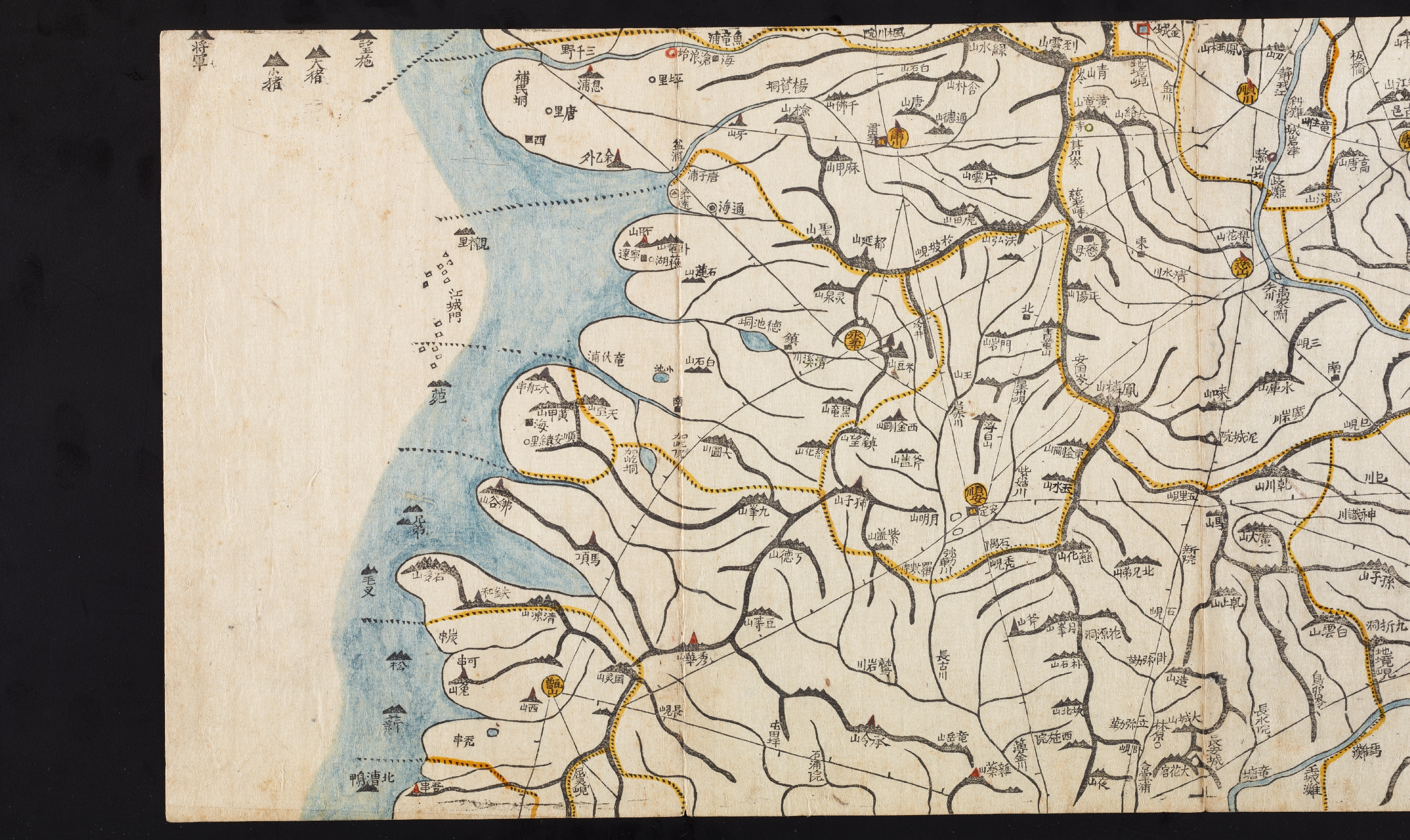
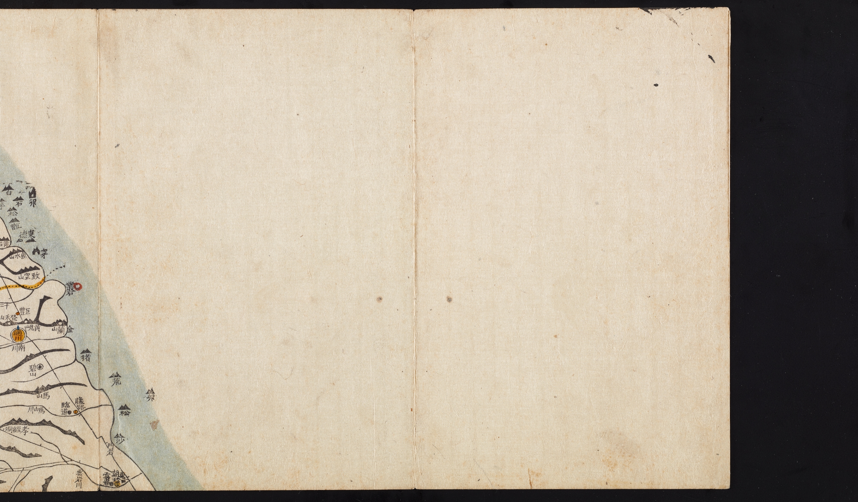
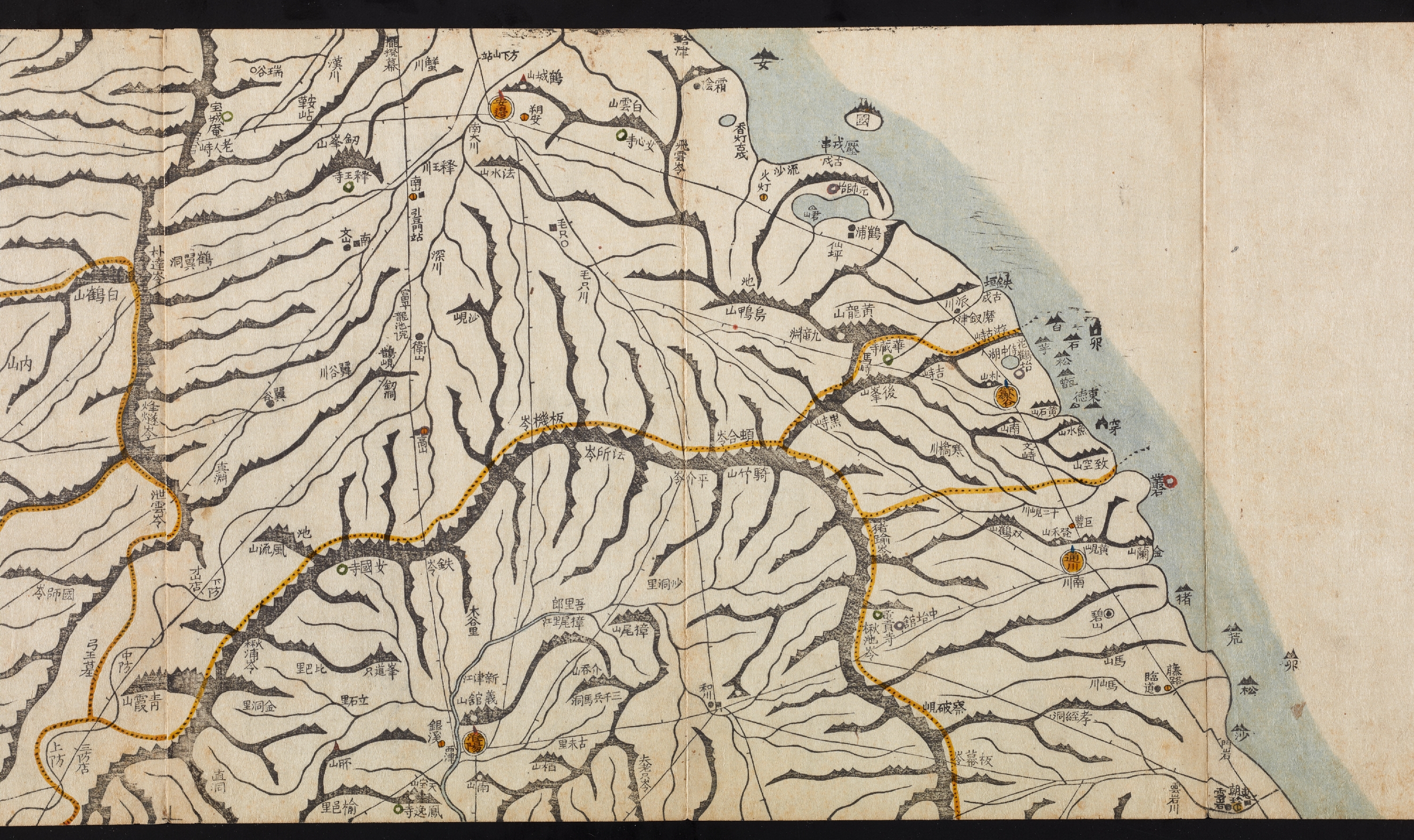
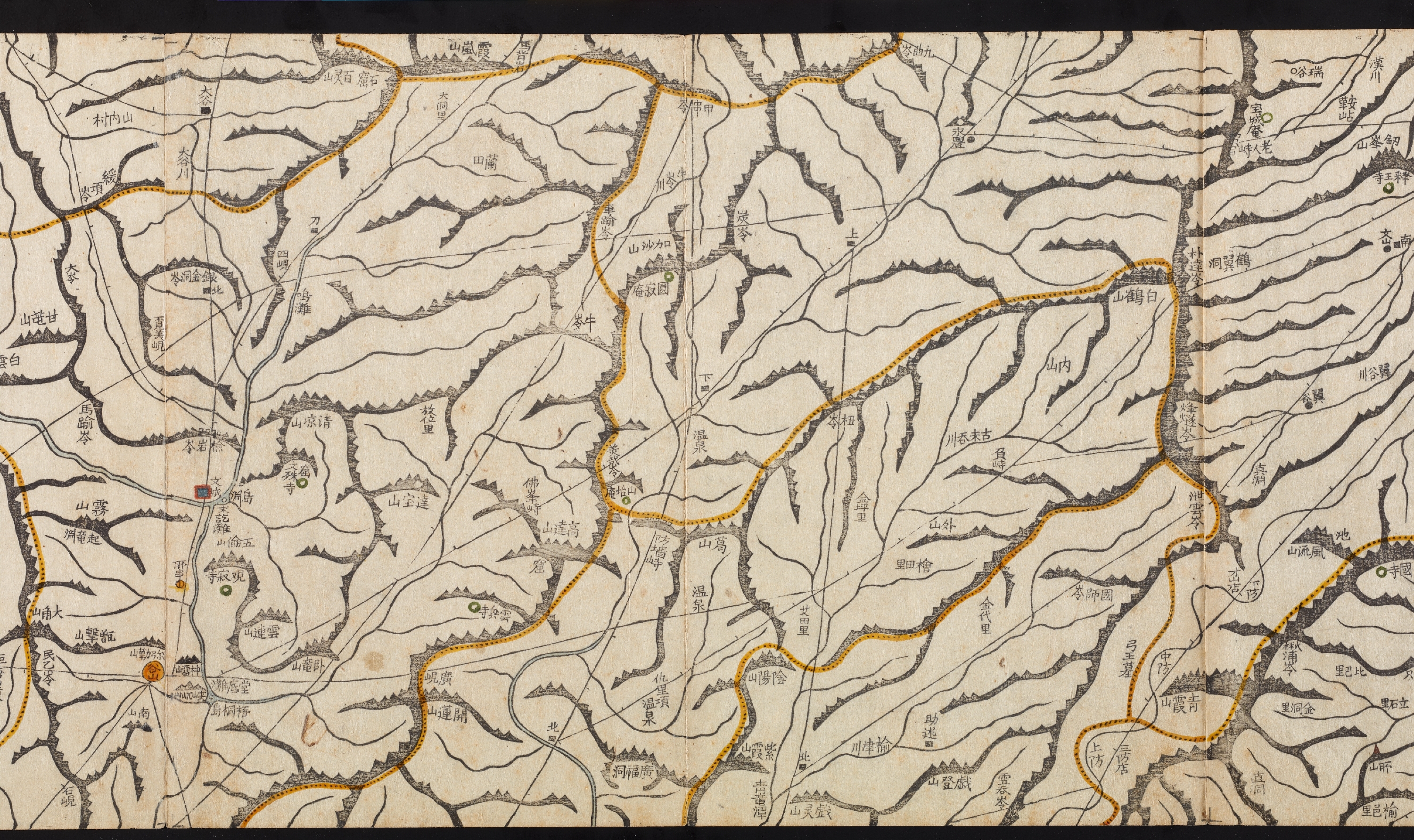
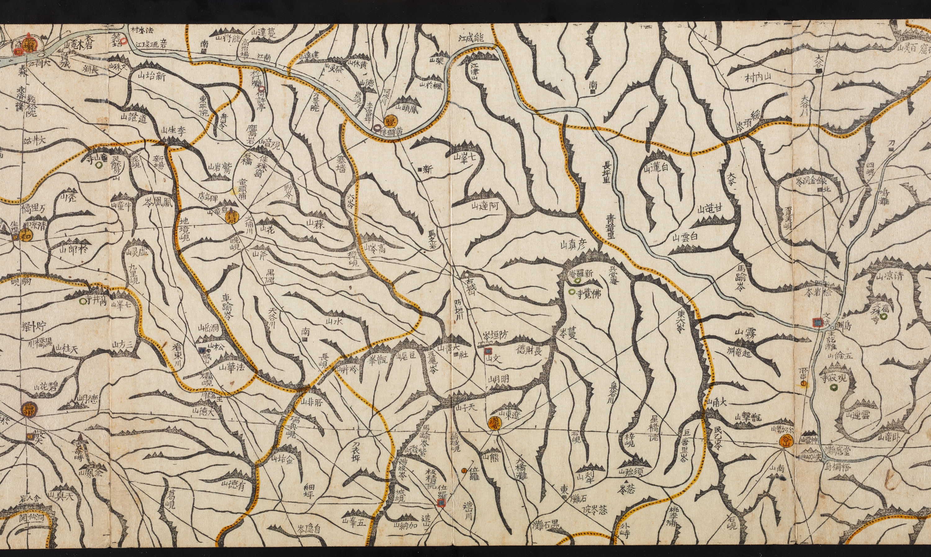
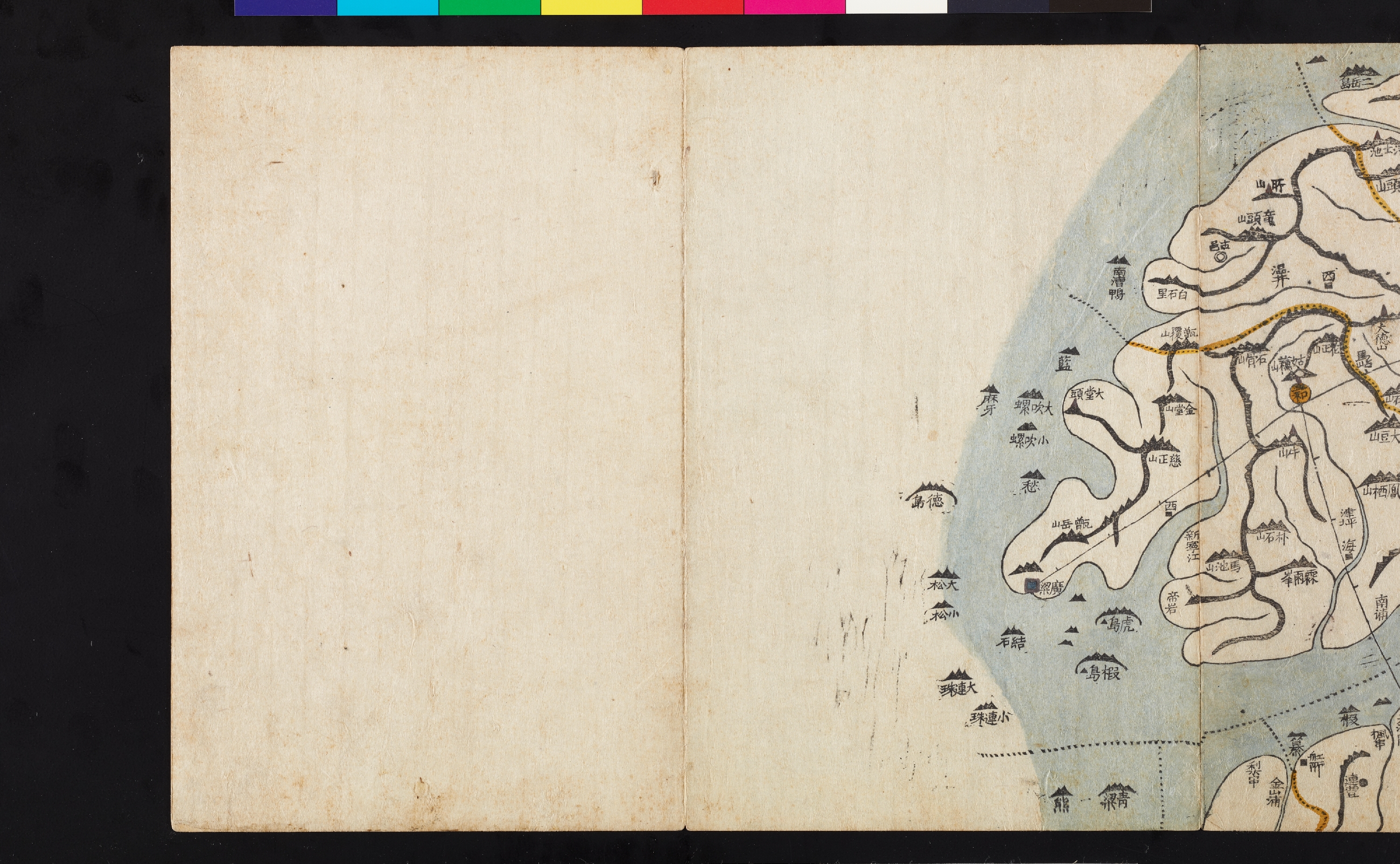
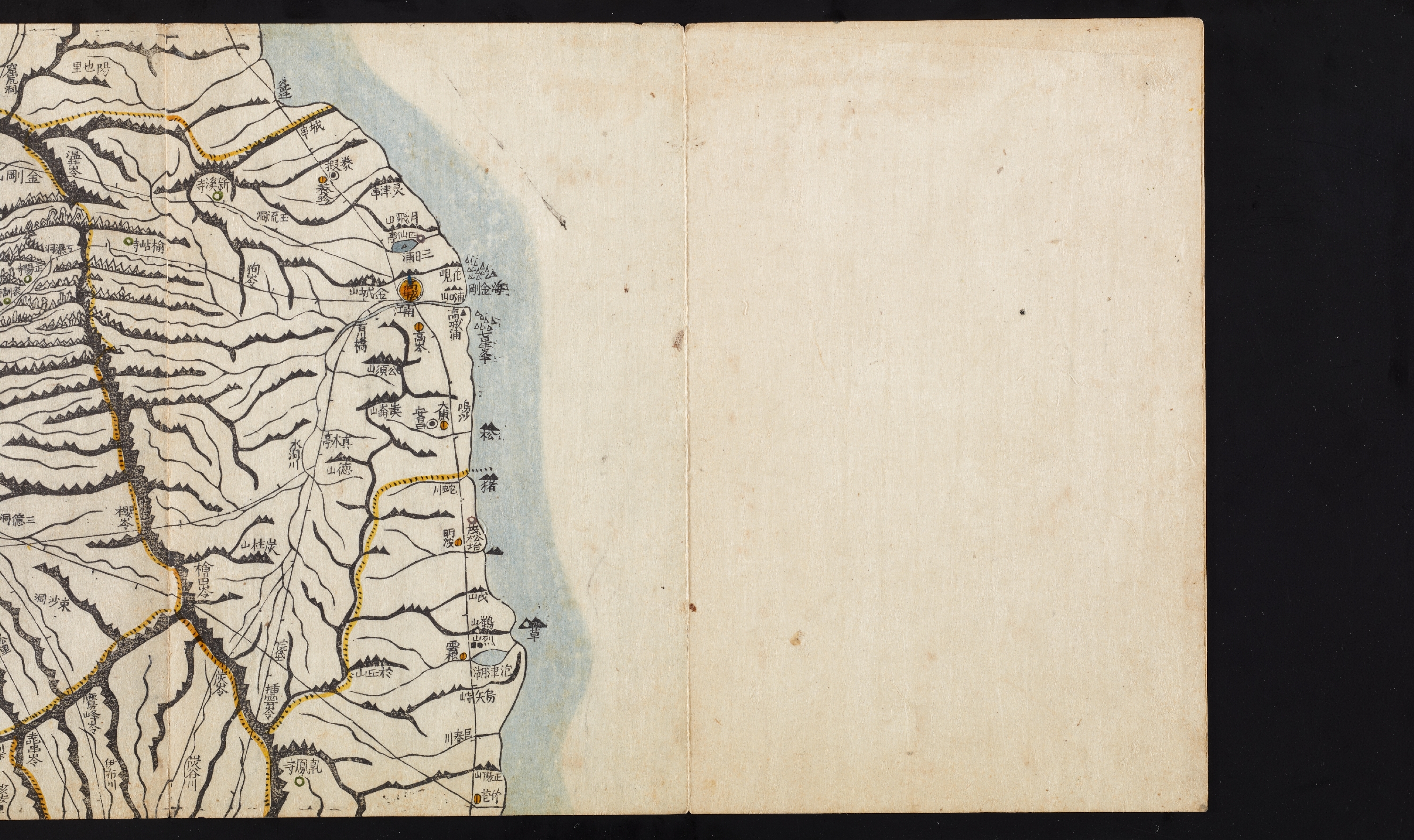
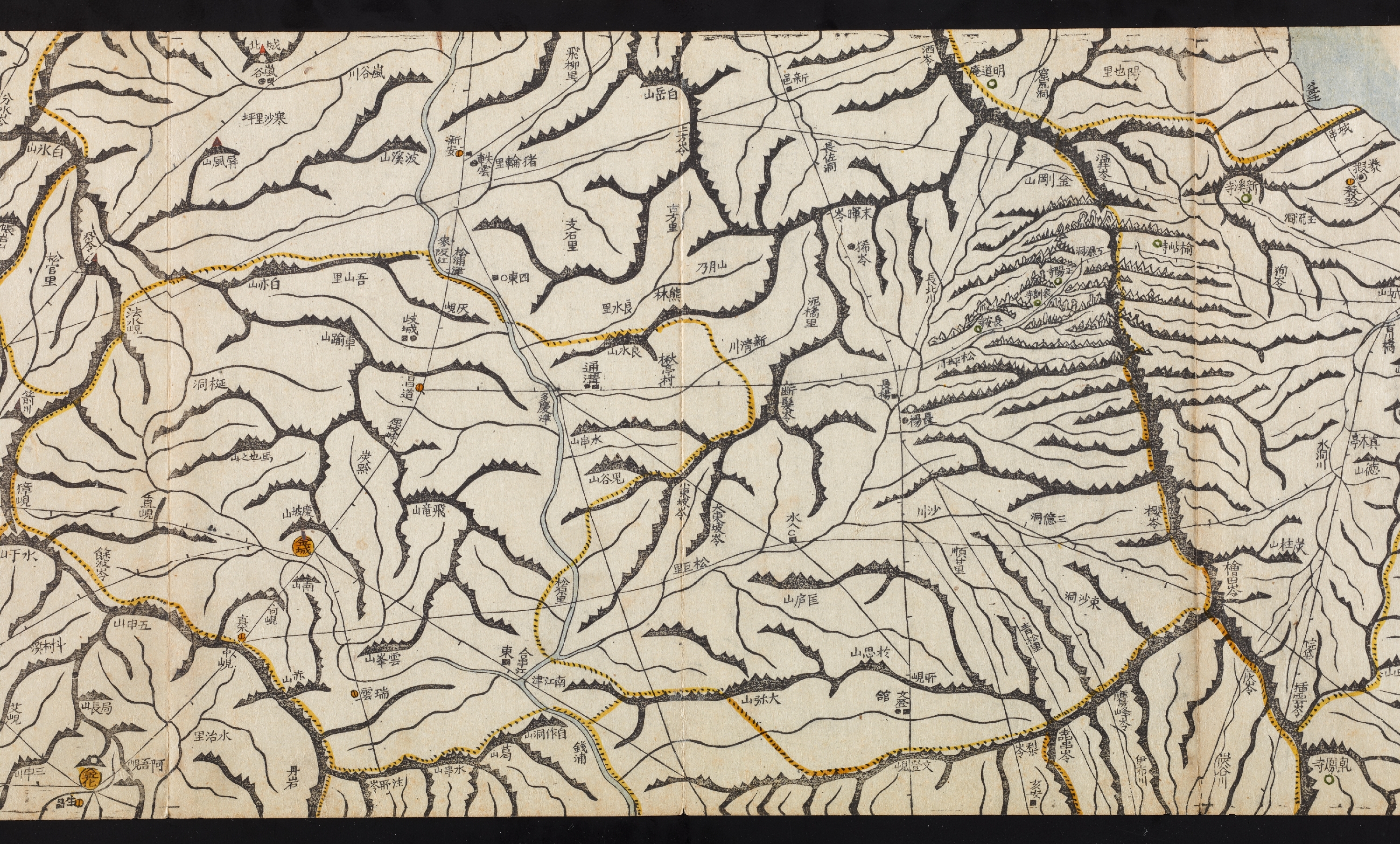
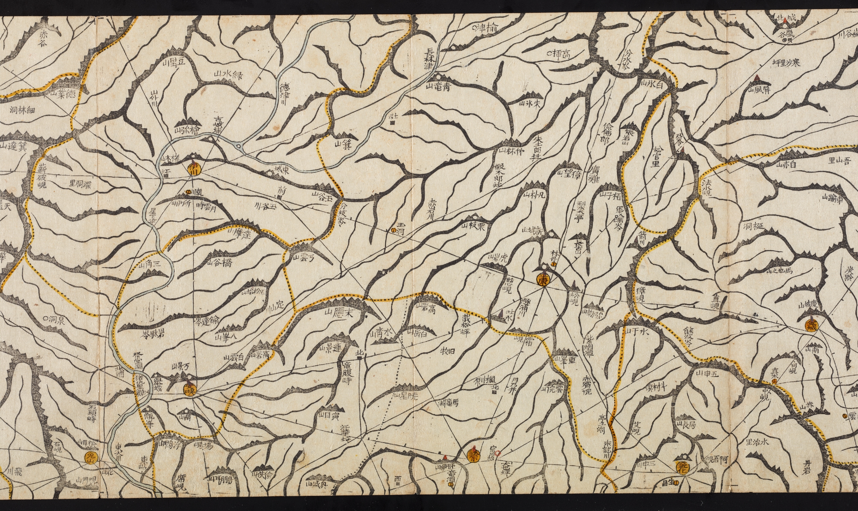
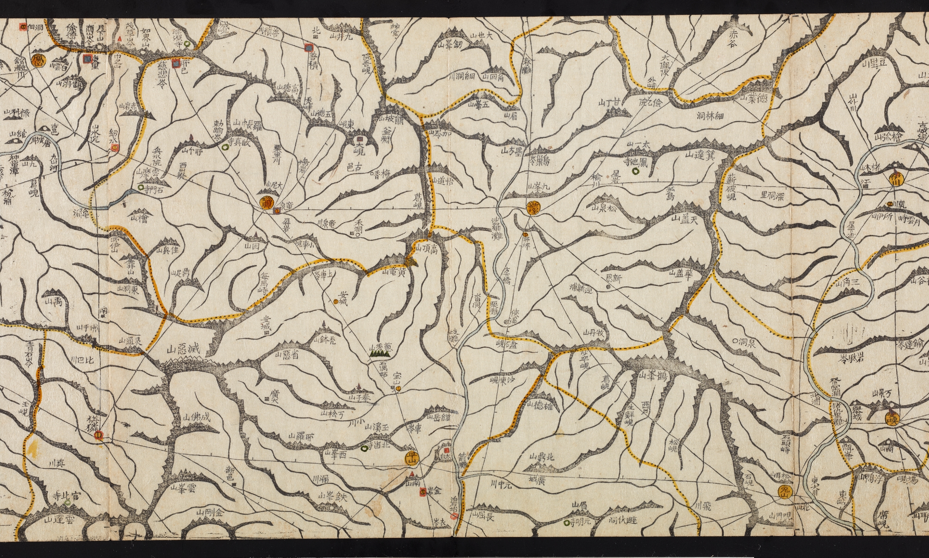
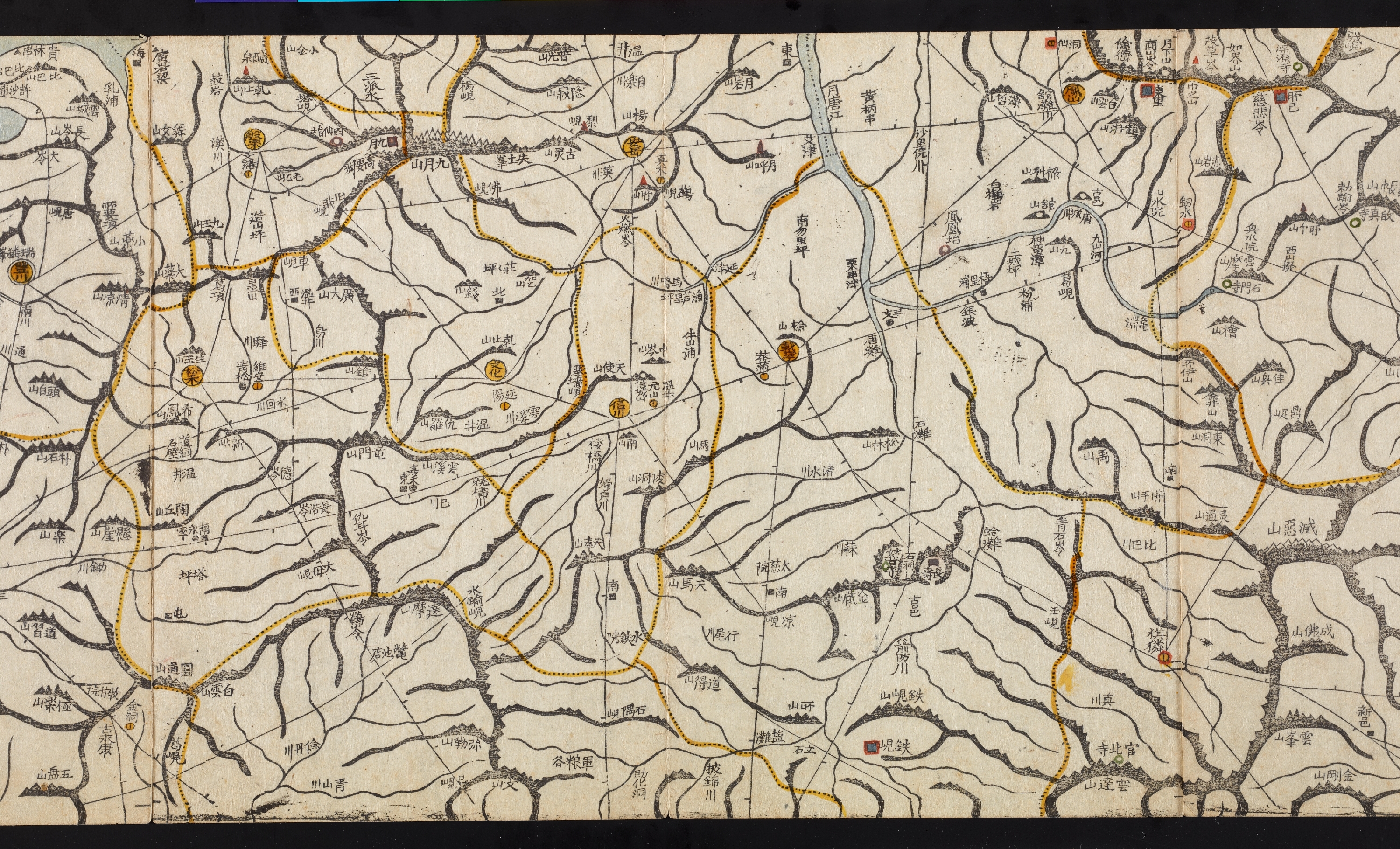
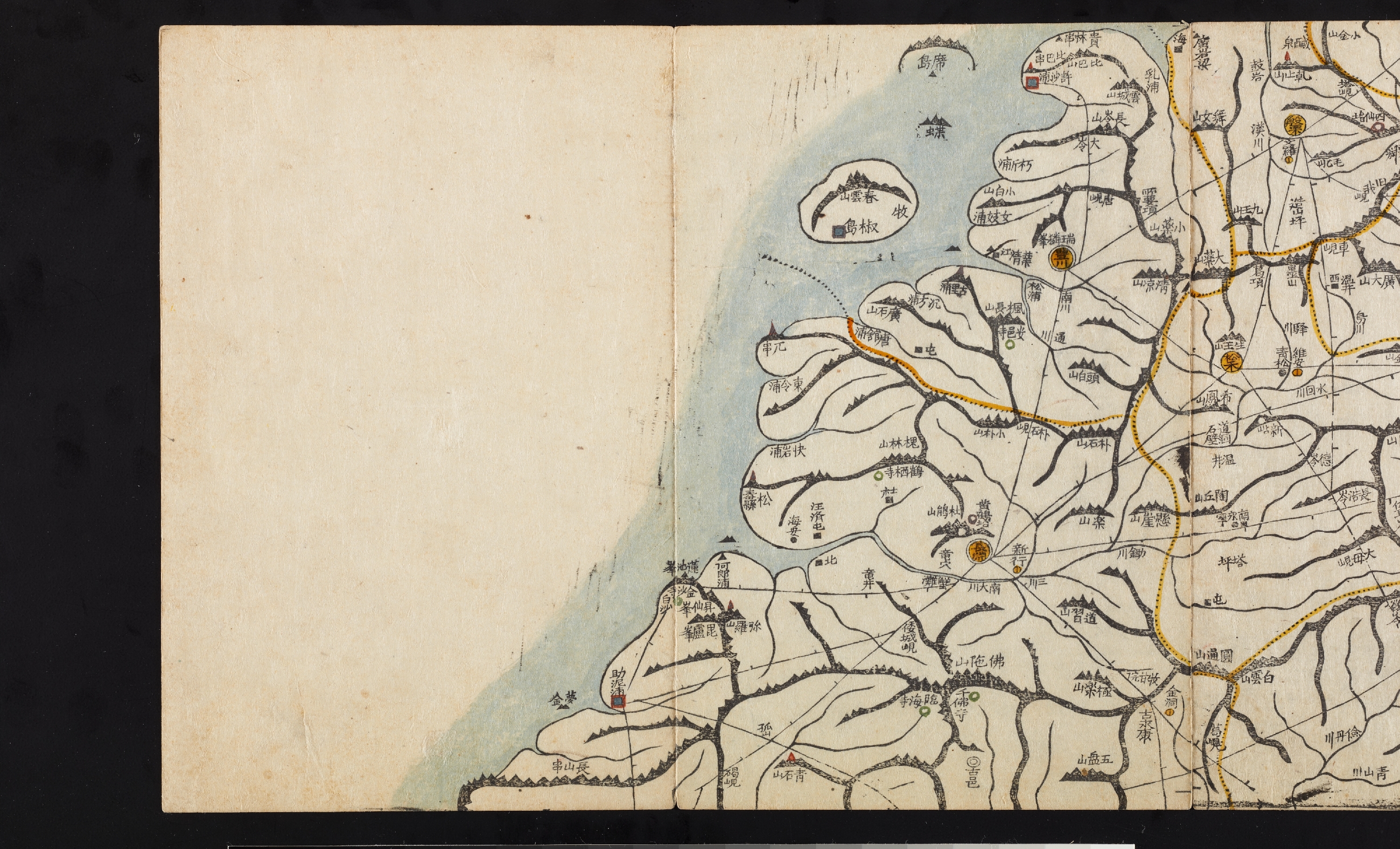
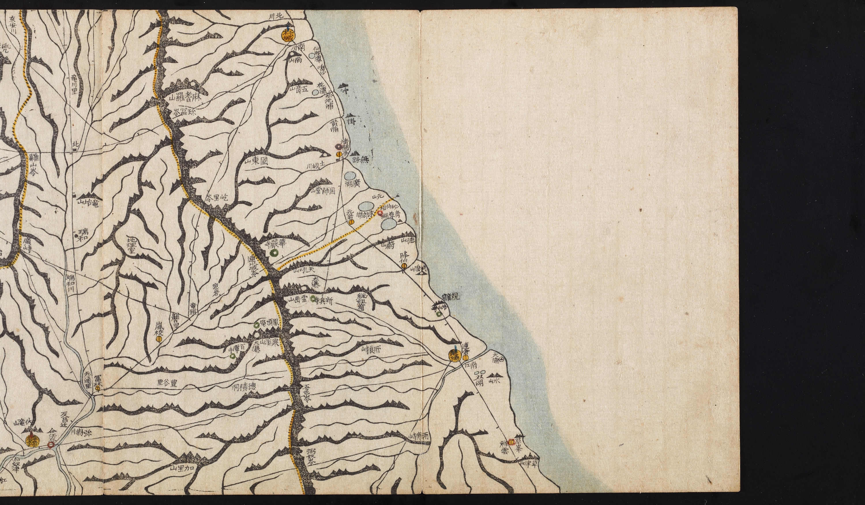
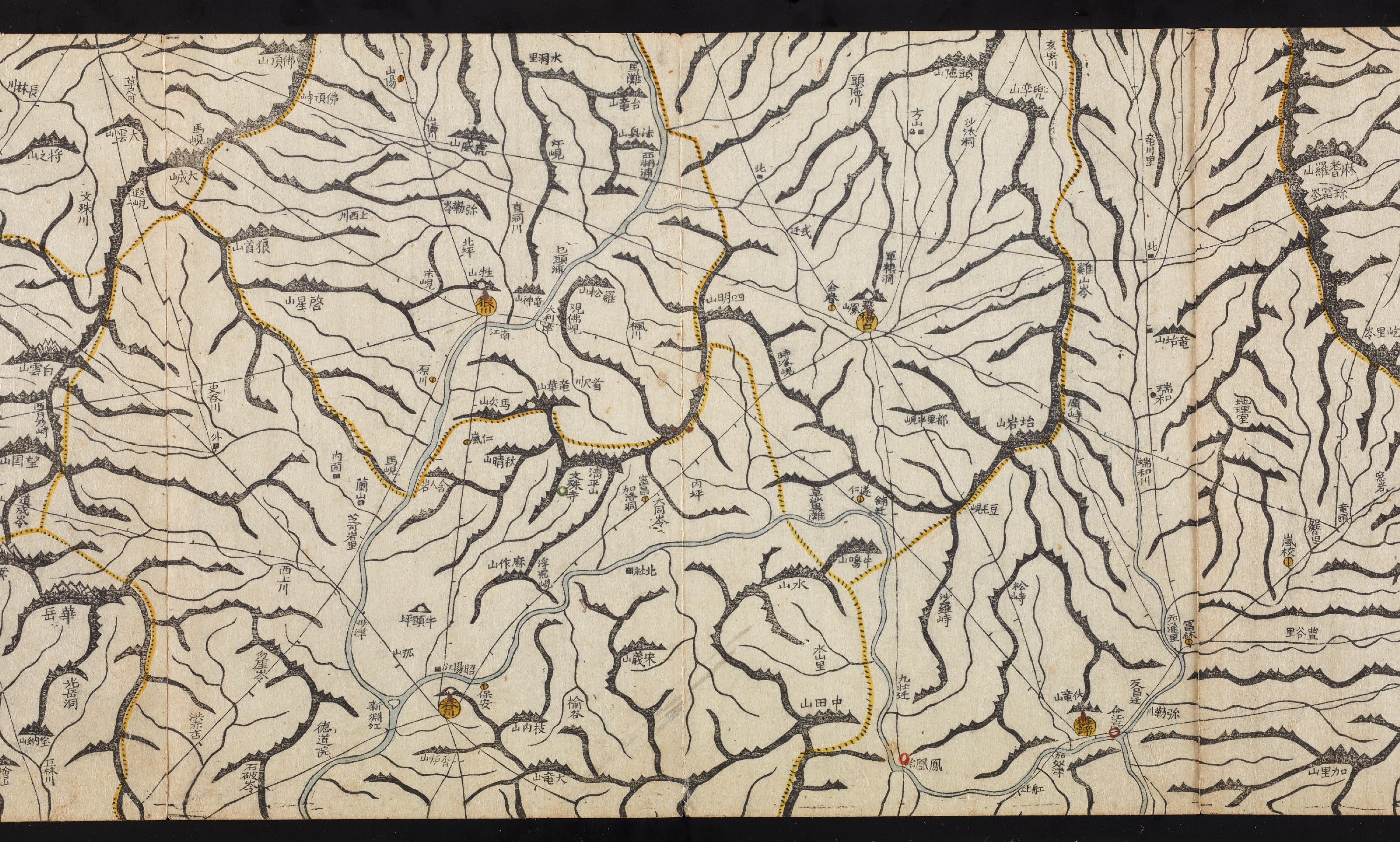
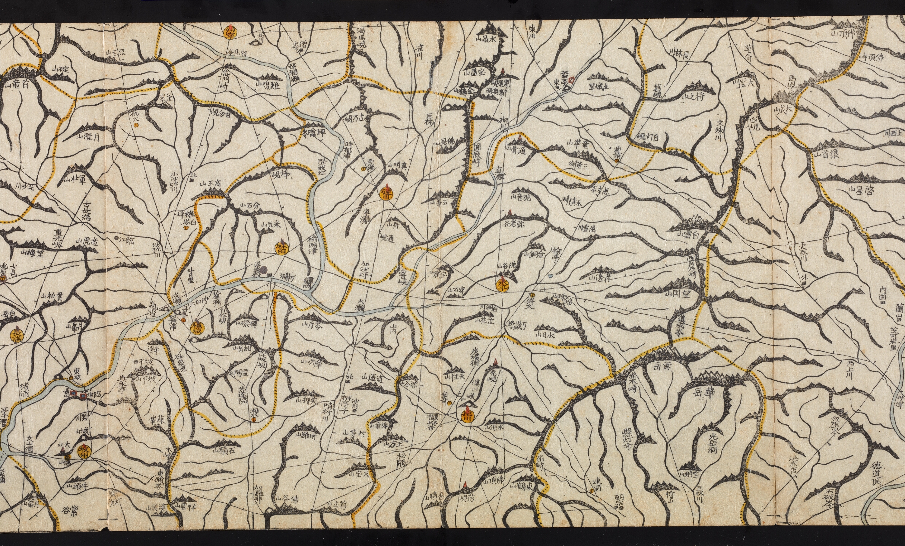
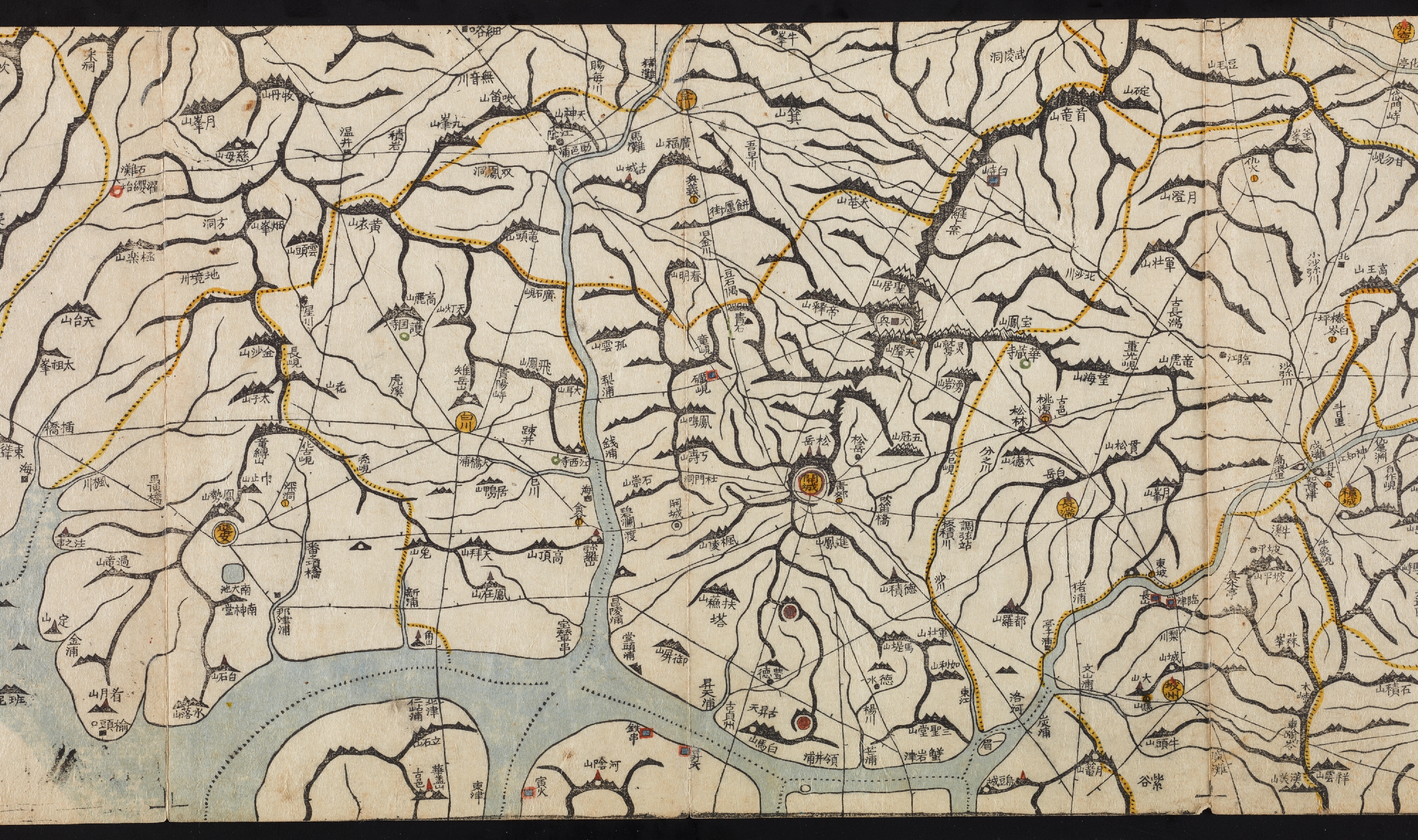
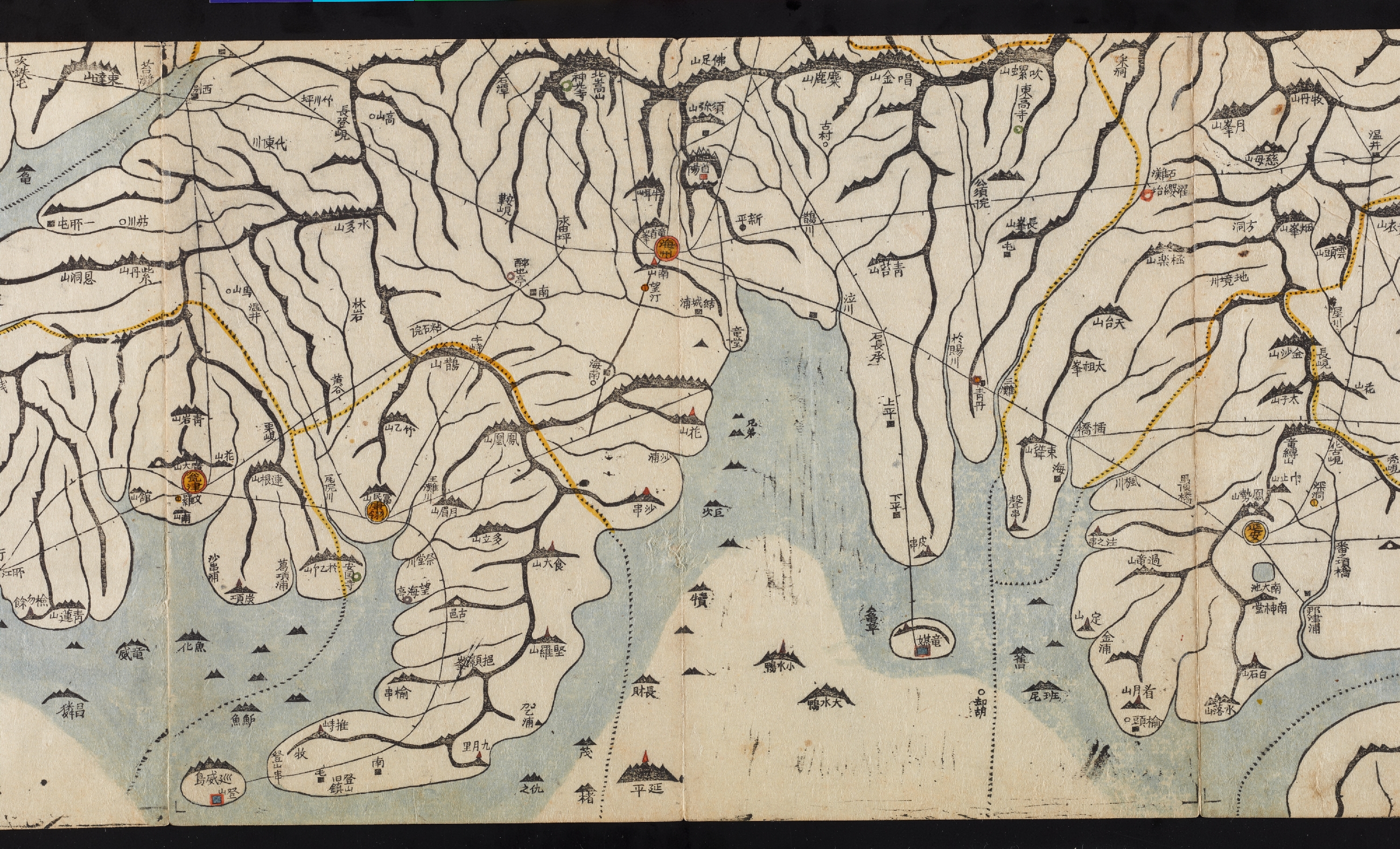
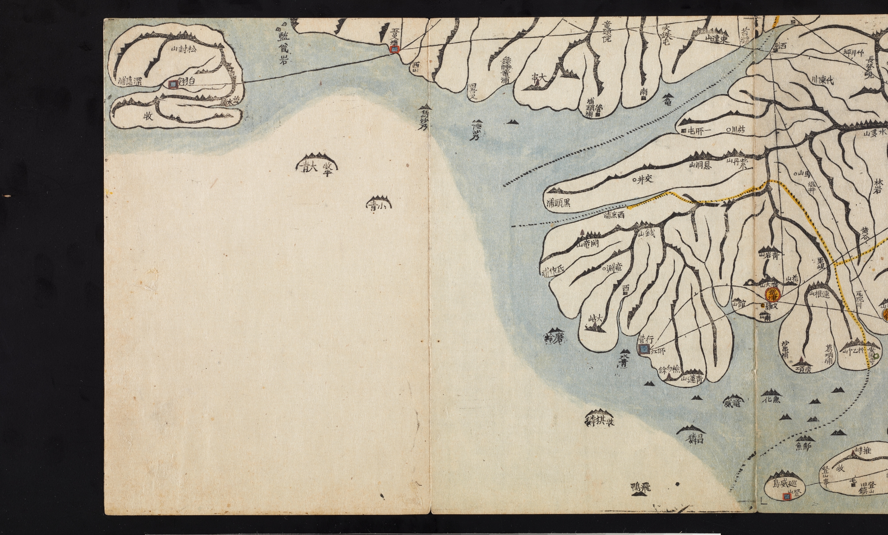
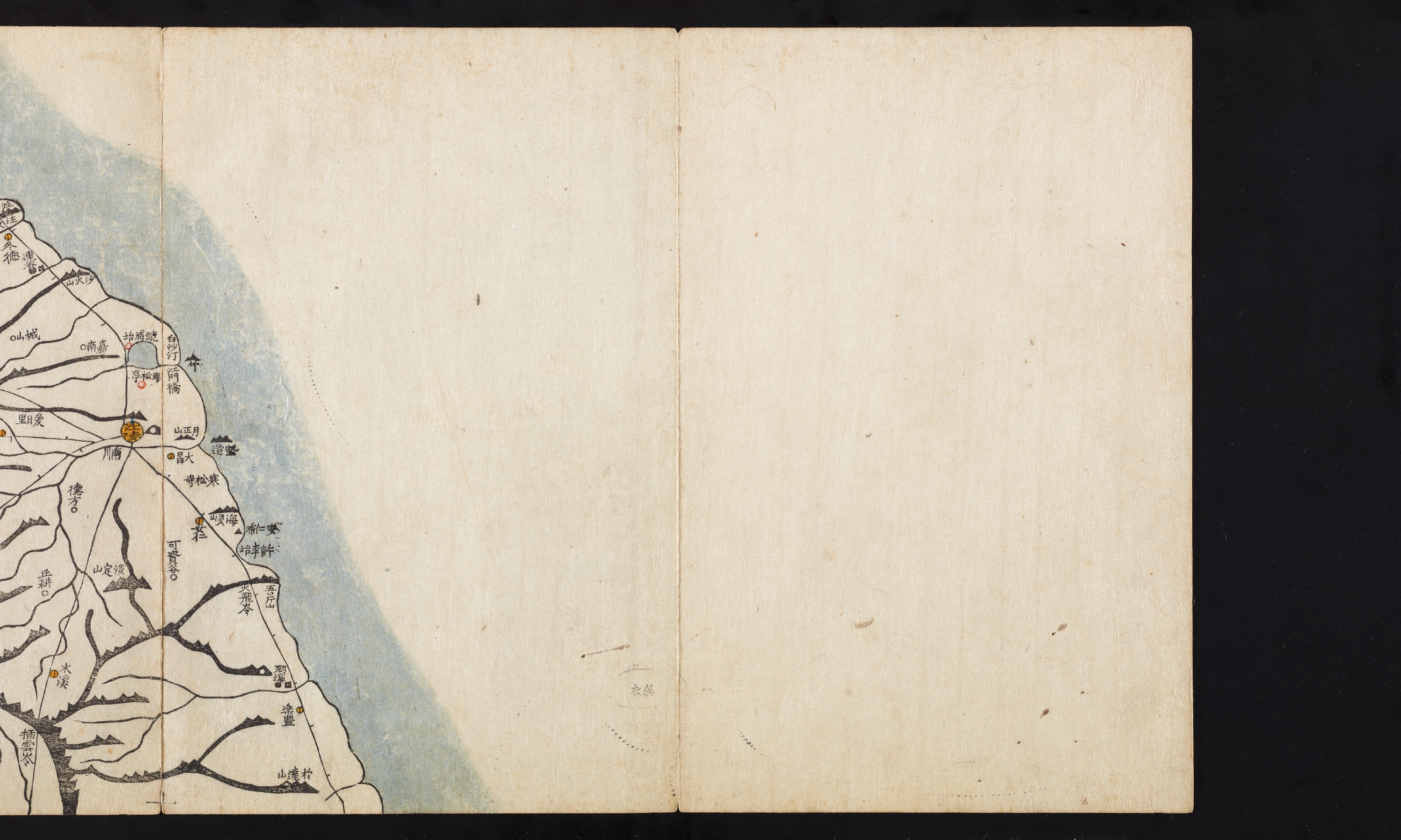
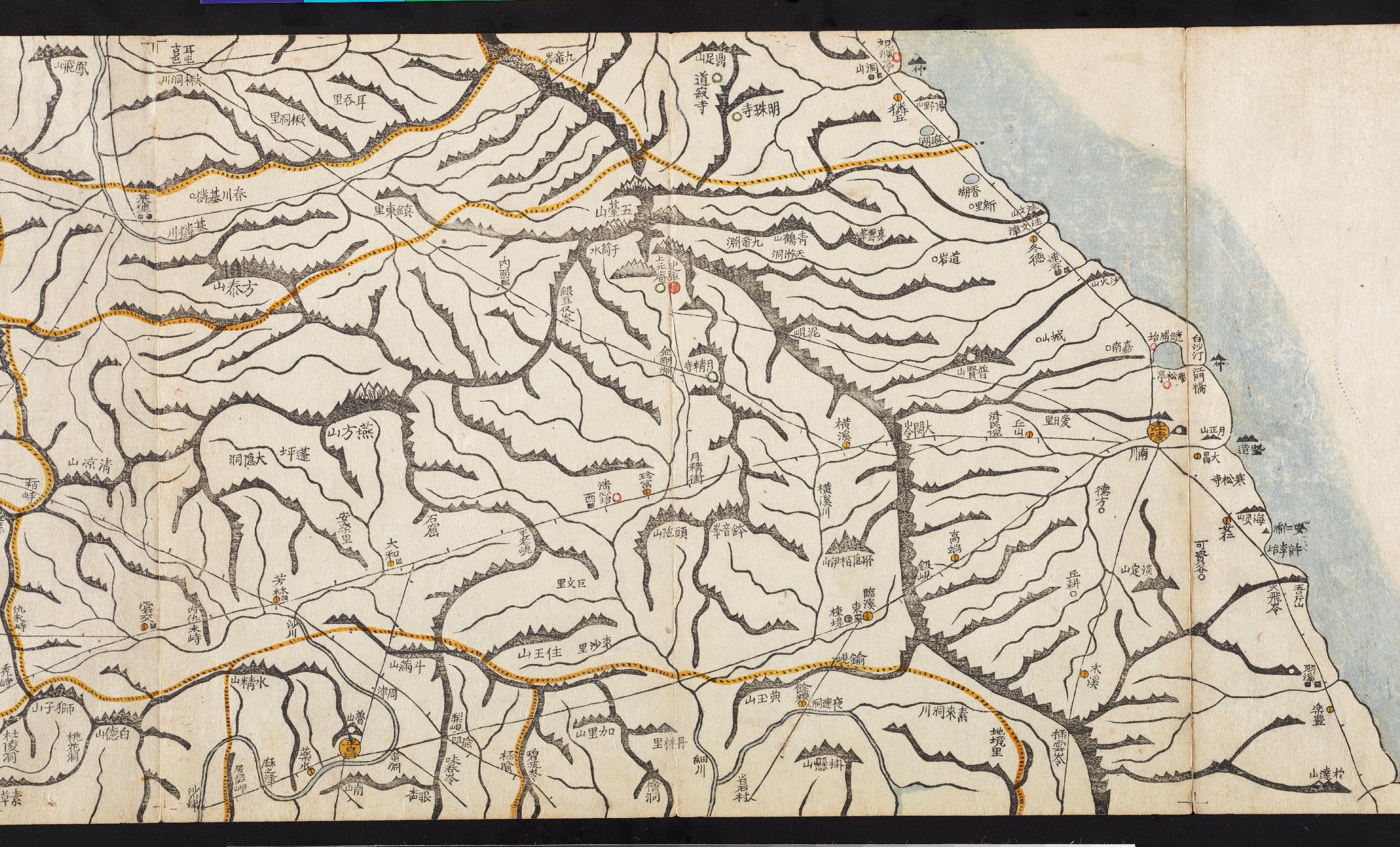
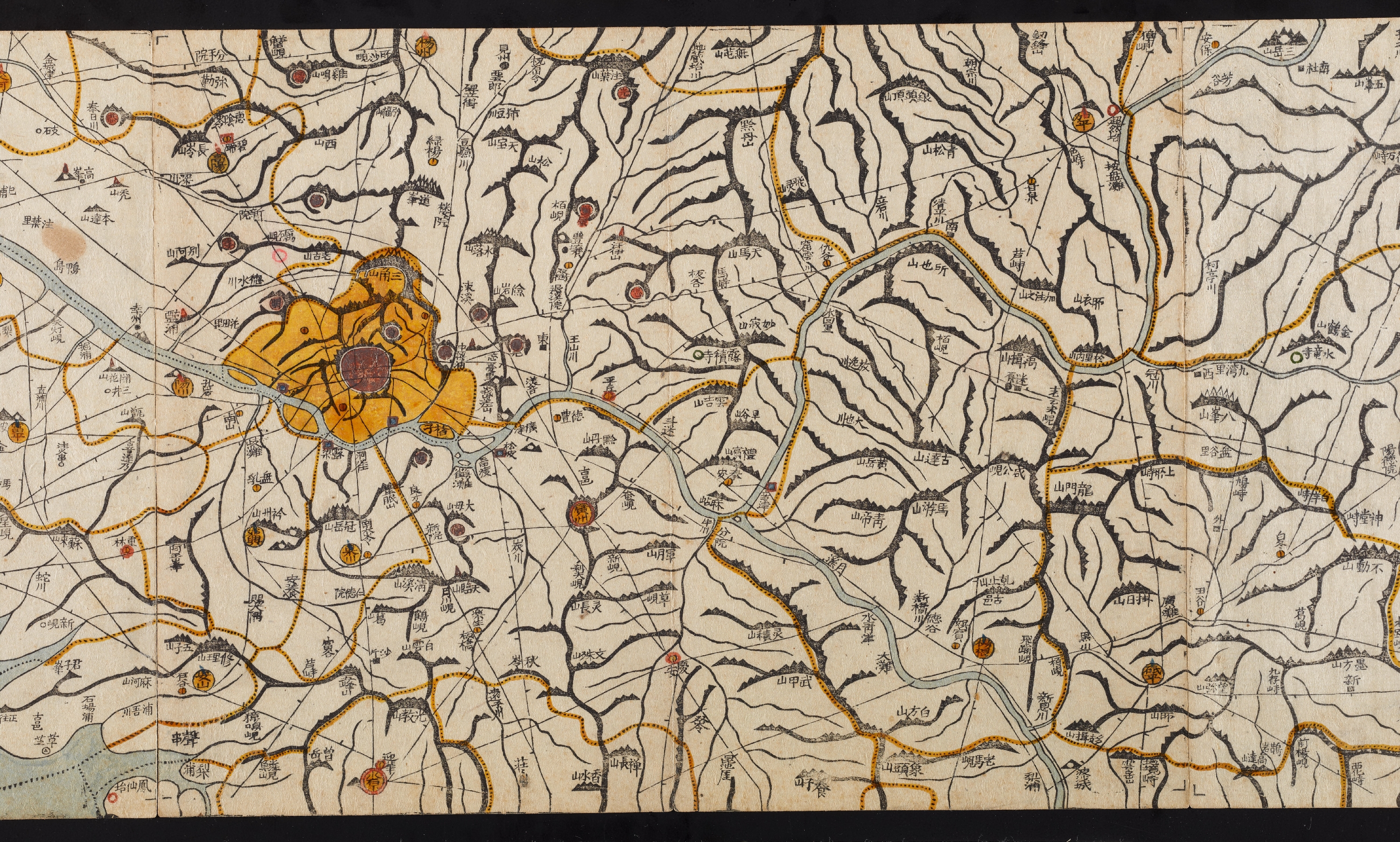
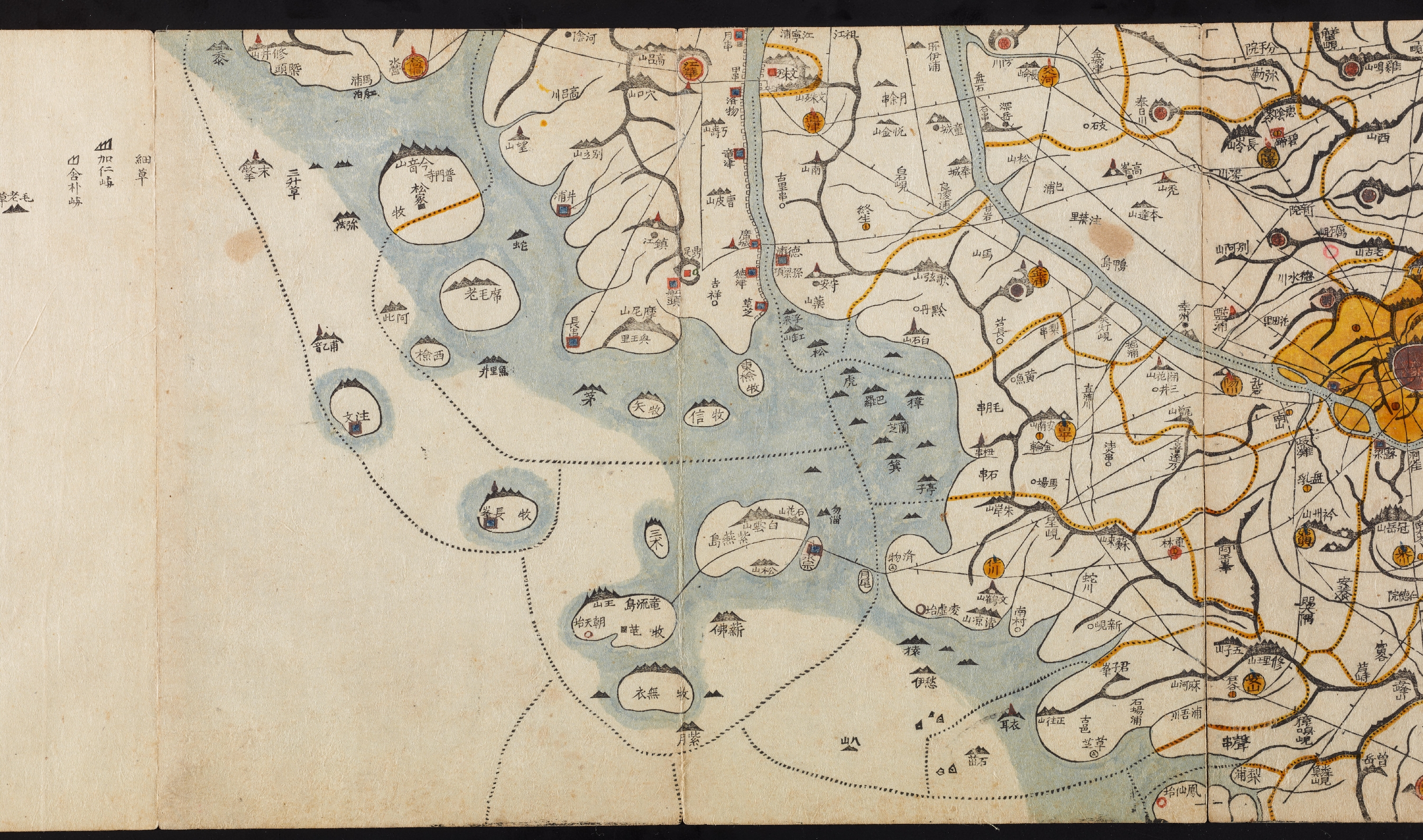
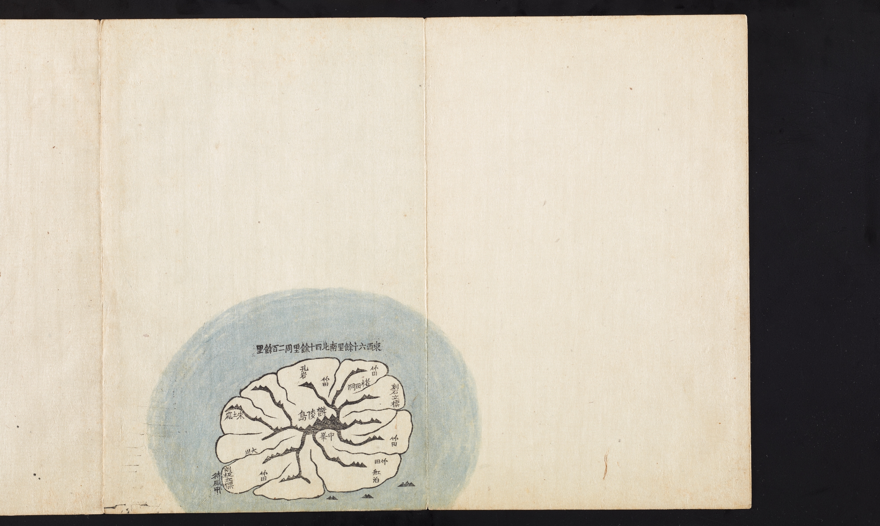
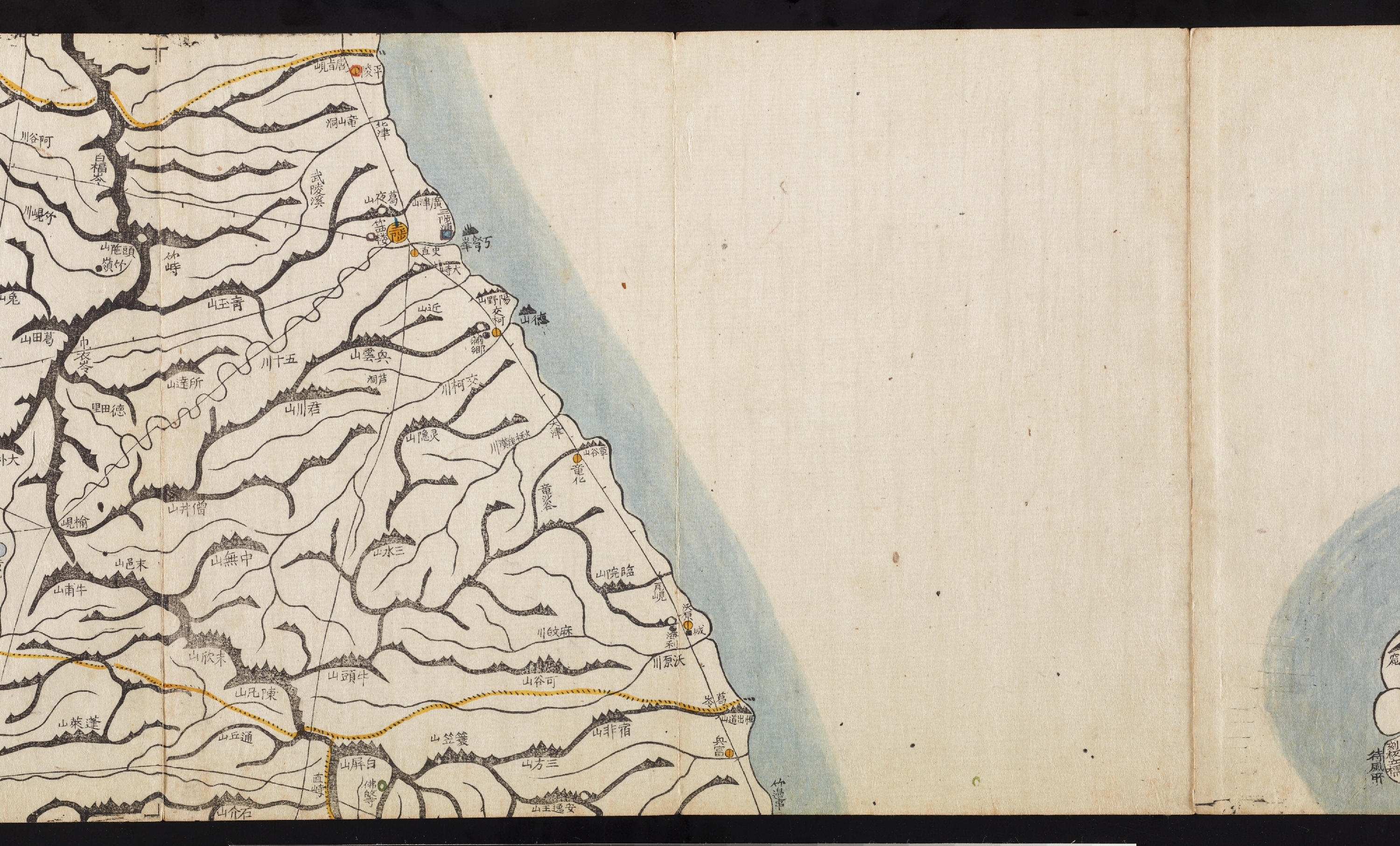
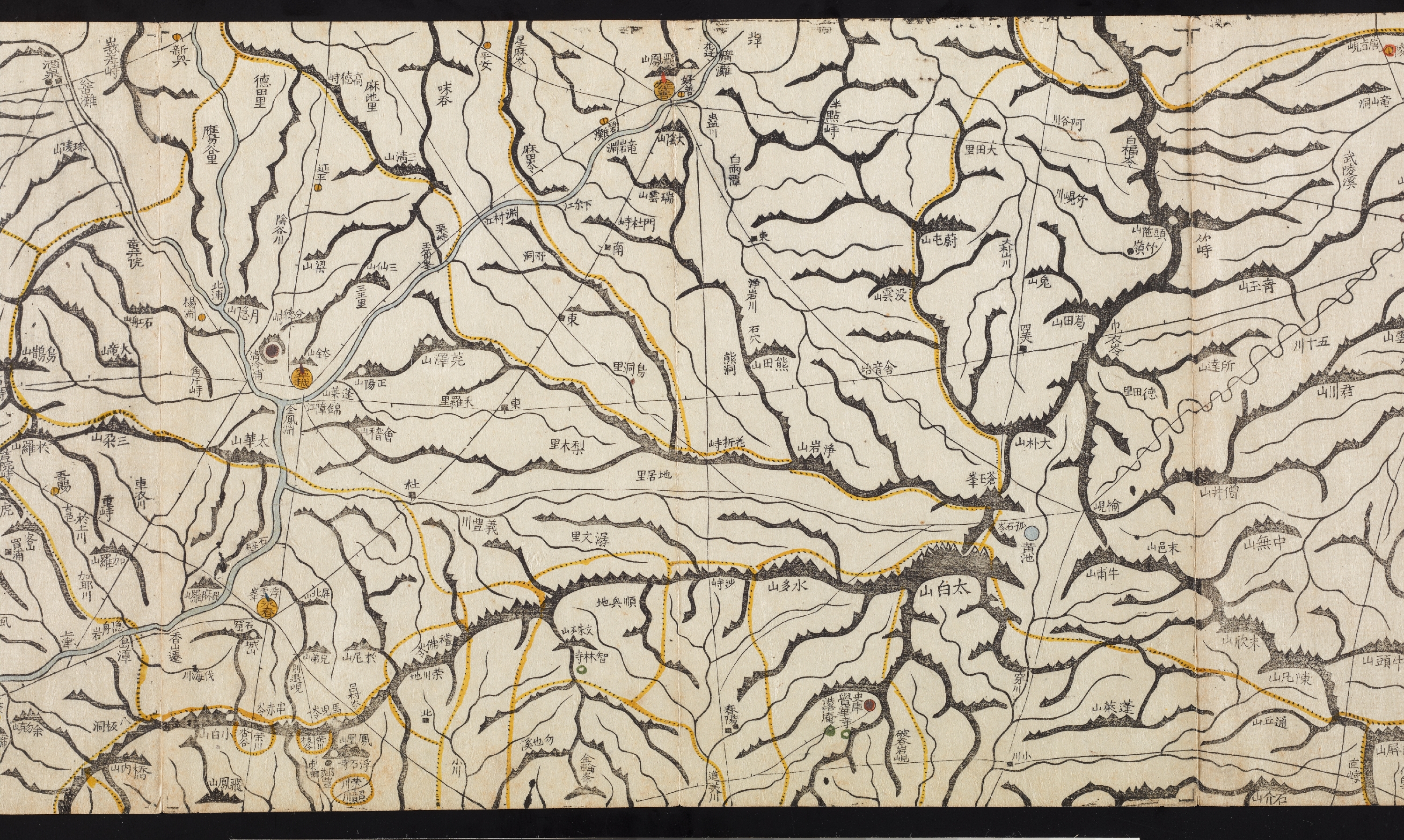
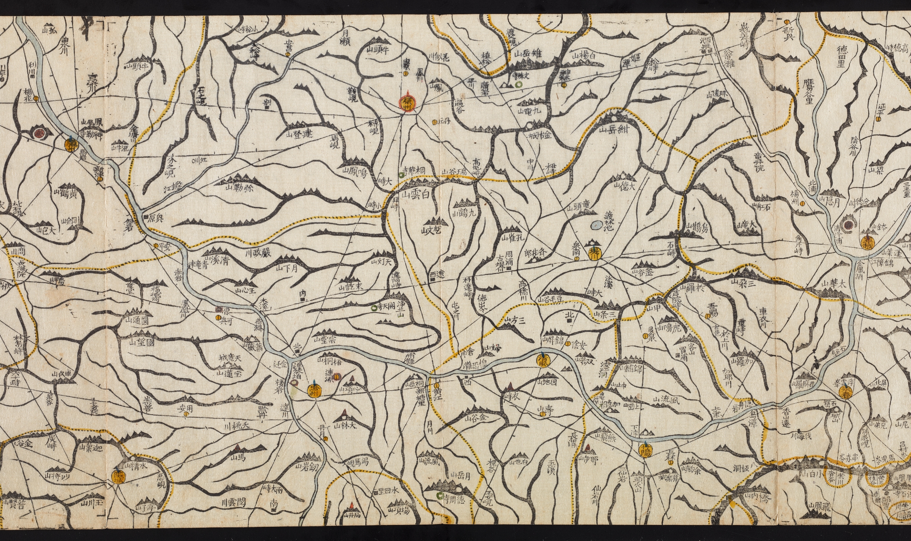
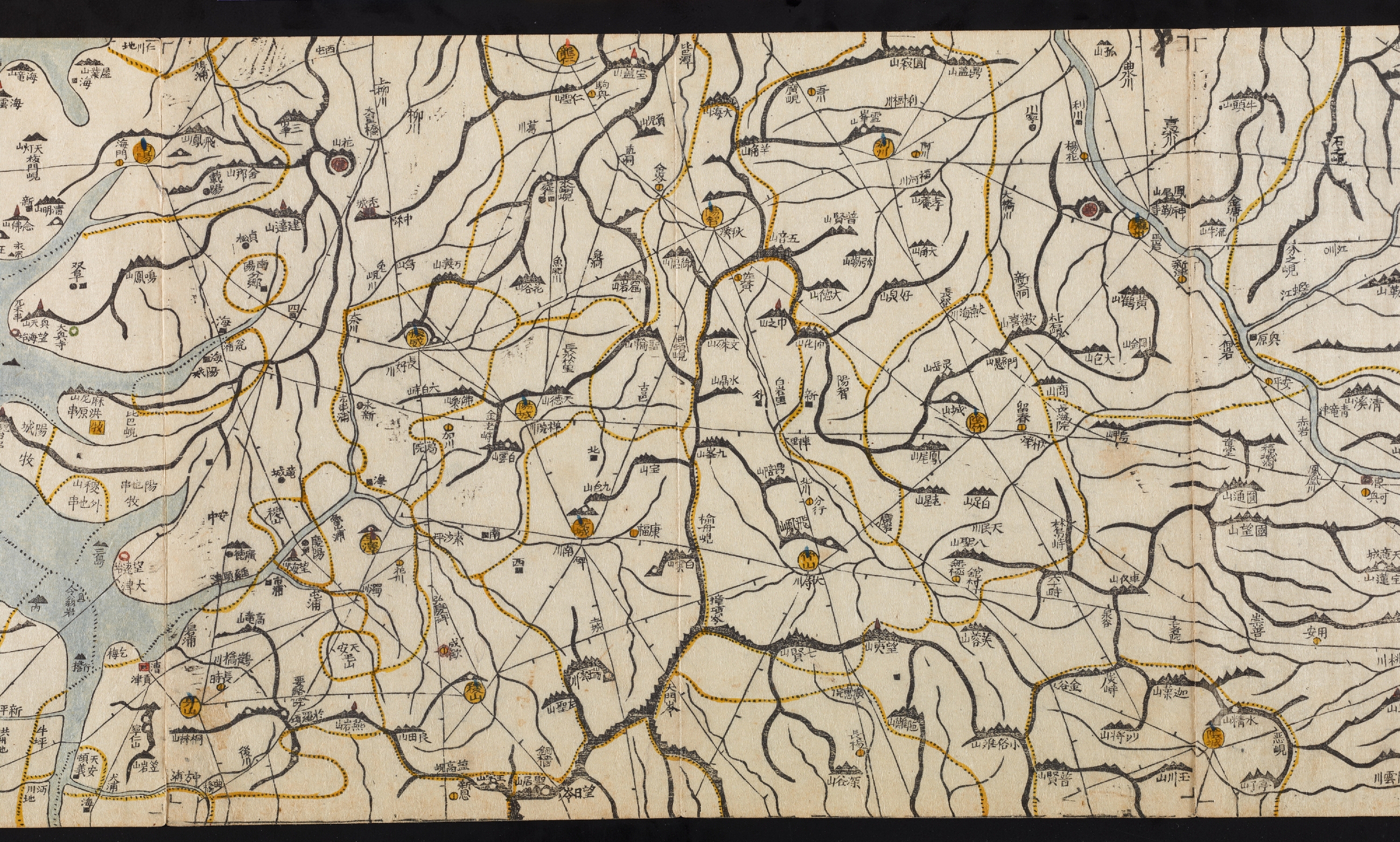
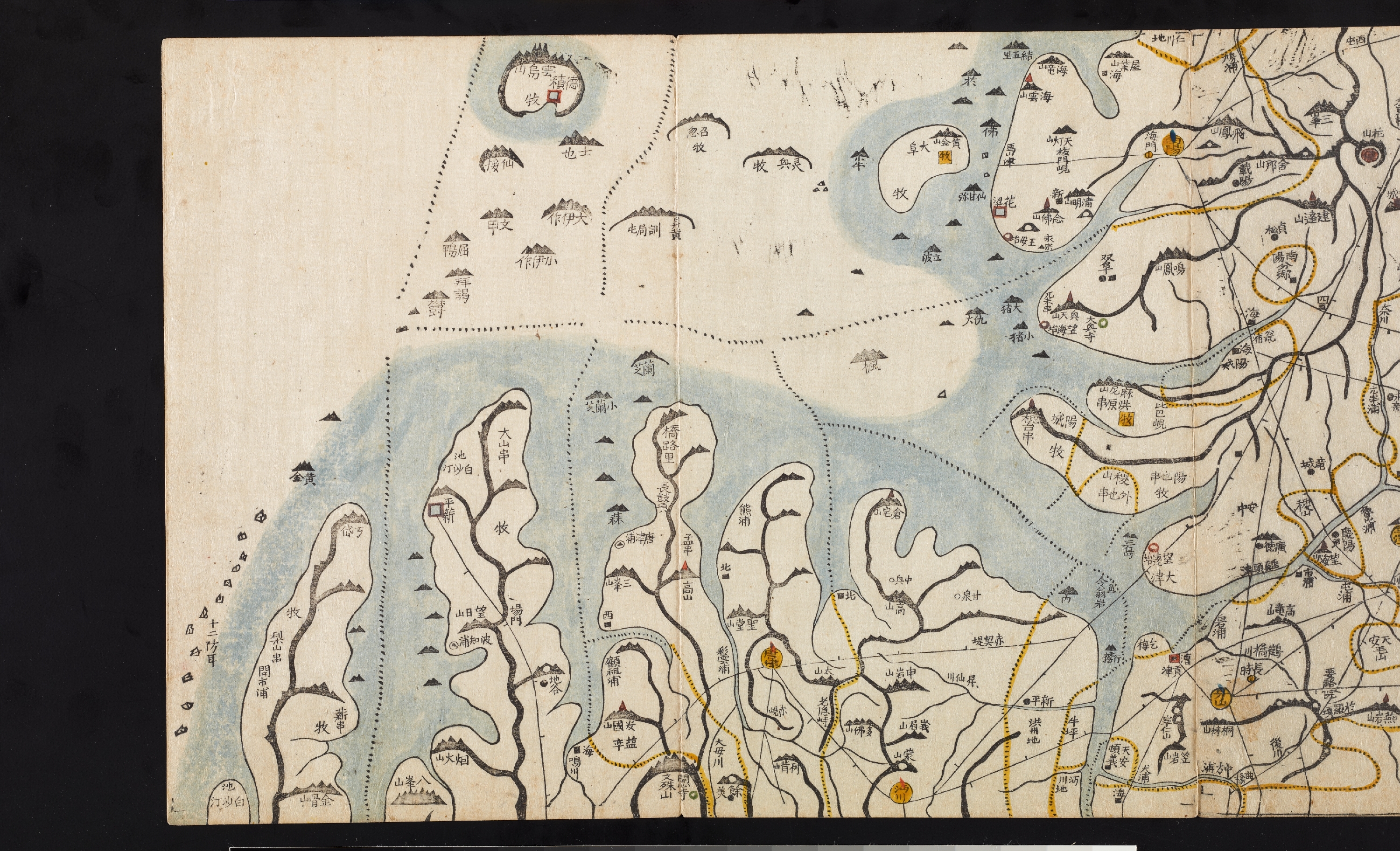
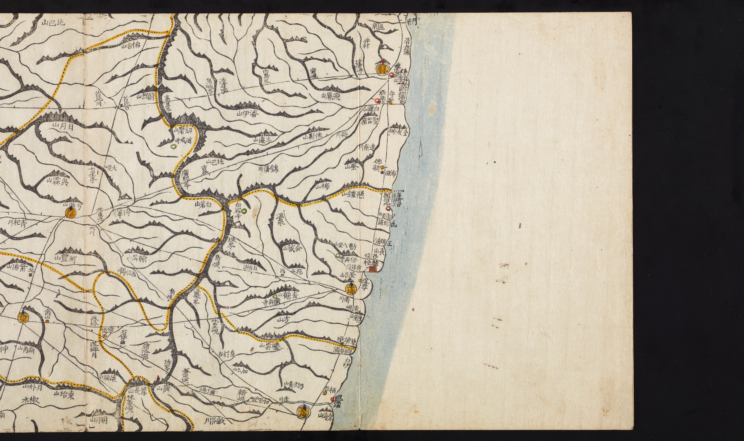
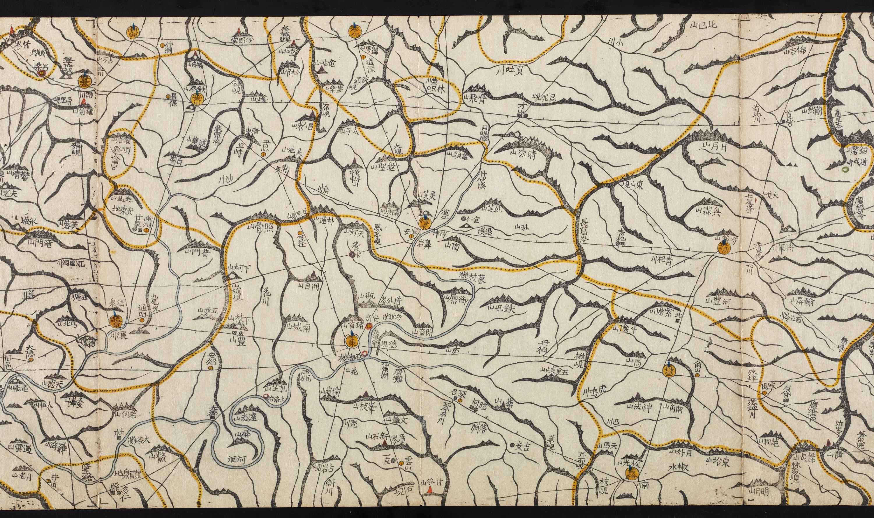
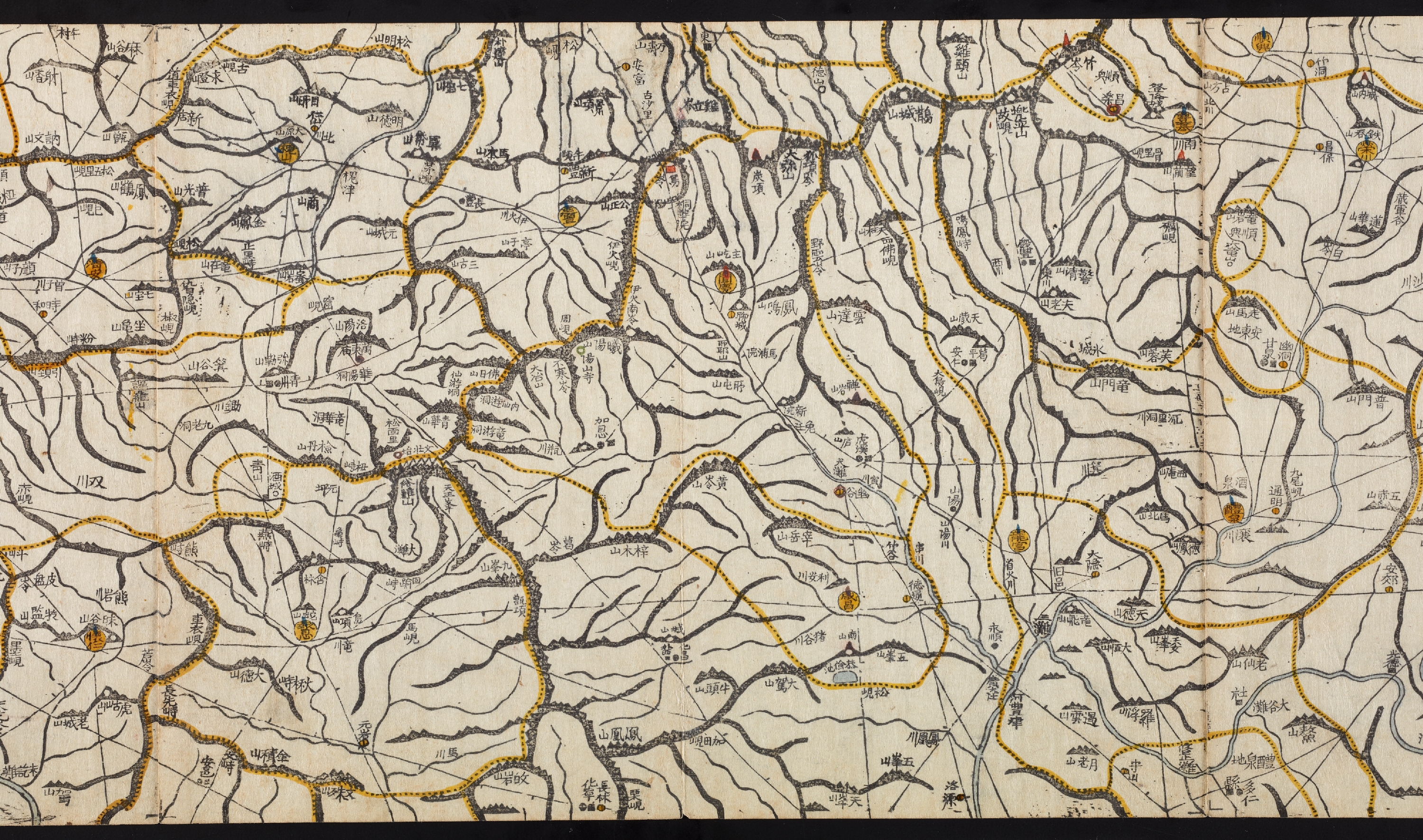
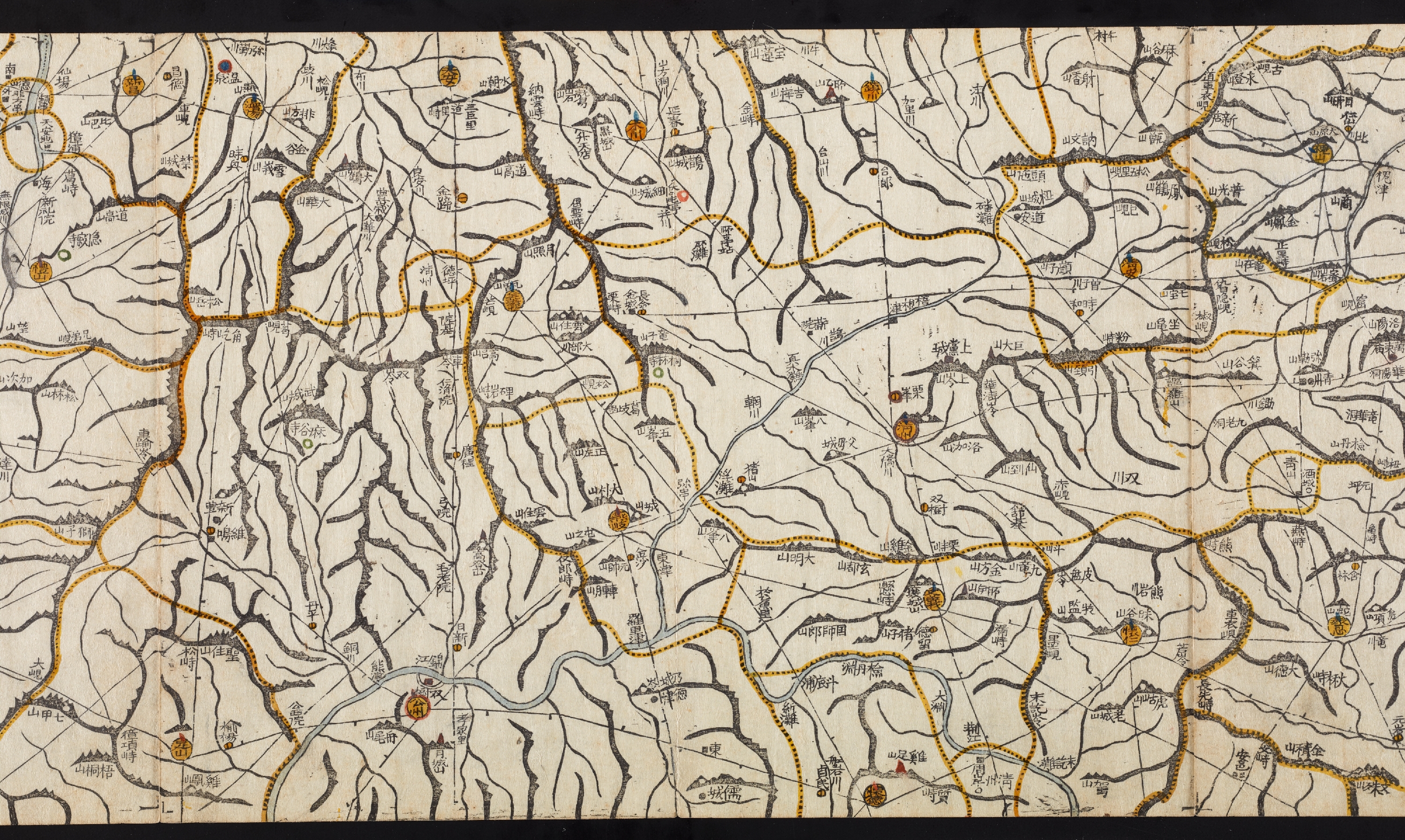
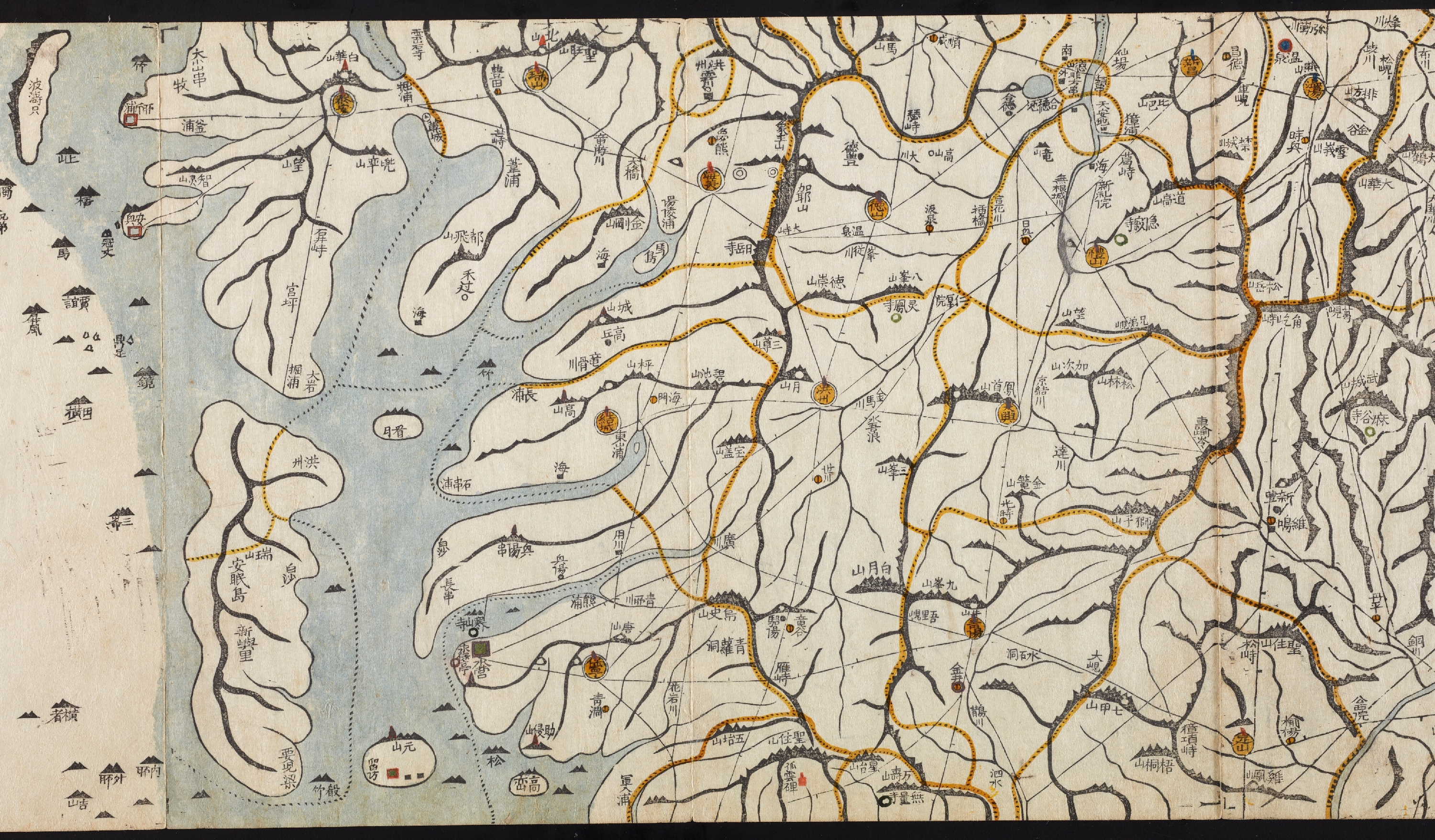
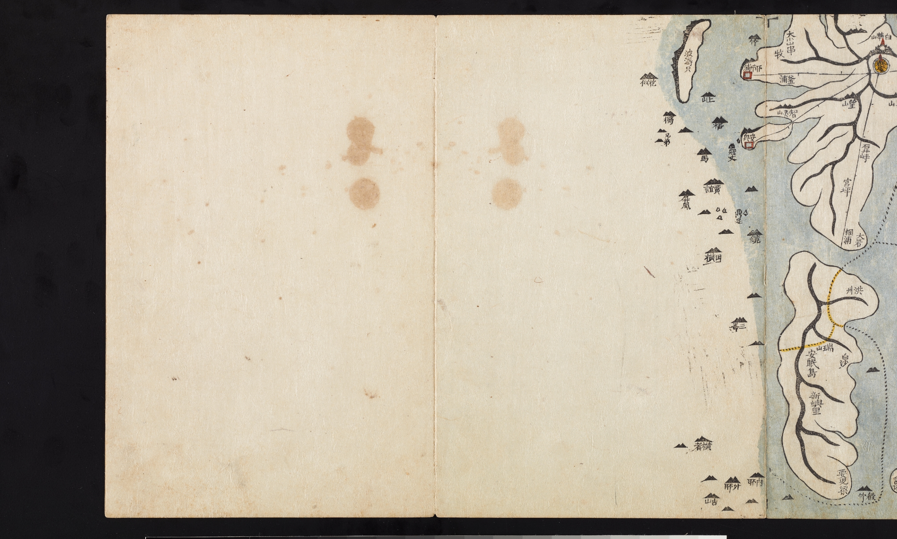
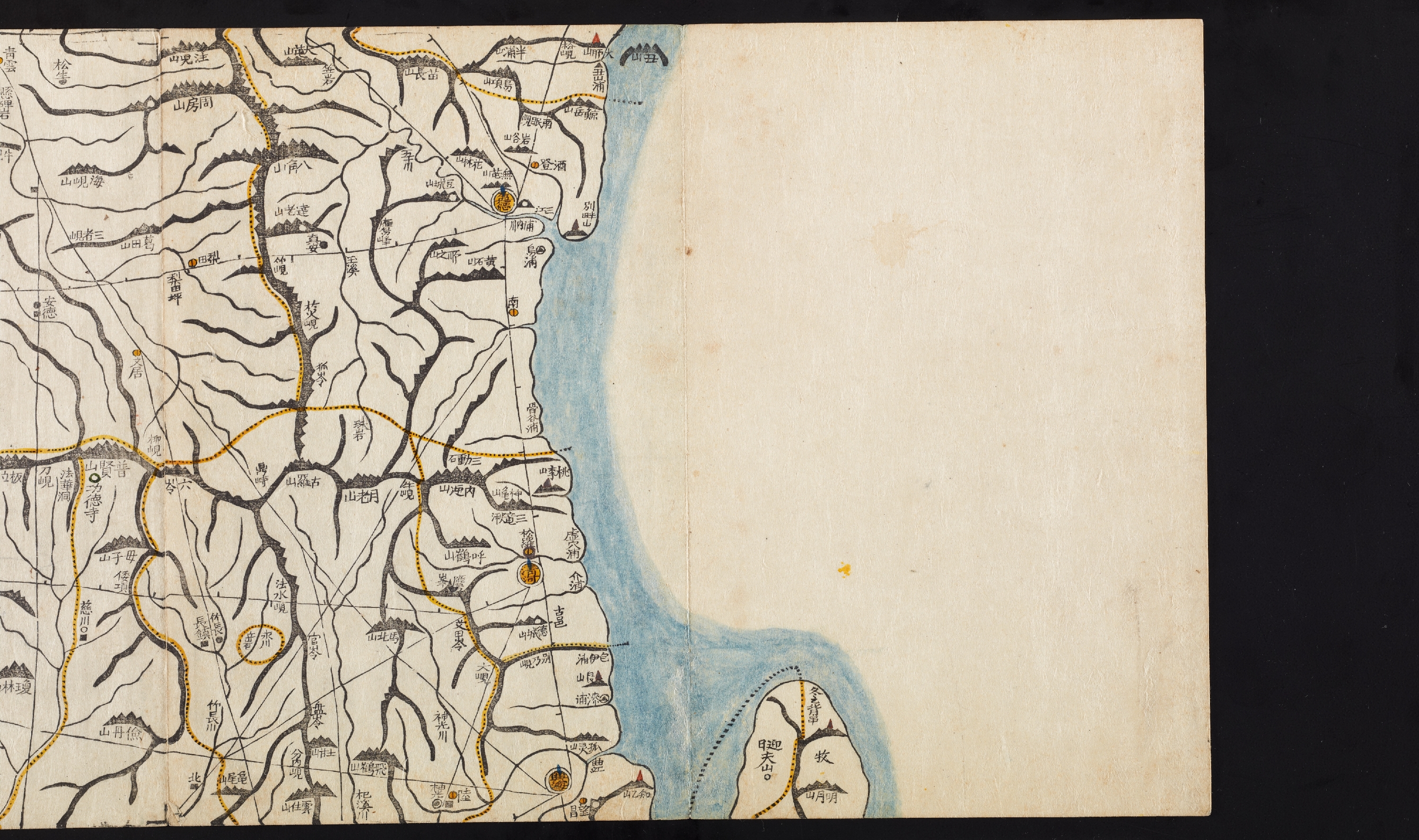
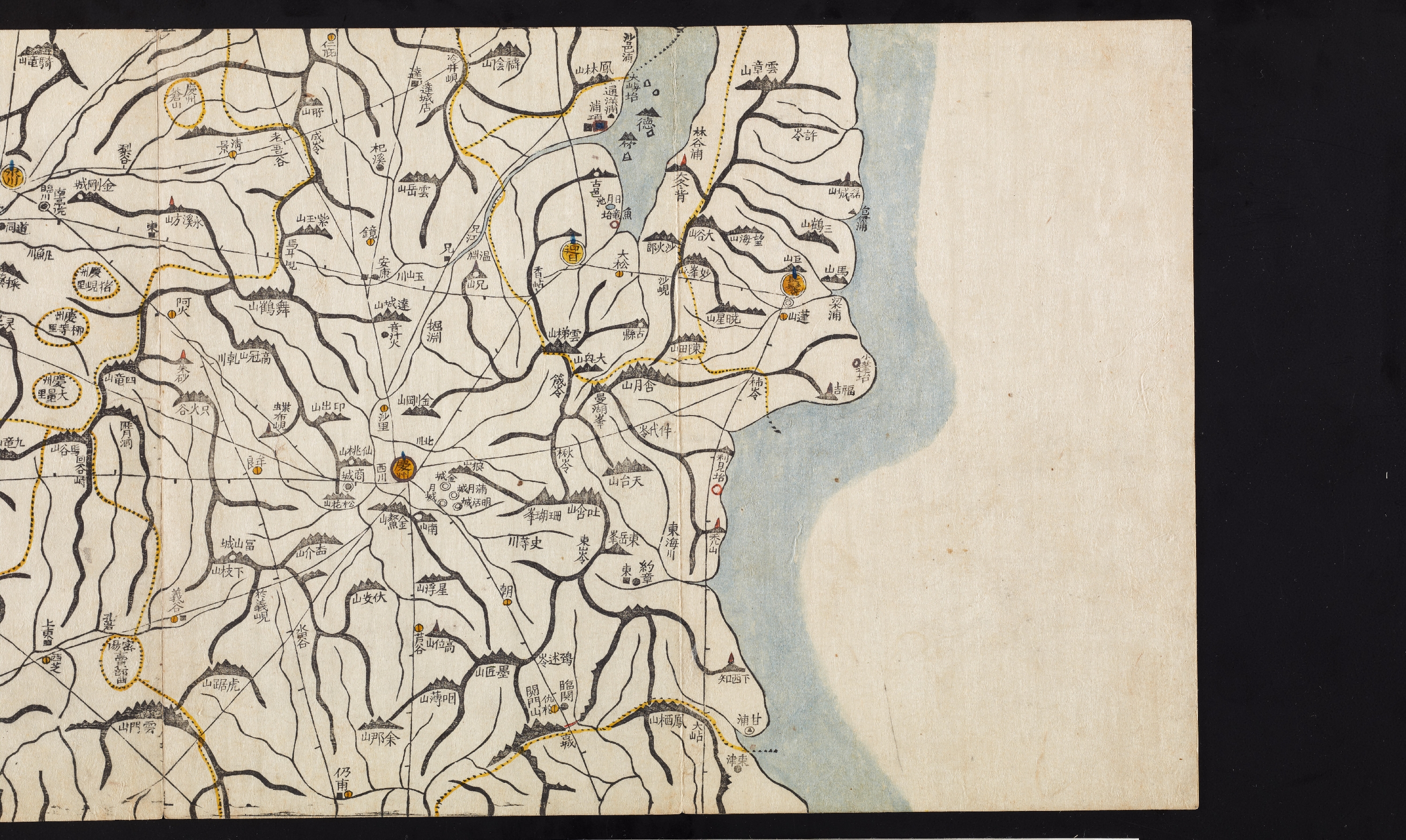
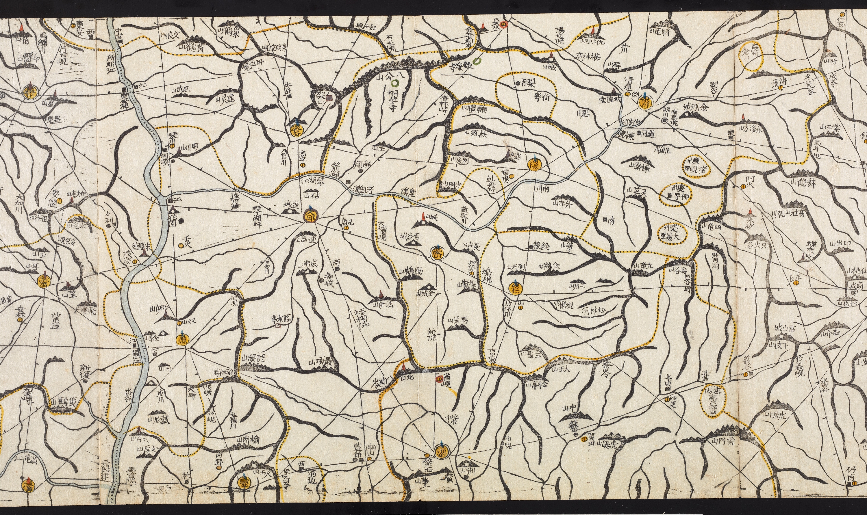
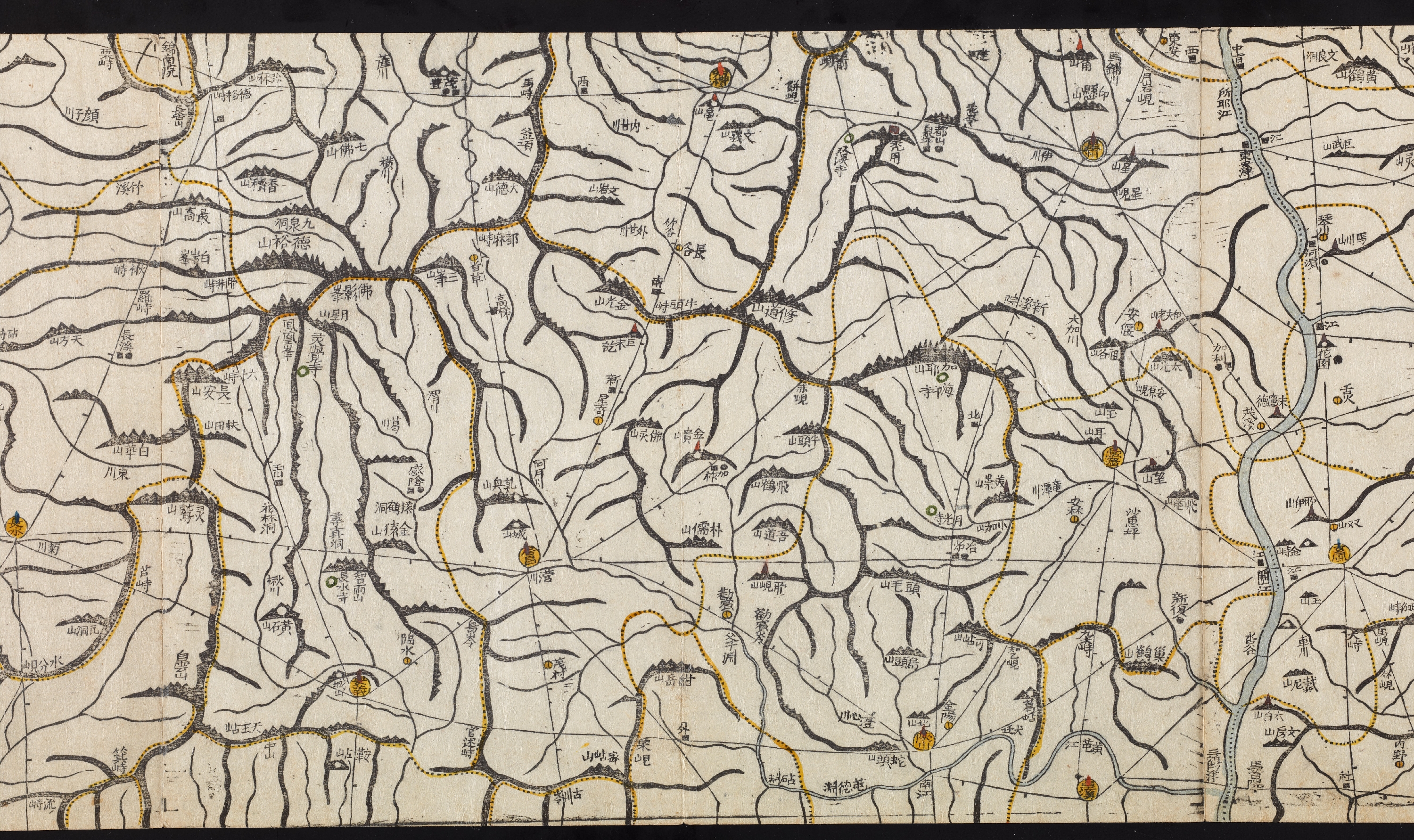
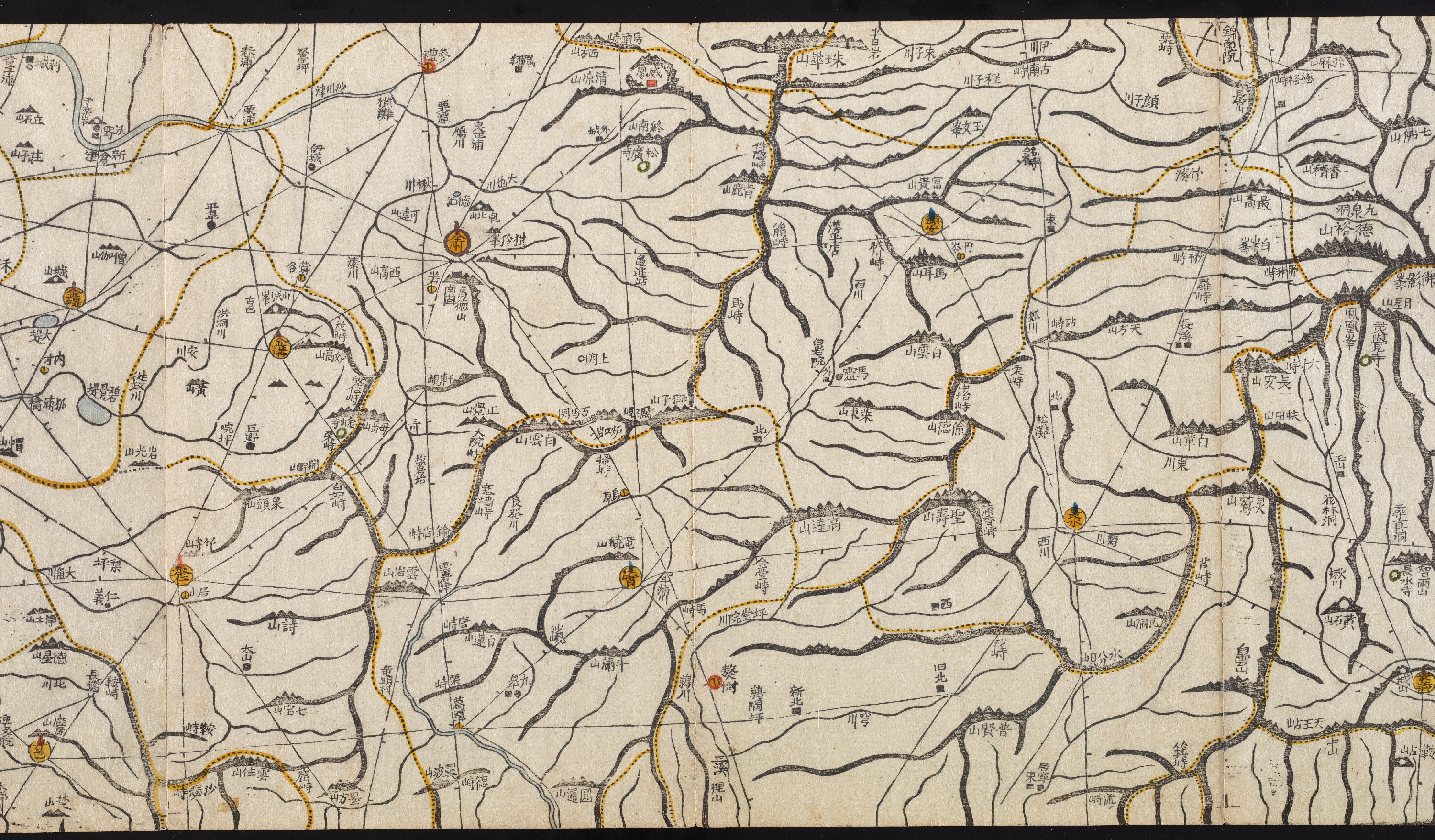
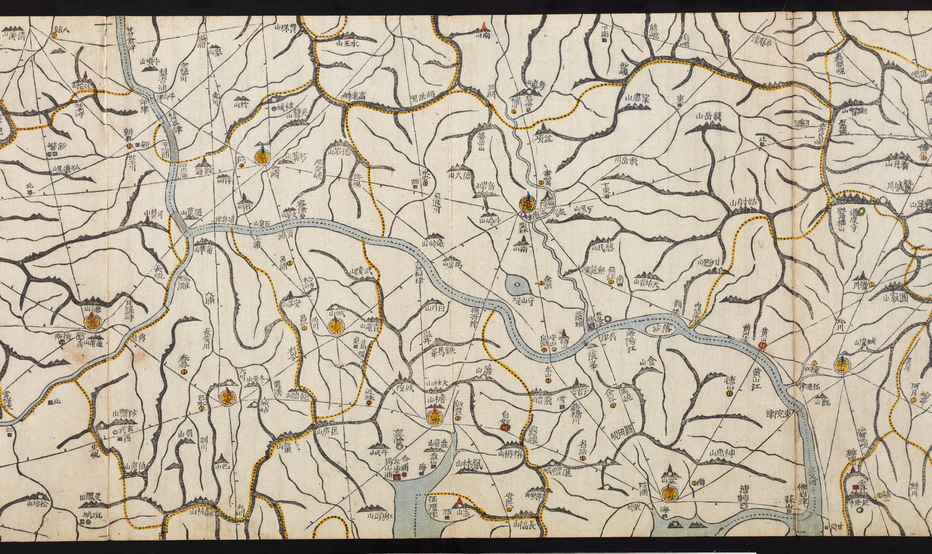
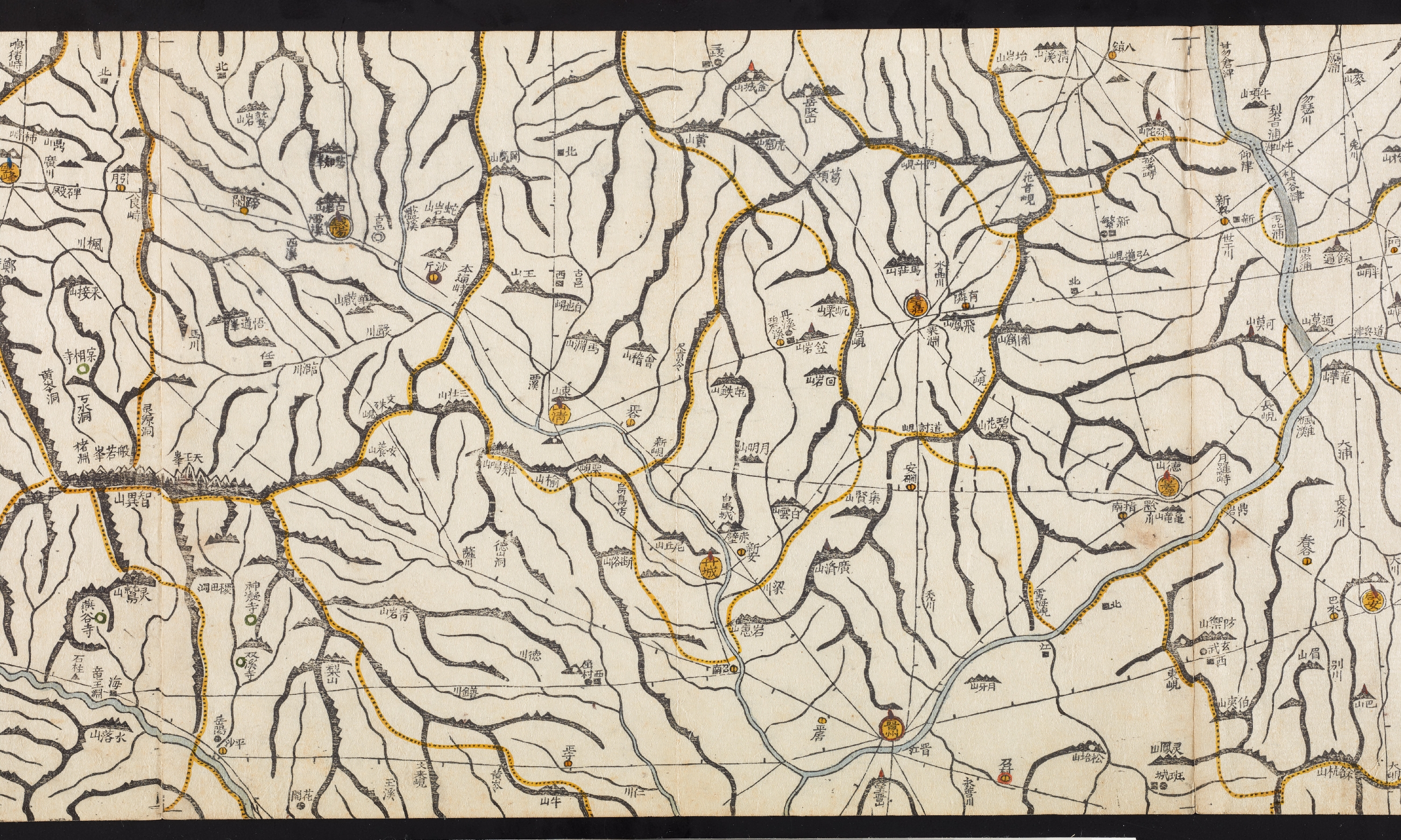
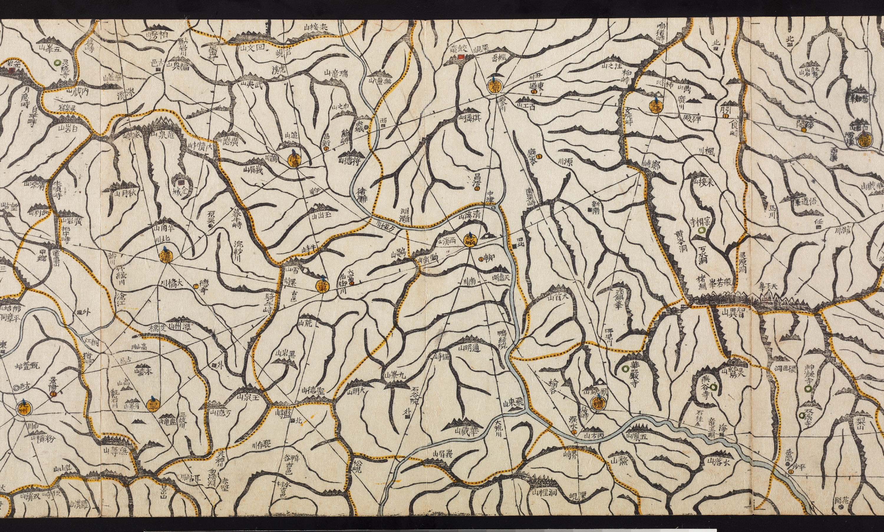
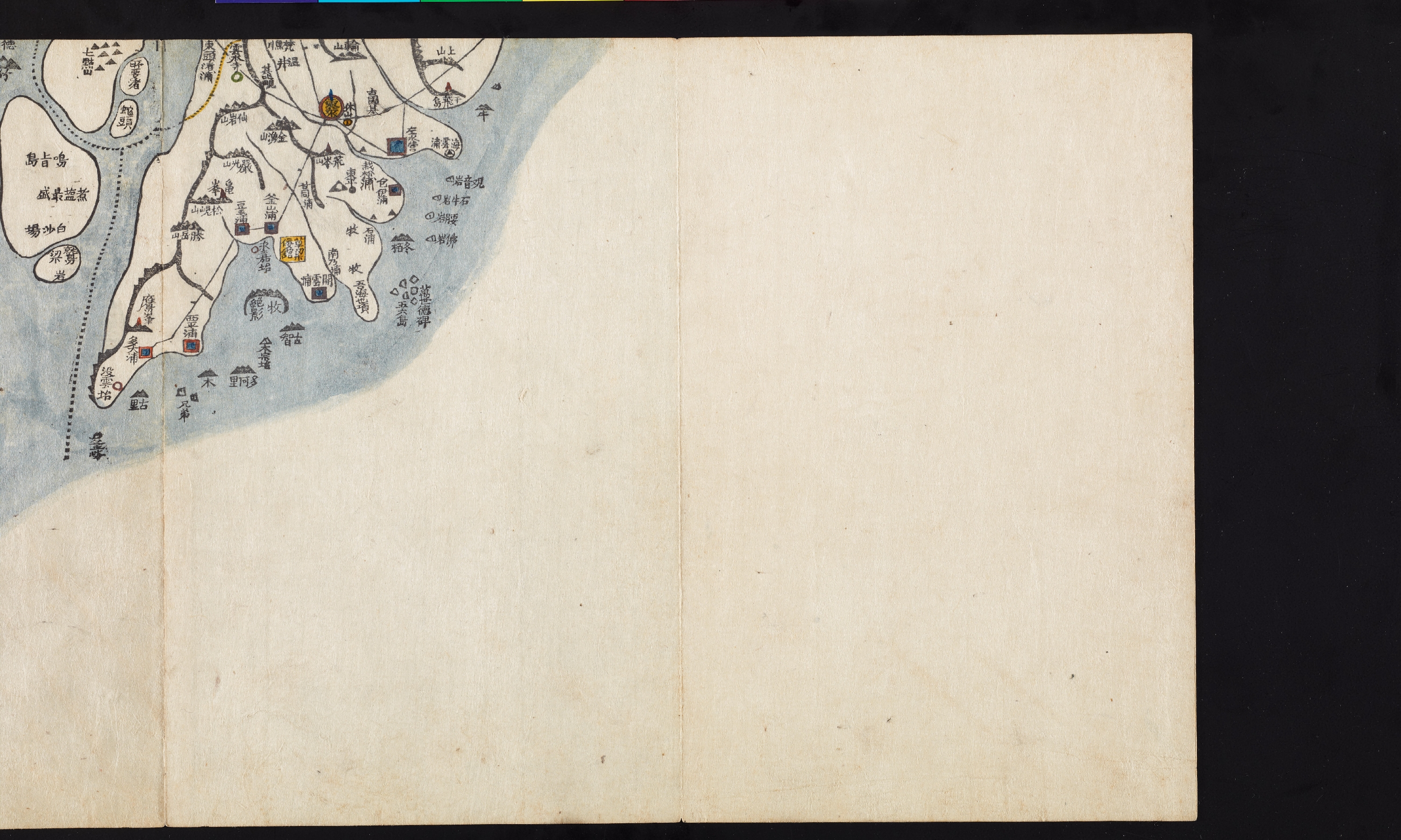
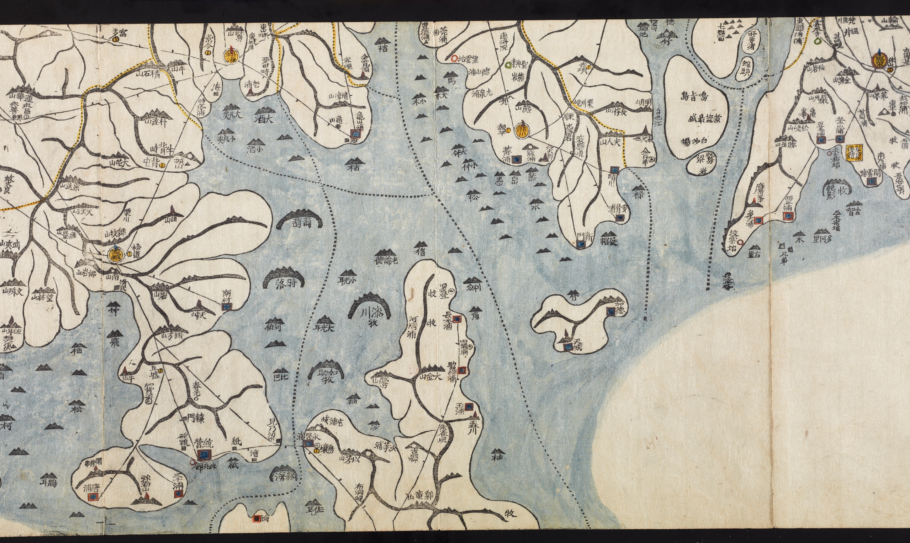
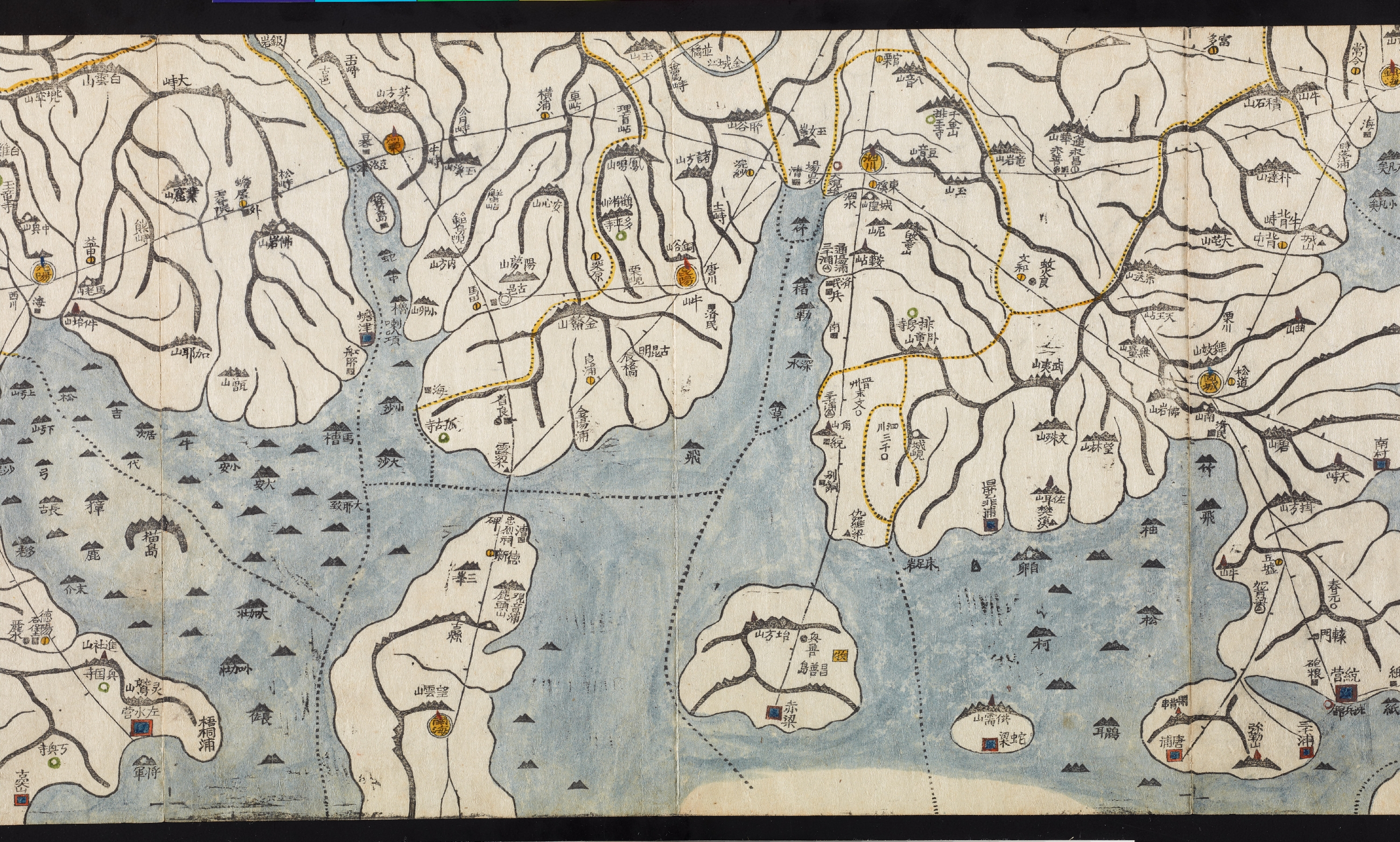
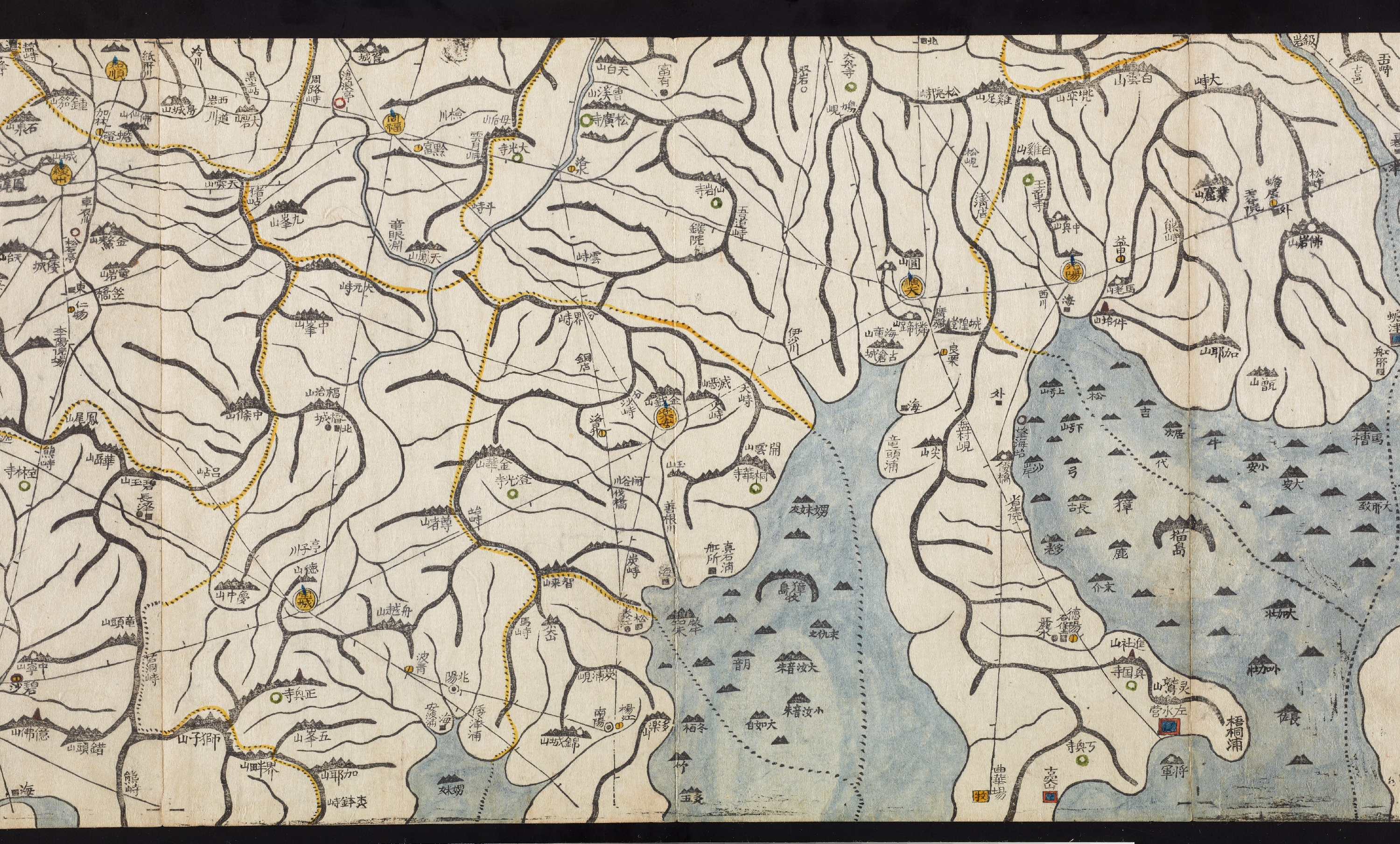
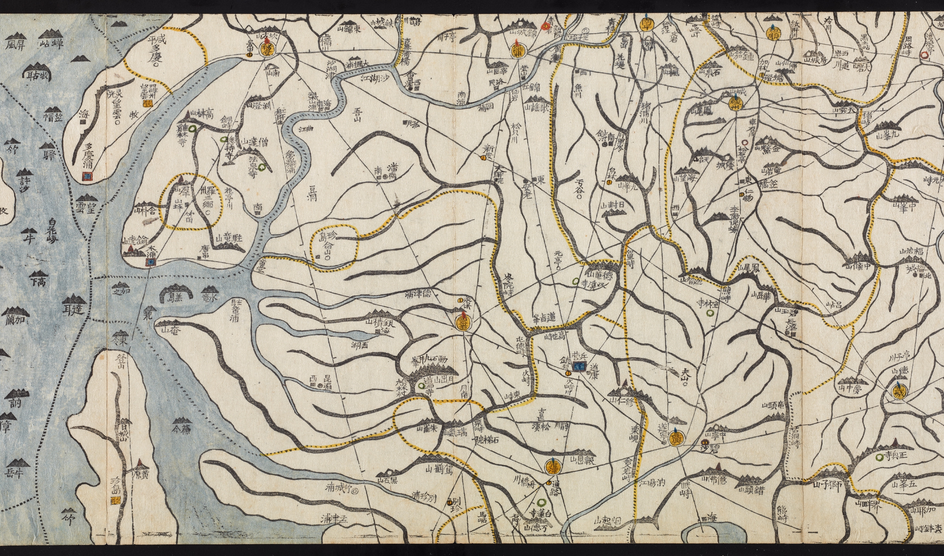
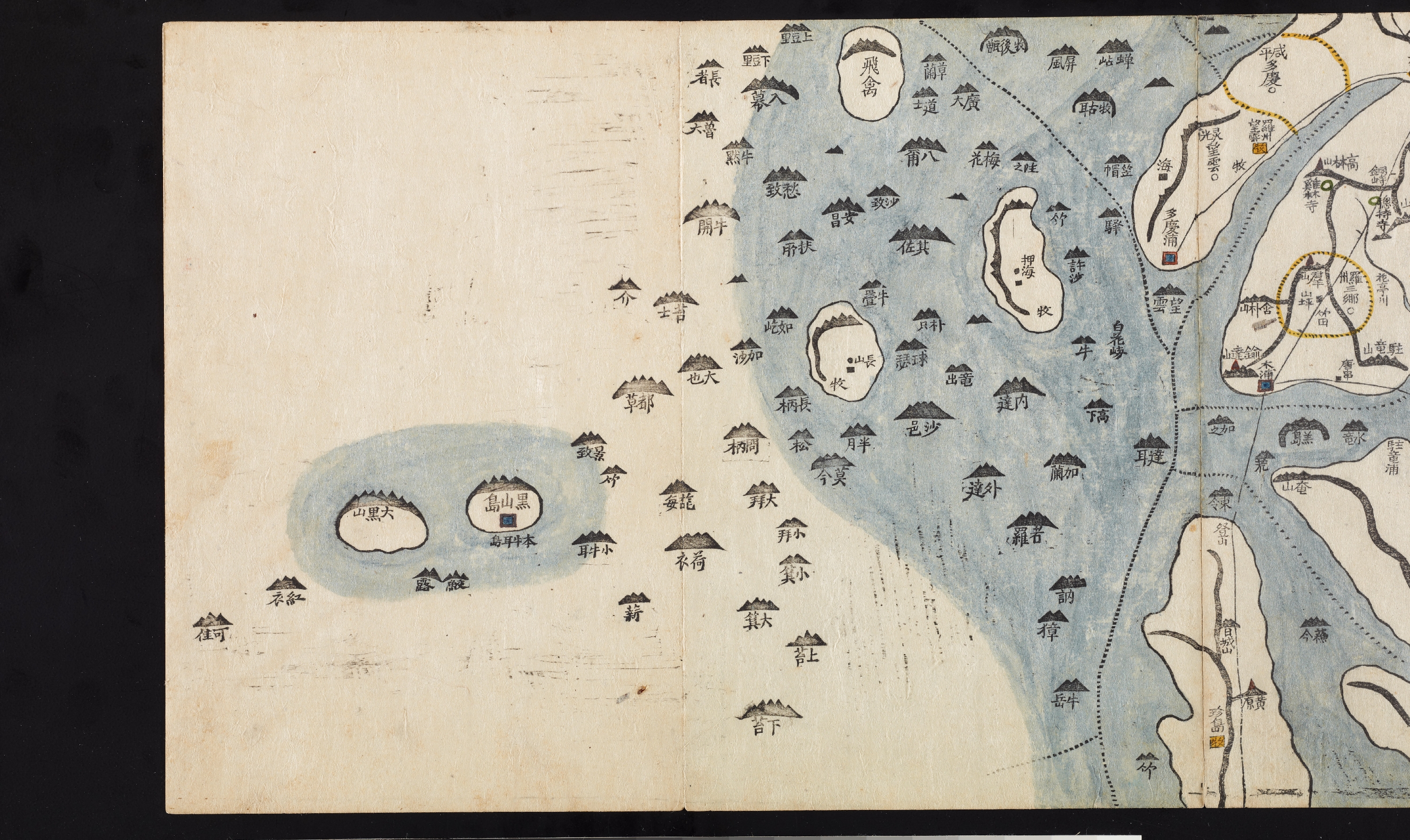
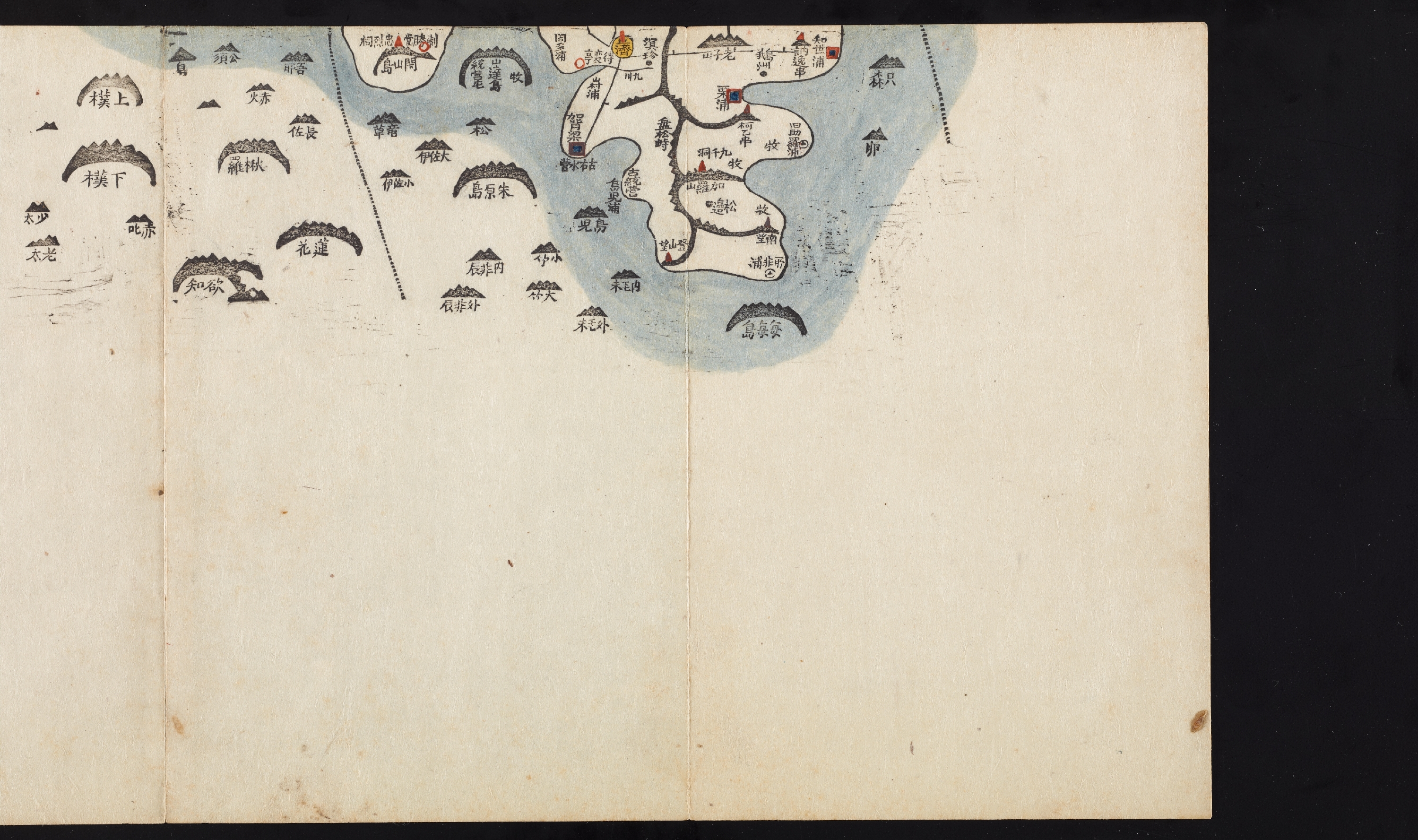
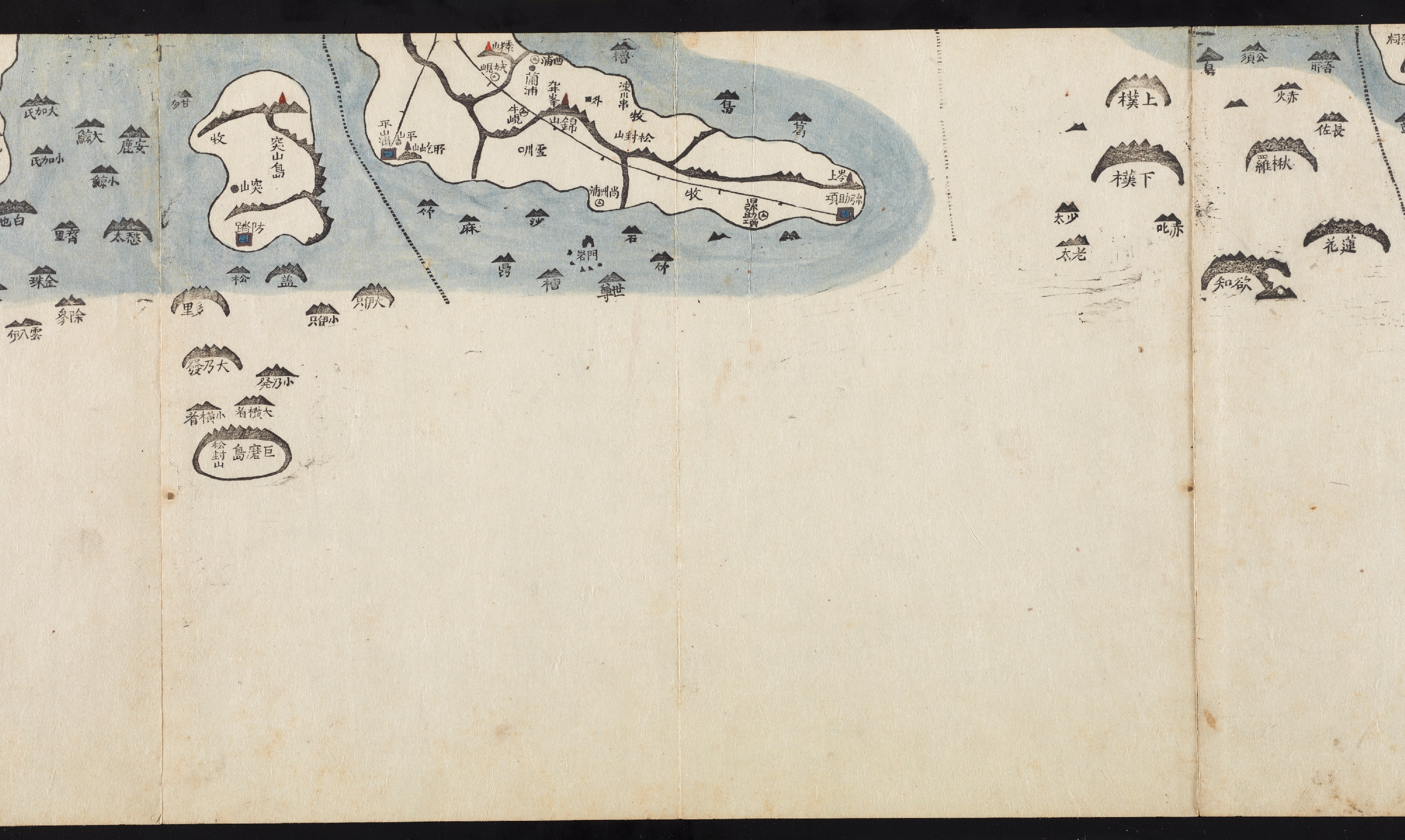
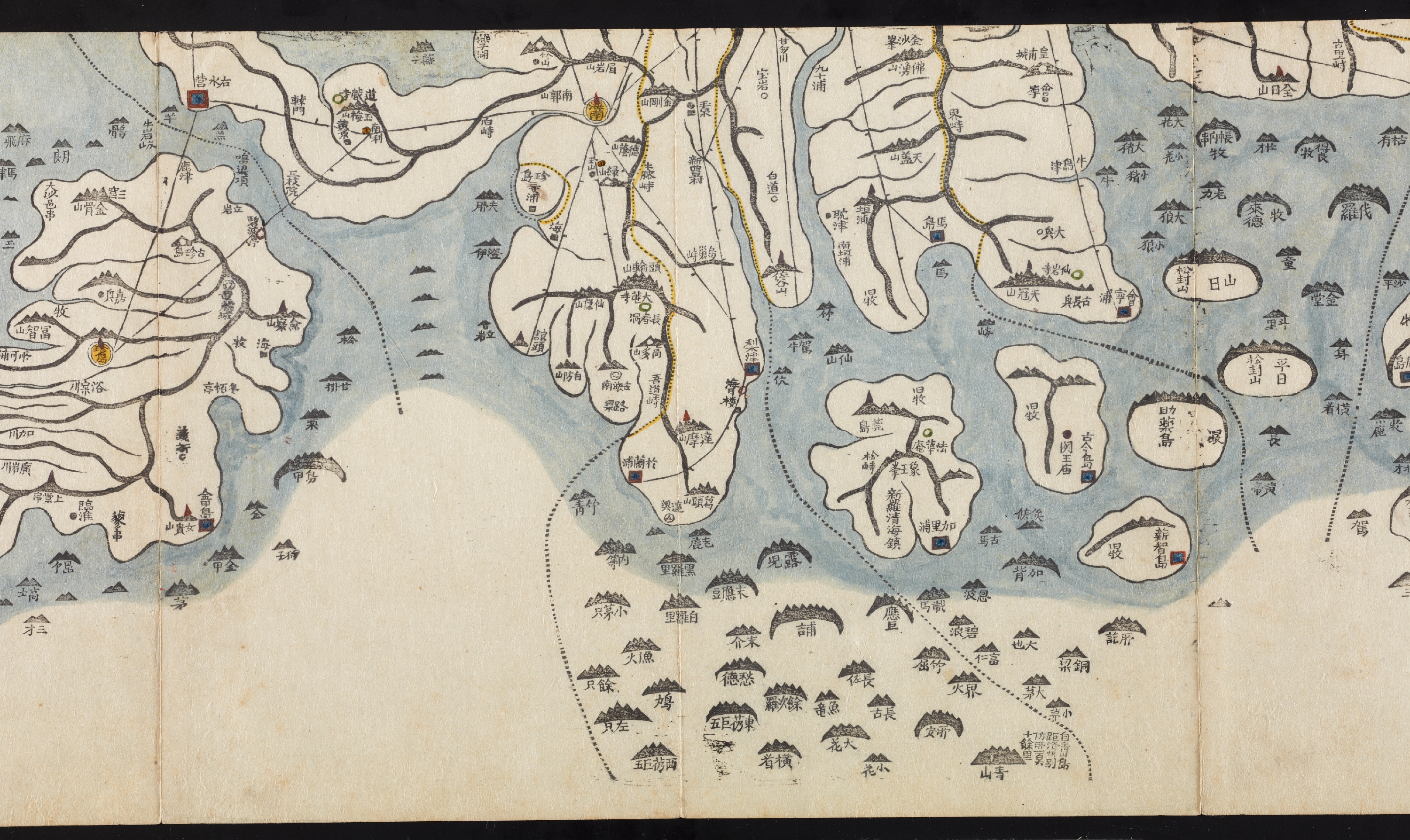
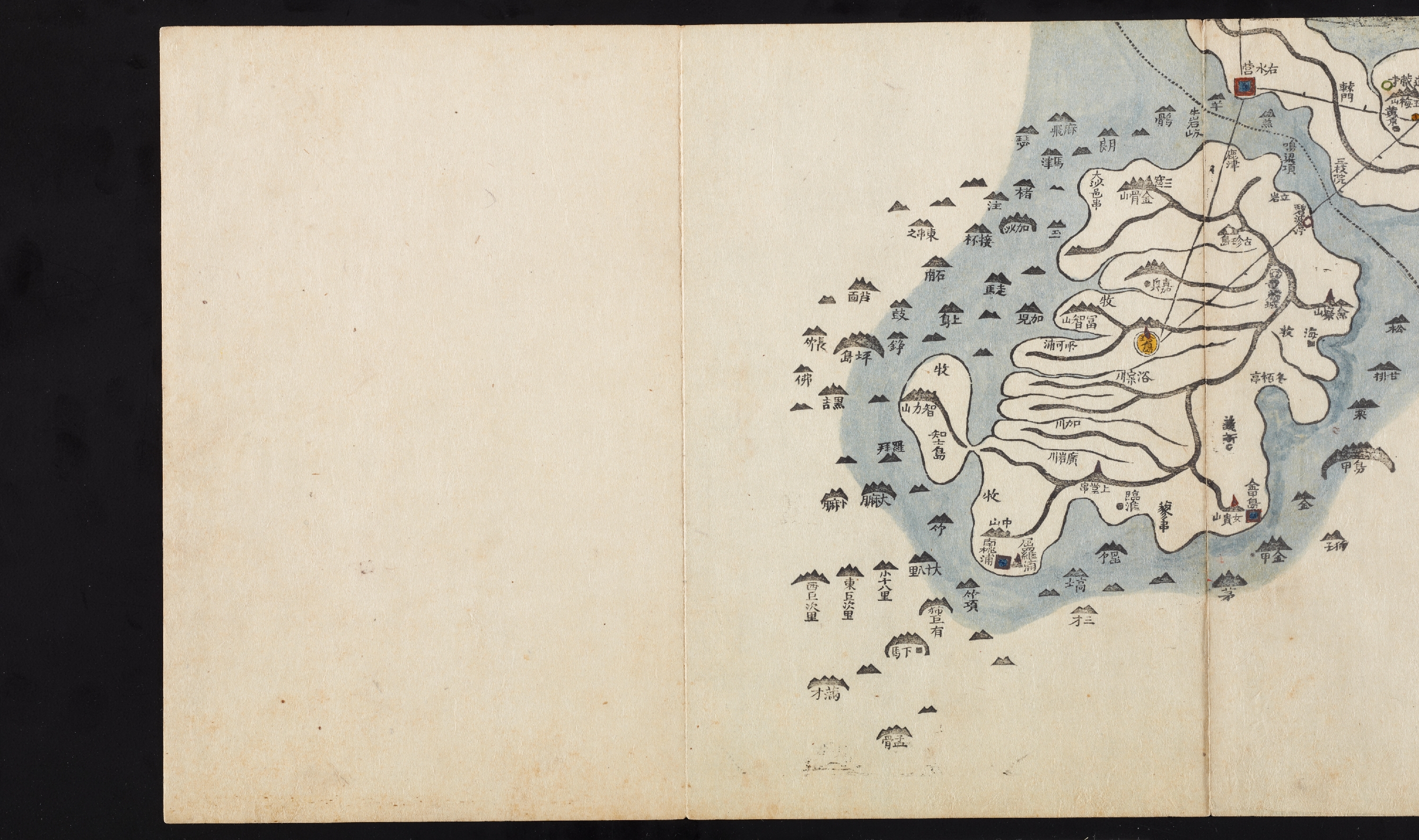
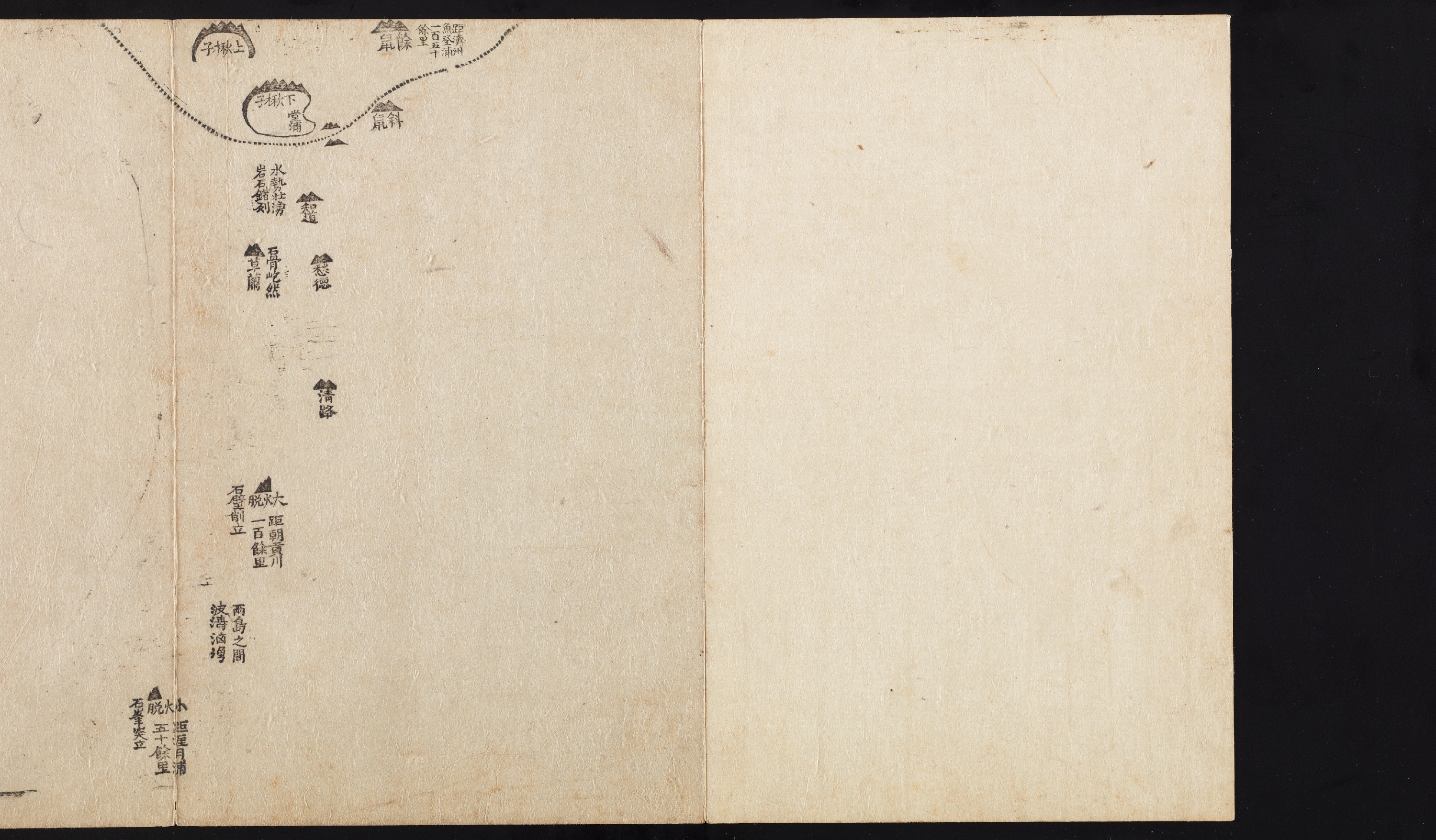
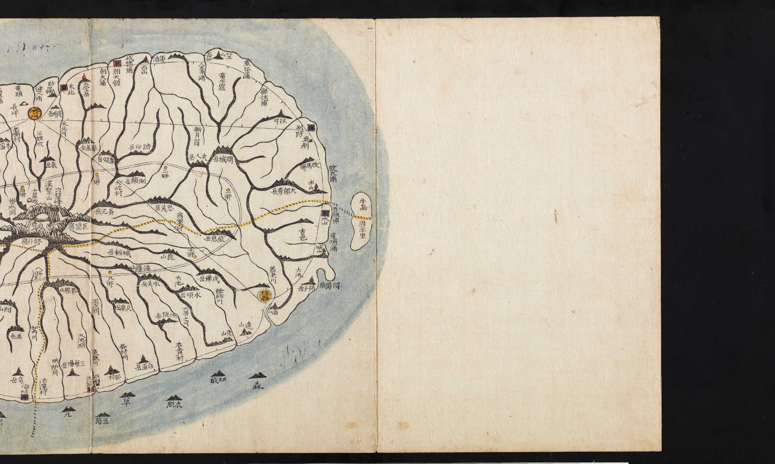
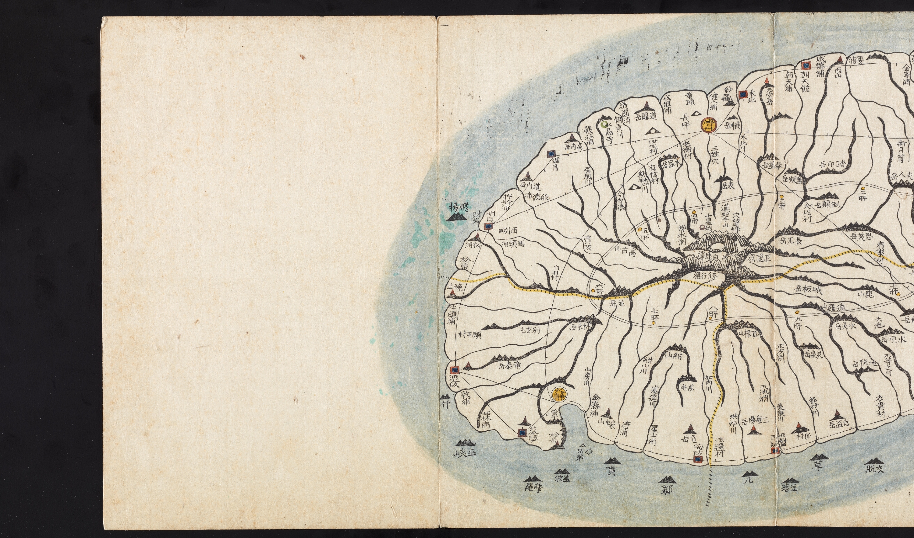
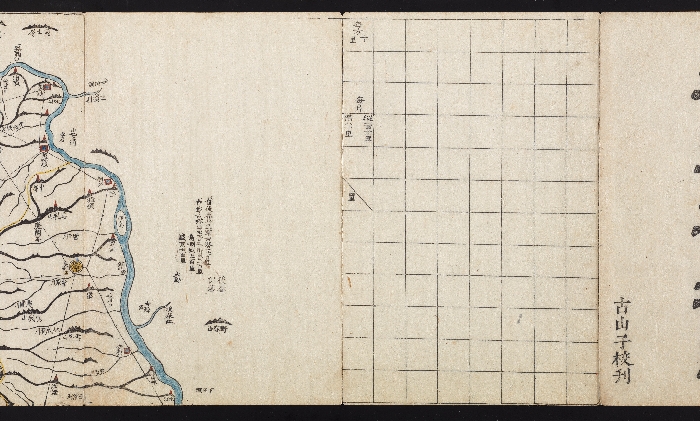
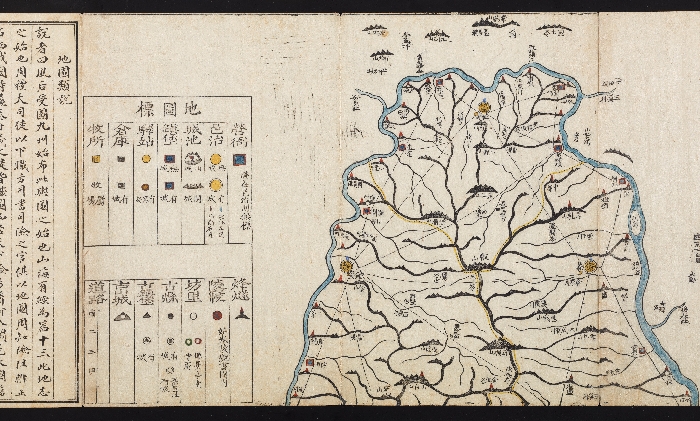
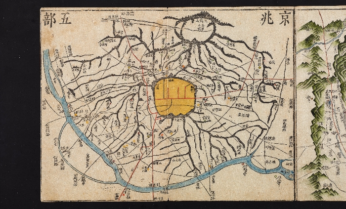
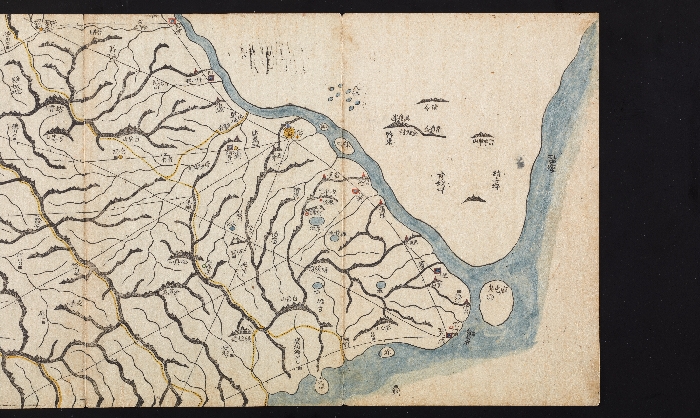
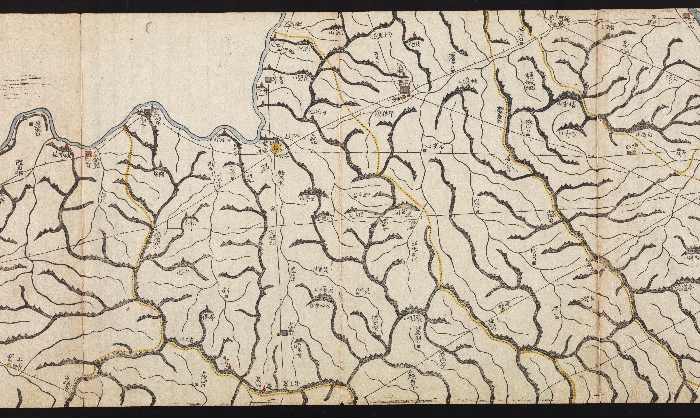
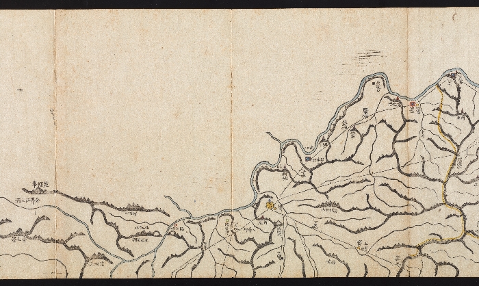
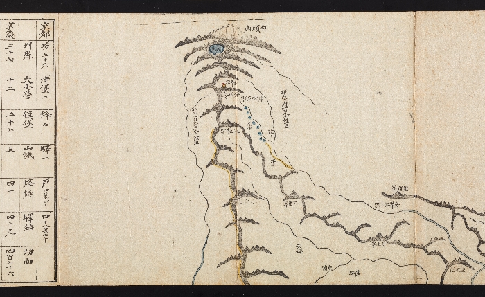
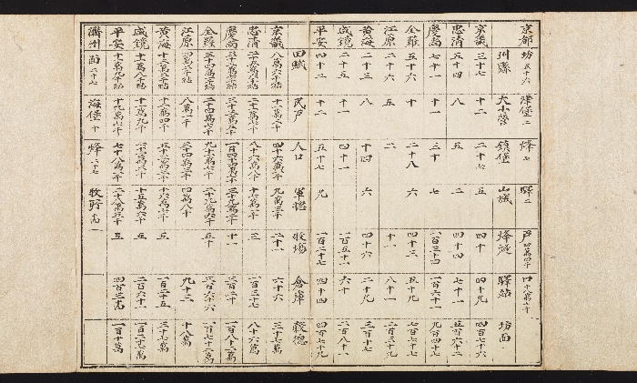
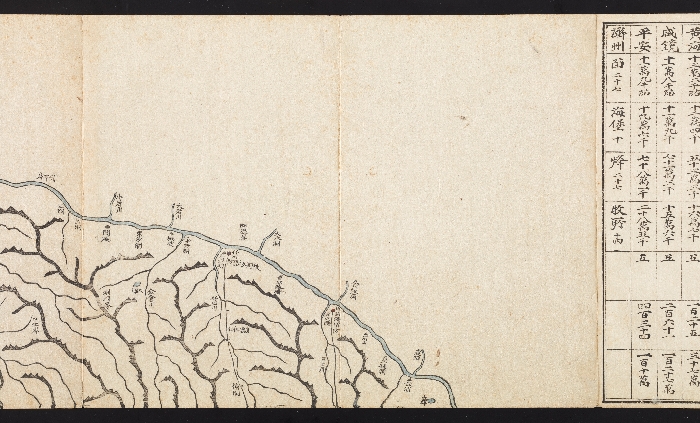
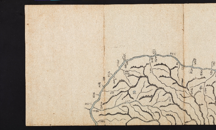
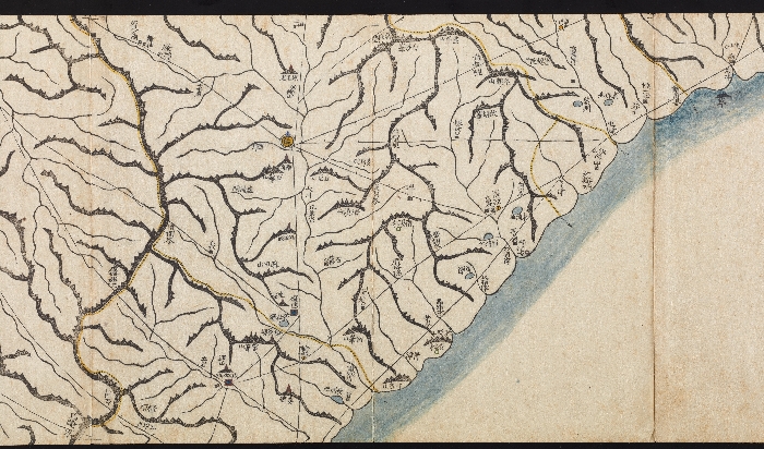
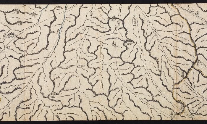
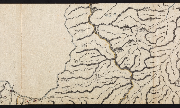
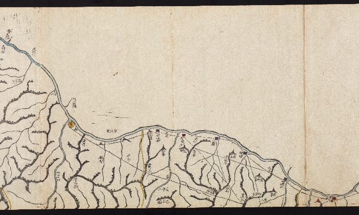
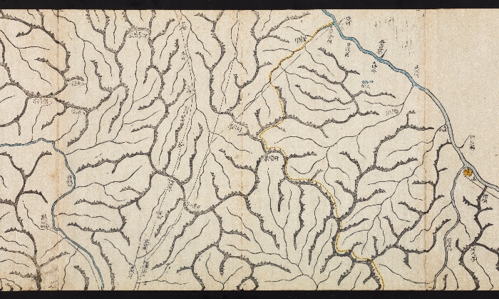
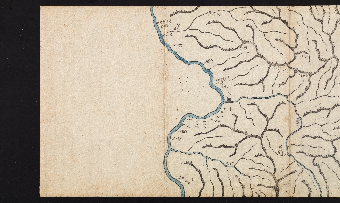
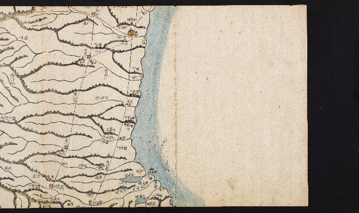
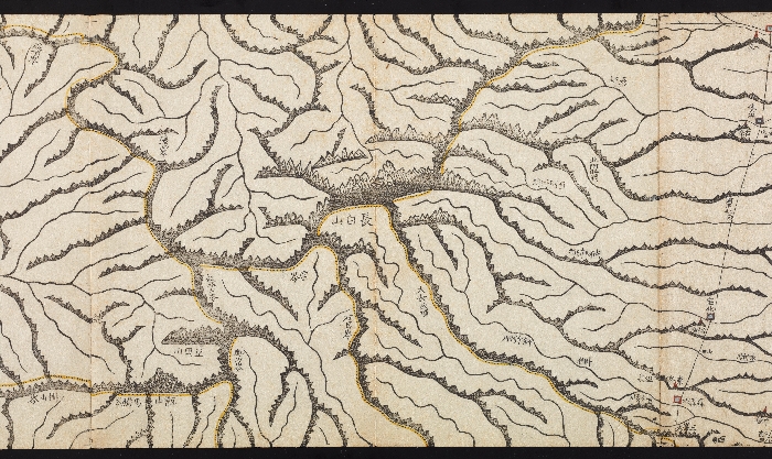
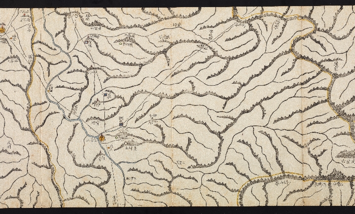
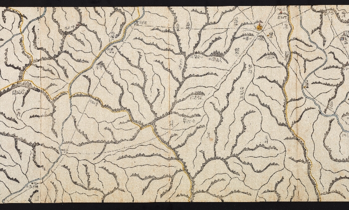
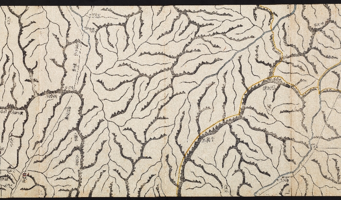
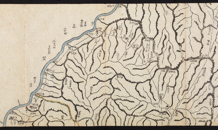
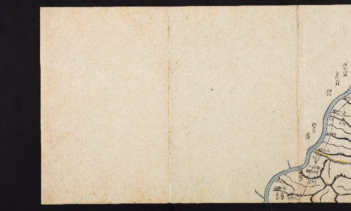
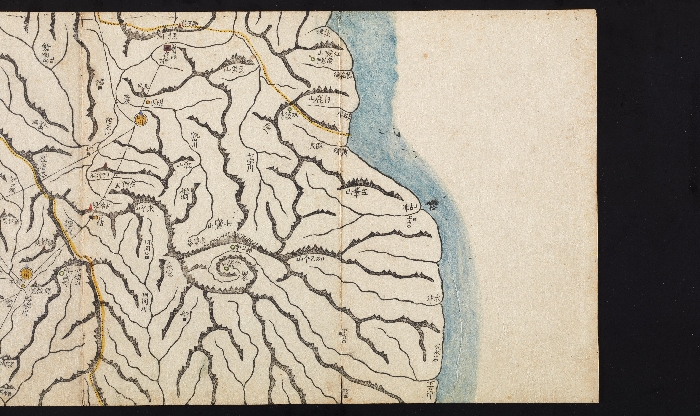
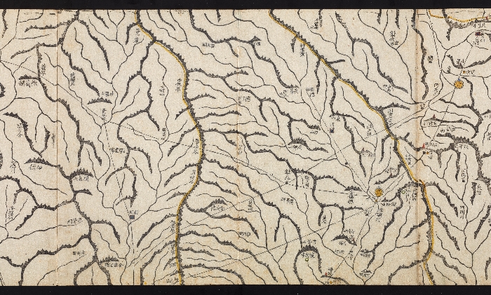
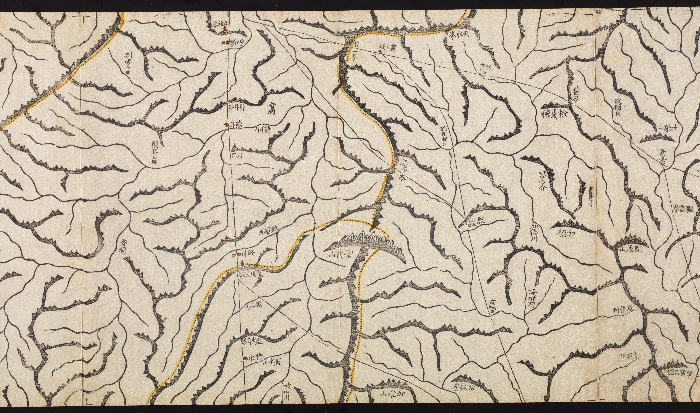
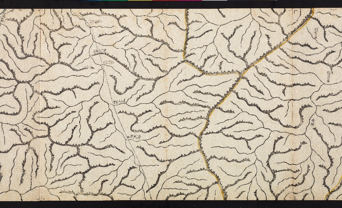
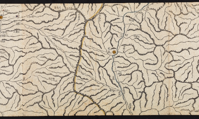
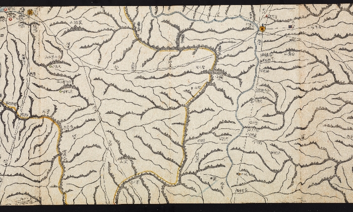
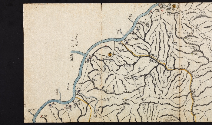
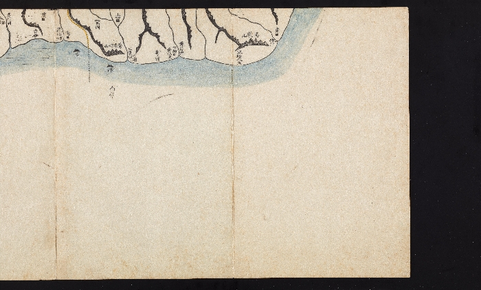
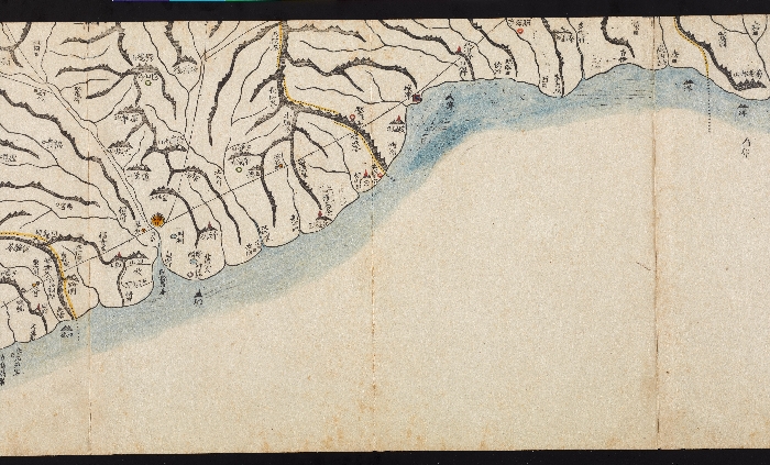
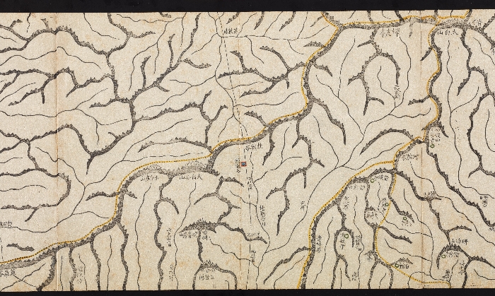
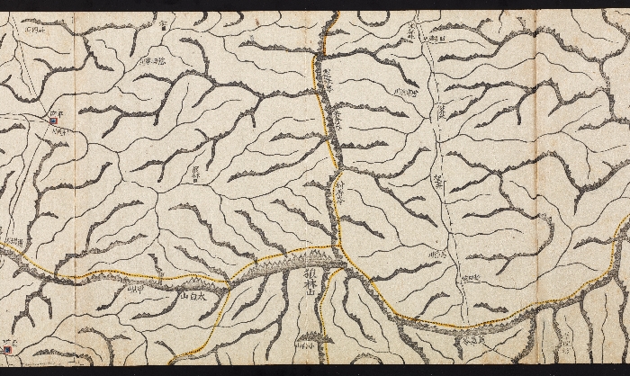
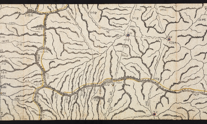
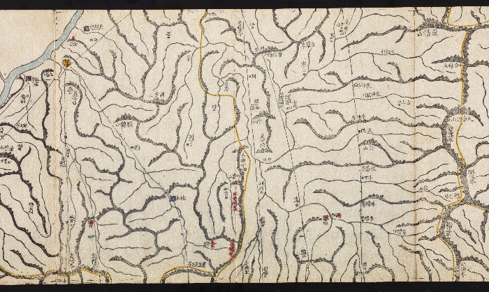
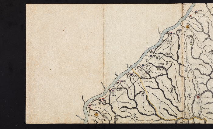
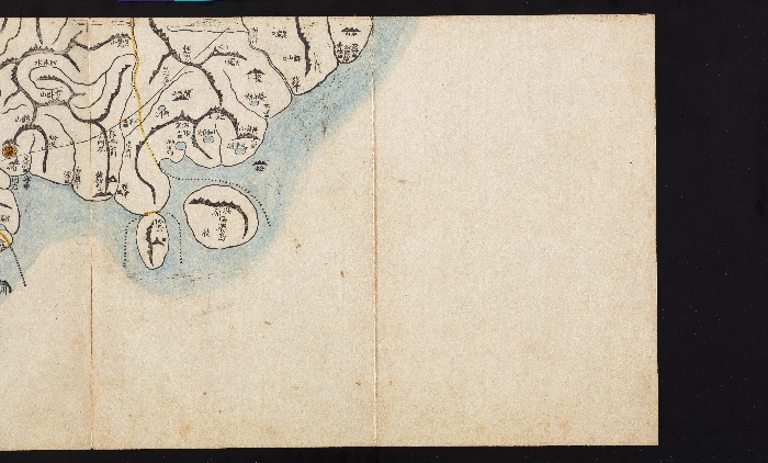
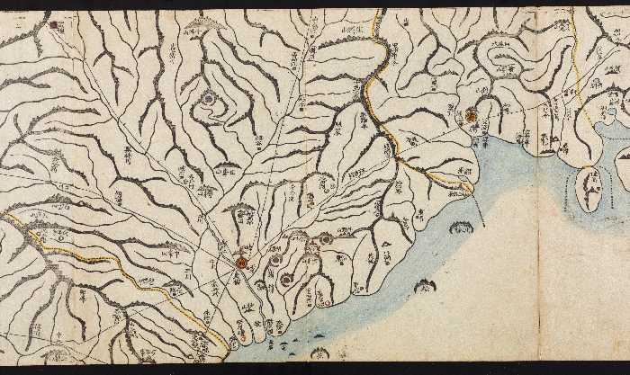
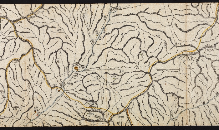
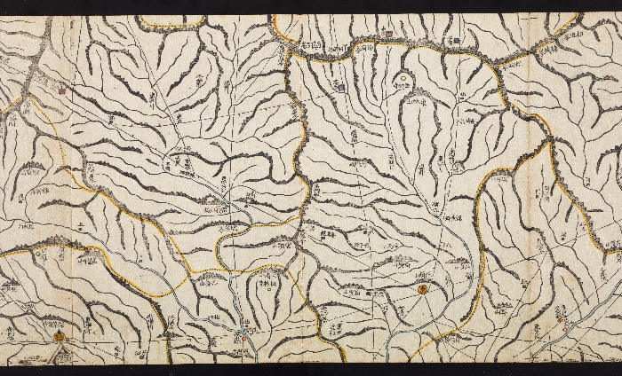
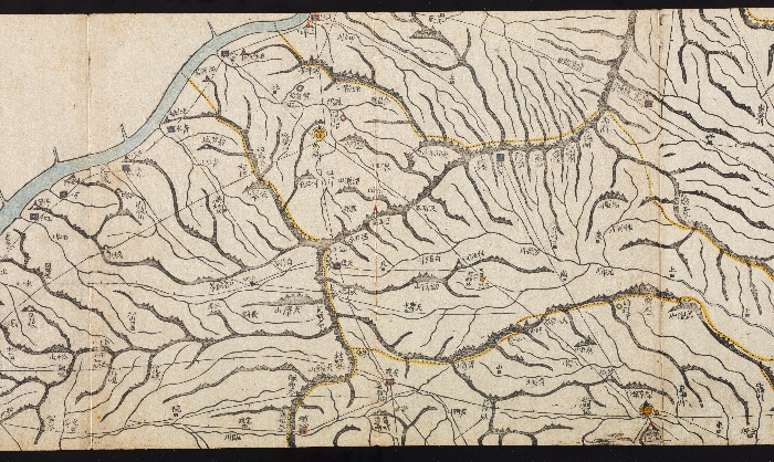
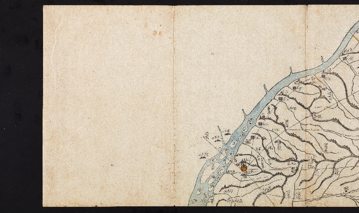
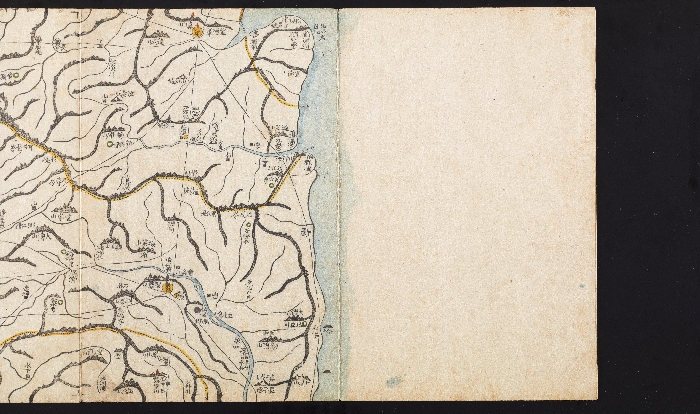
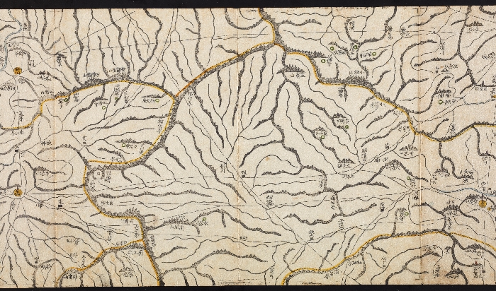
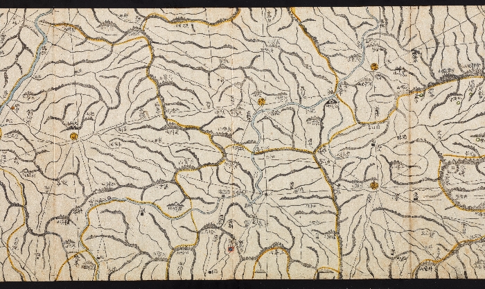
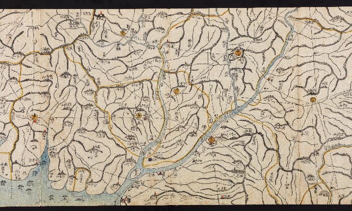
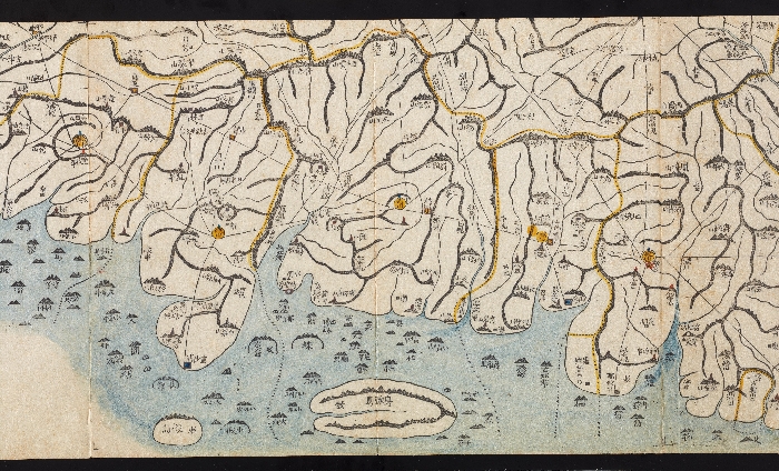
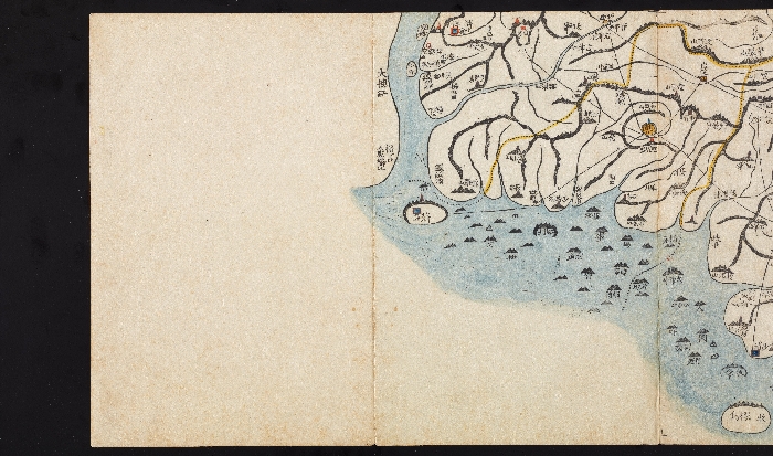
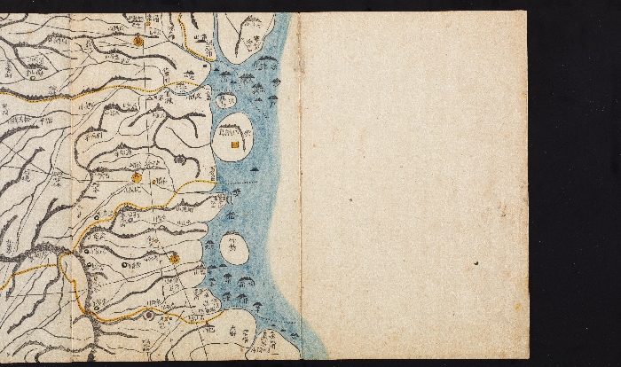
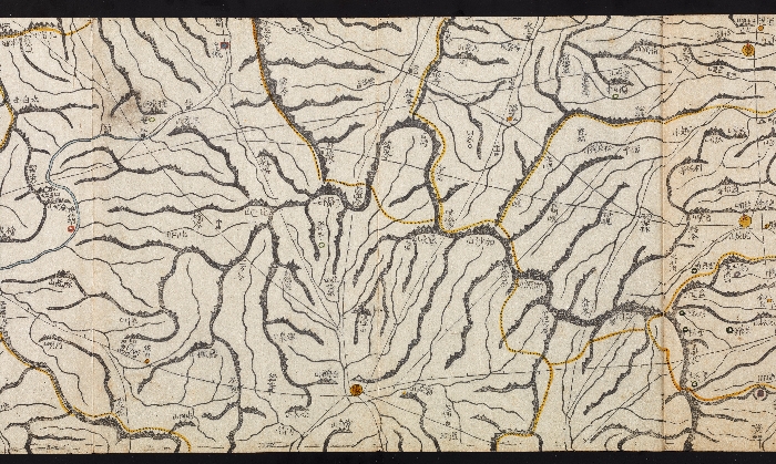
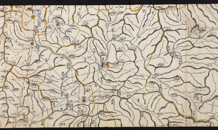
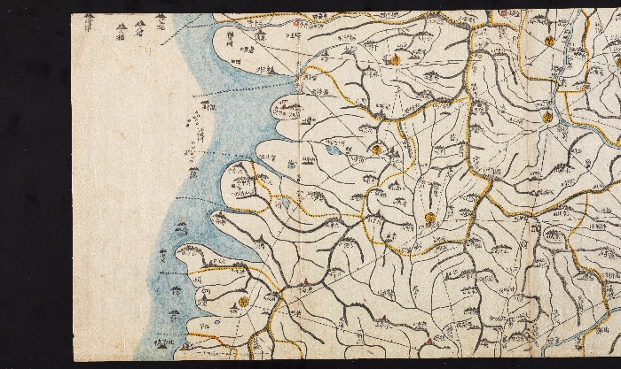
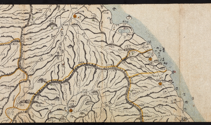
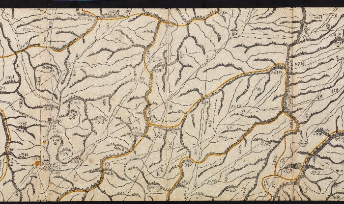
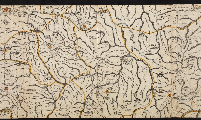
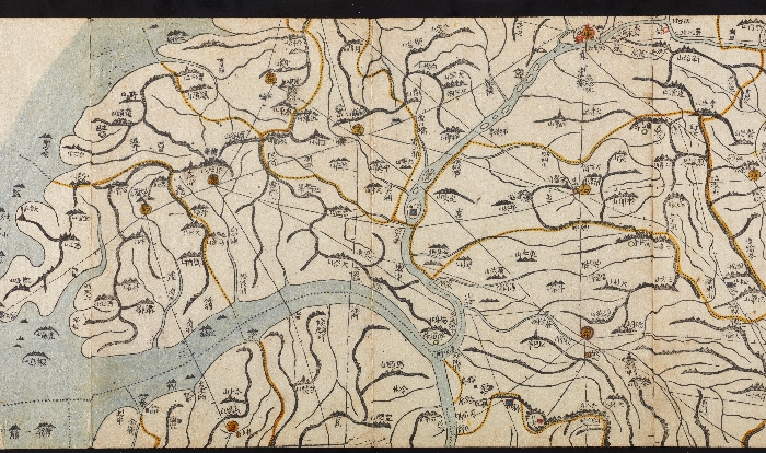
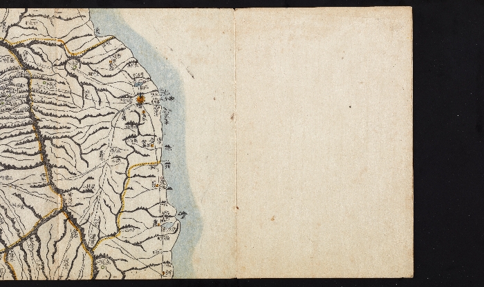
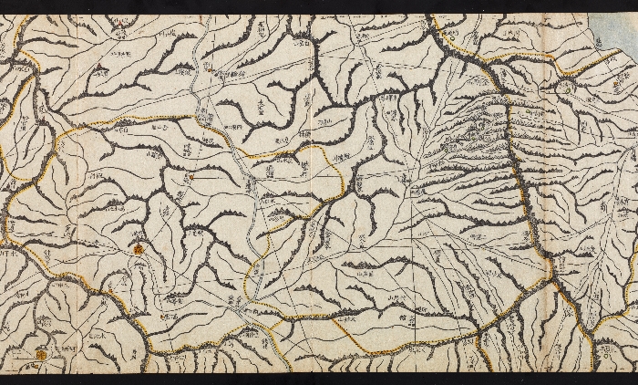
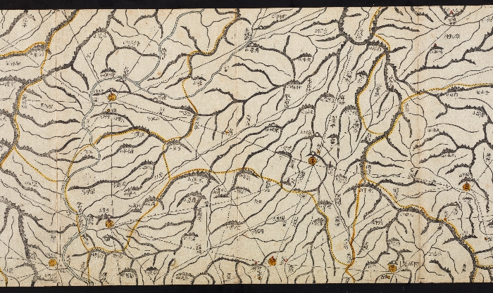
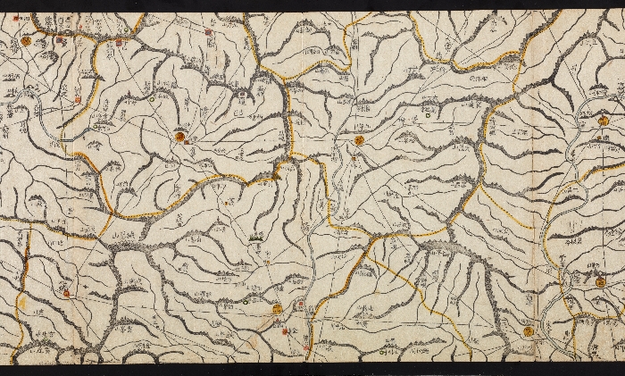
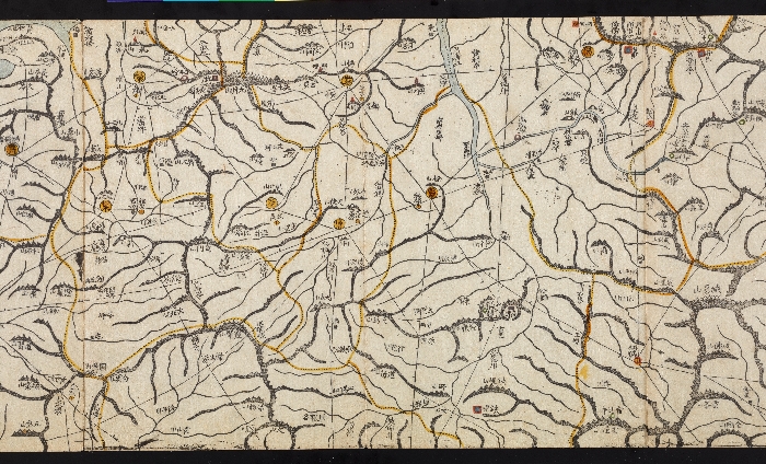
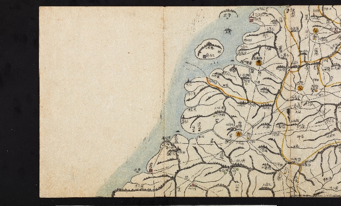
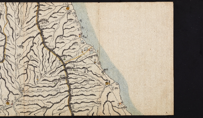
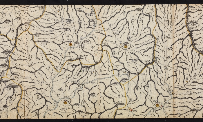
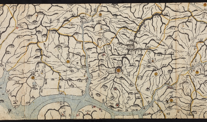
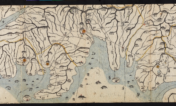
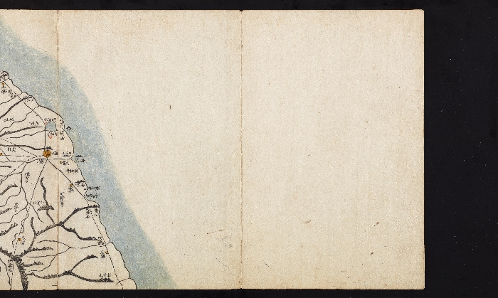
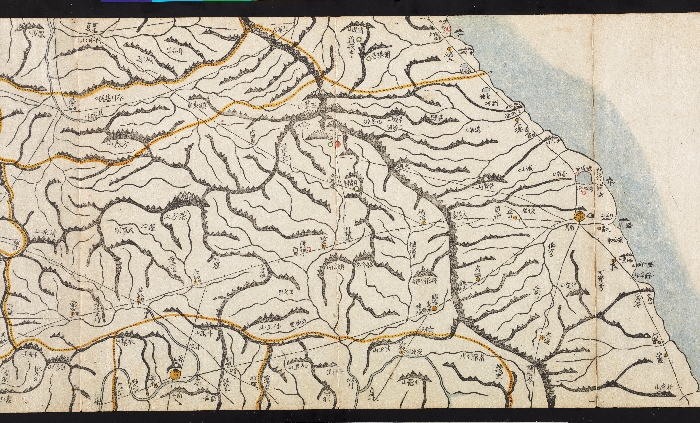
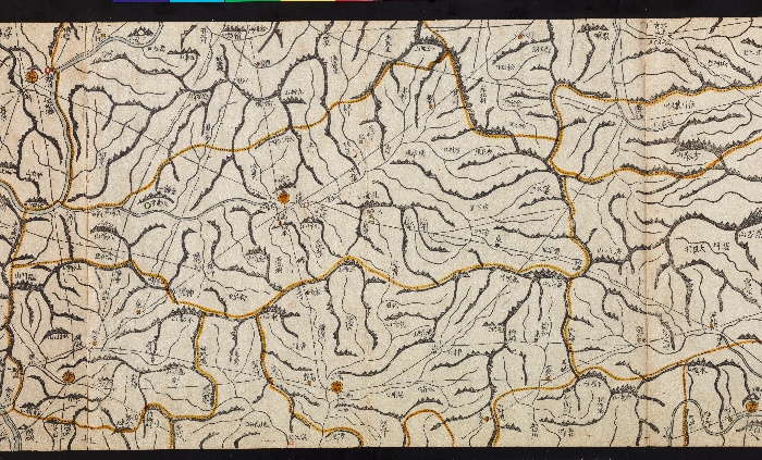
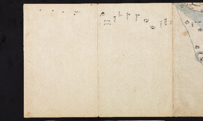
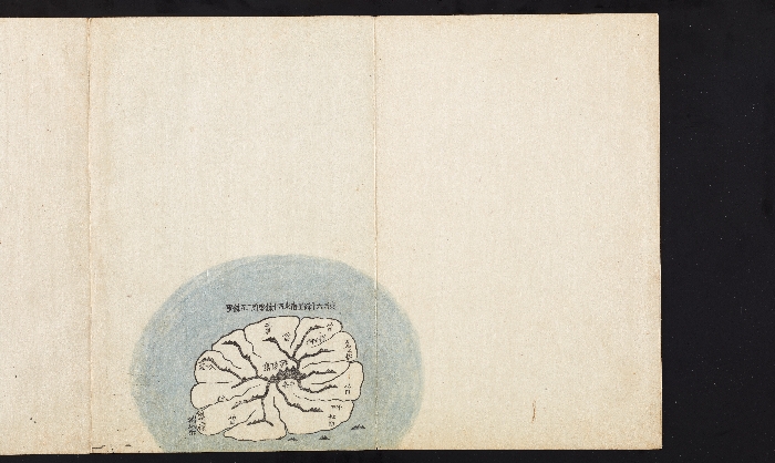
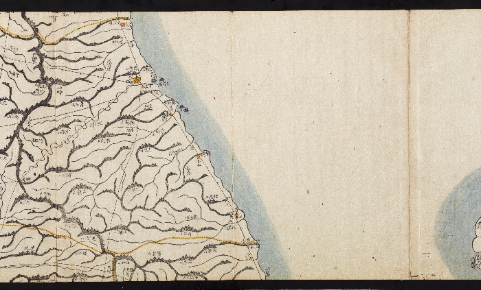
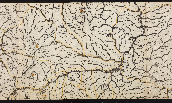
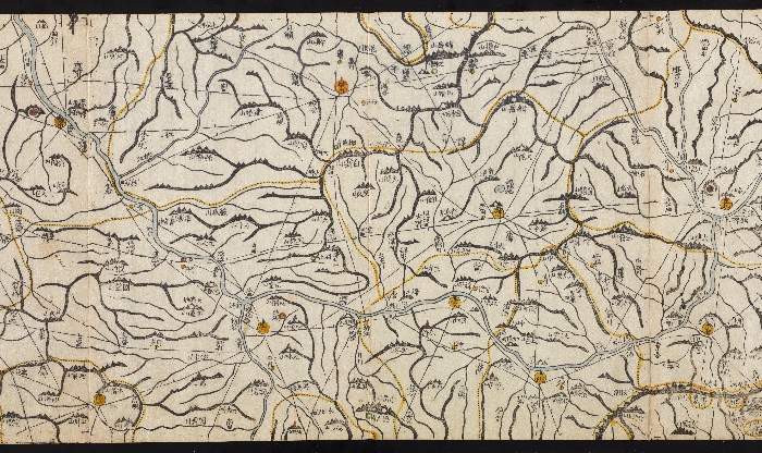
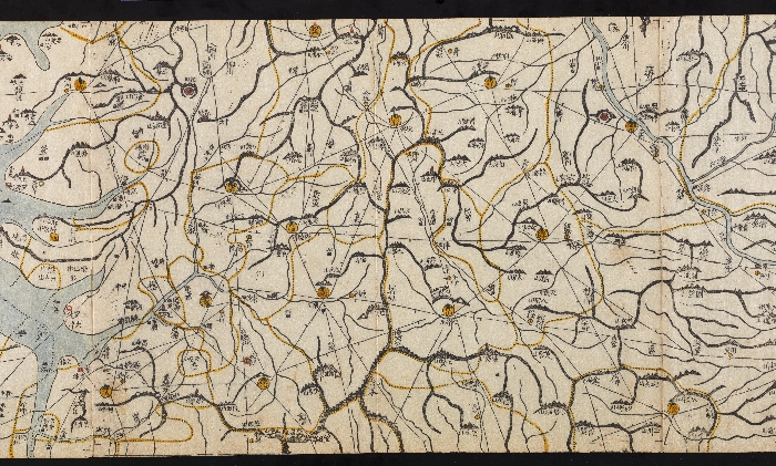
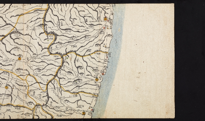
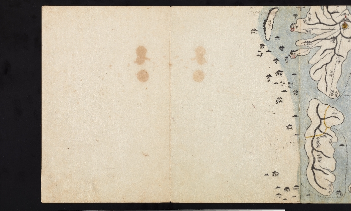
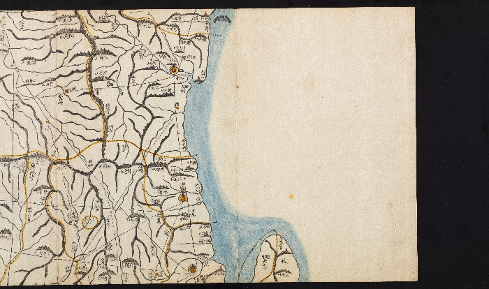
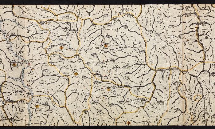
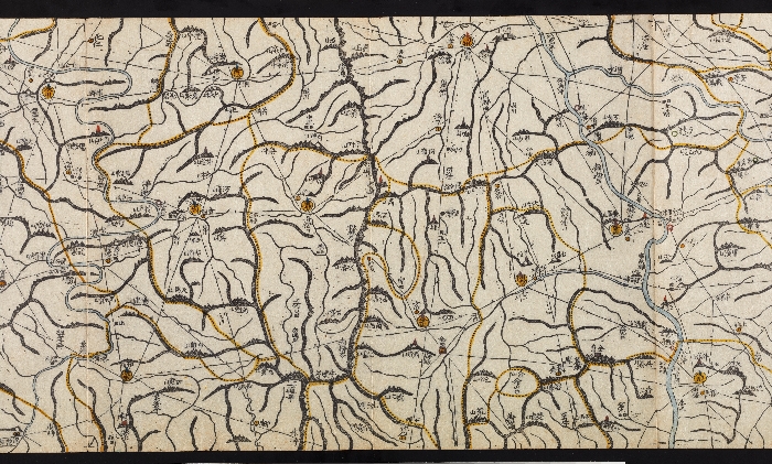
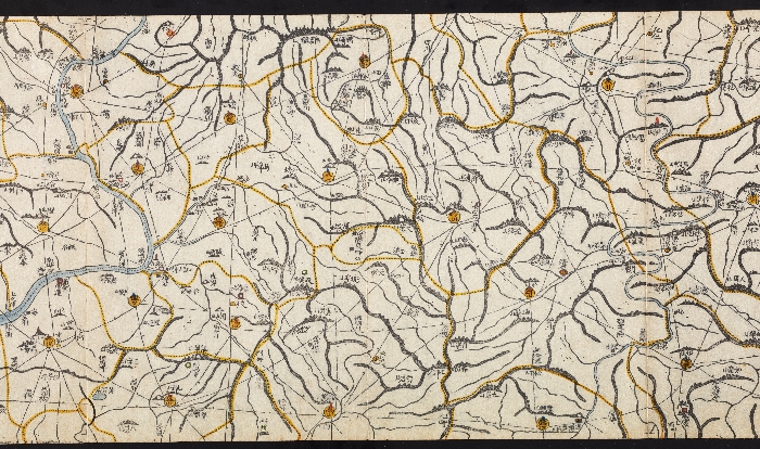
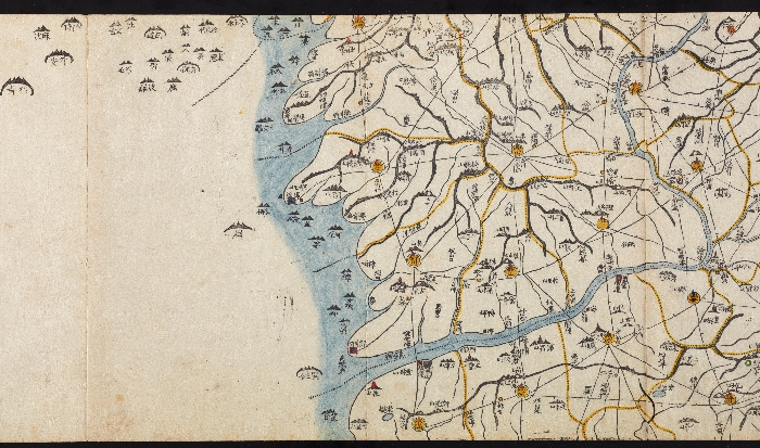
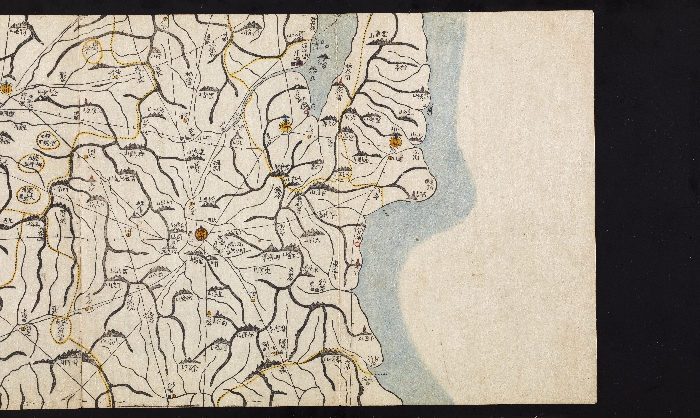
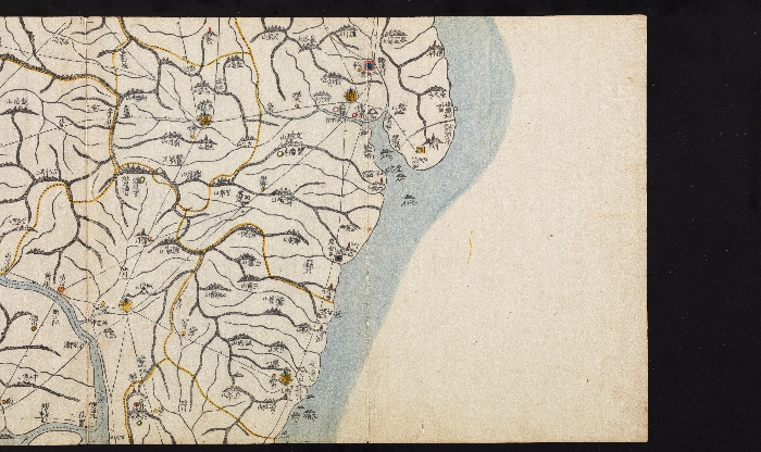
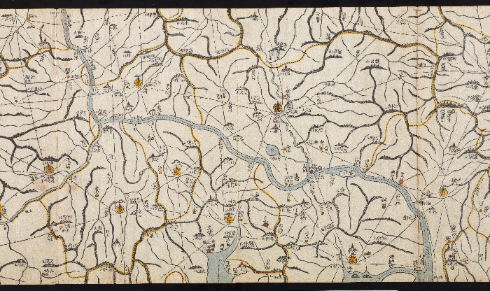
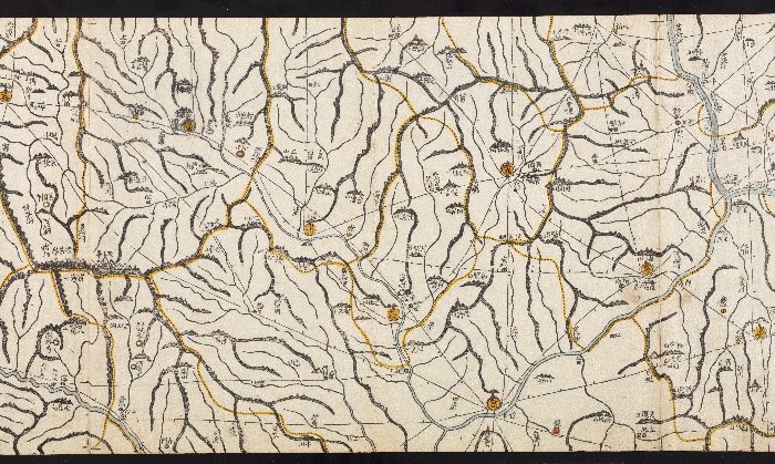
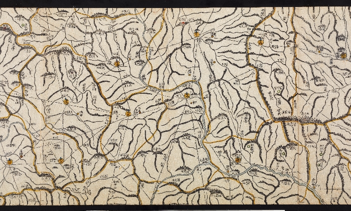
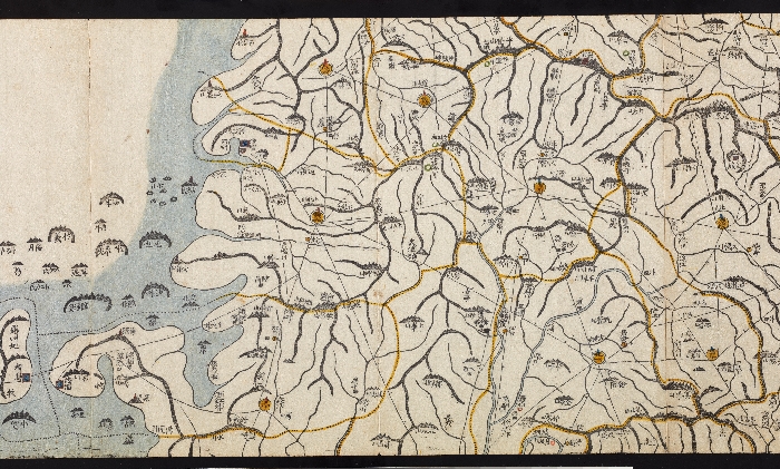
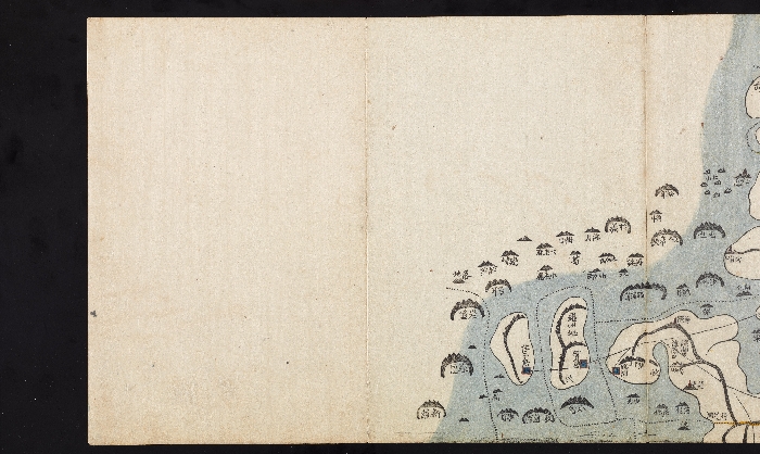
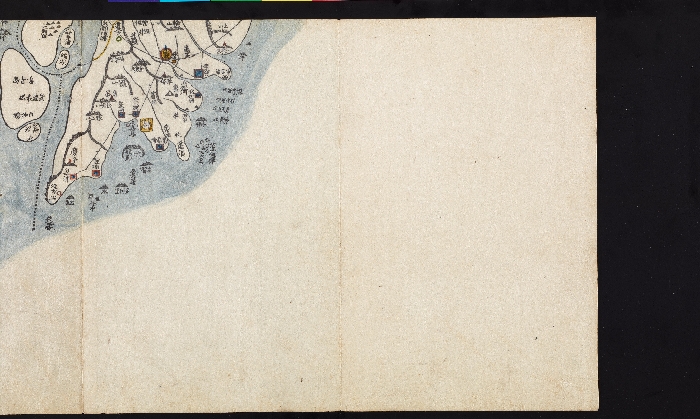
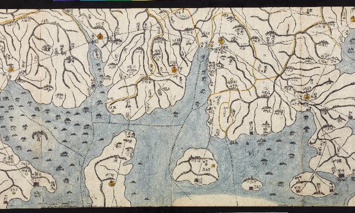
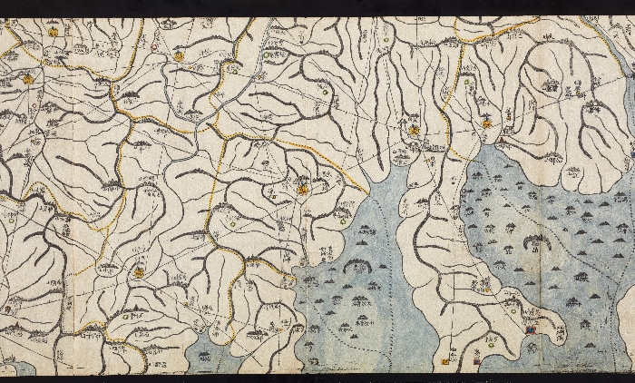
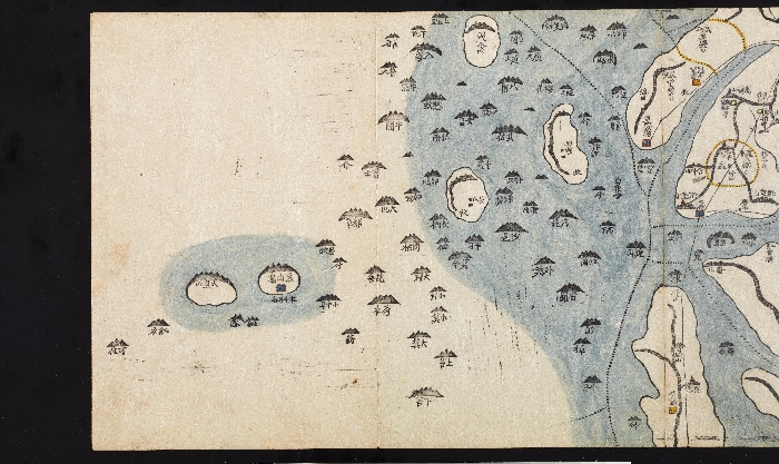
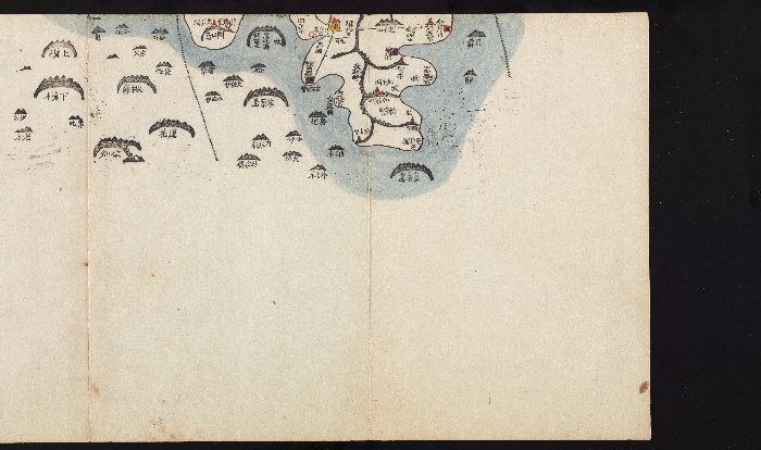
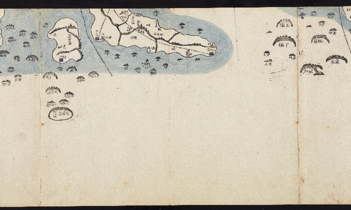
대동여지도는 1861년 김정호가 손수 제작하고 목판으로 인출하여 간행한 전국지도로, 이 지도는 신유본(1861)이다. 대동여지도는 우리나라 전체를 남북 120리 간격으로 구분해 22층으로 나누고, 각 층마다 동서 방향의 지도를 수록했다. 각 층의 지도는 1권의 책으로 묶어 동서 80리를 기준으로 접고 펼 수 있도록 만들어 휴대가 간편하고, 보기 쉽게 만들었다. 이렇게 제작된 22권의 책을 모두 펼쳐 연결하면 세로 약6.7m, 가로 약3.8m의 초대형 지도가 된다. 대동여지도에는 산줄기와 물줄기가 상세하고 정확하게 표현되어 있고, 다양한 정보가 오늘날의 지도처럼 기호로 표기되어 있다. 상세하게 기재된 교통로에는 10리마다 점을 찍어 여행의 편의를 도모했다. 이는 근대적인 측량 기술로 제작된 지도와 비교할 때에도 손색이 없는 것으로, 우리 민족의 지도 제작 전통이 집대성된 최고의 지도라고 할 수 있다.

국립중앙박물관이(가) 창작한 대동여지도 저작물은 공공누리 "출처표시-공공누리 공공저작물 자유이용허락" 조건에 따라 이용할 수 있습니다.


